Plans in the Philippine Island. insets: 1) Luzon – North Coast. Aparri. From the Philippine Government Chart of 1954. 2) Bataan I. Basco. From the Philippine Government Chart of 1954. 3) Luzon – West Coast. Santa Cruz. From the Philippine Government Chart of 1952. 4) Bataan I. Balugan Bay. From the Philippine Government Chart of 1953.

11,000.00

In Stock

In Stock

Author: anonymous

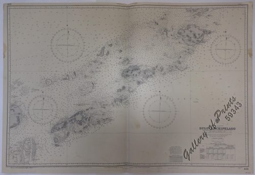
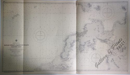
Publisher: Admiralty London, 14th Aug. 1964 under the Superintendence Rear Admiral E.G.Erving,C.B., O.B.E., Hydrographer of the Navy.

Year: 1964

Size: 45.7 x 65.9 cm

Reference:
SKU: 59345 Category: Tag:

Description

lithograph. Map#989. Small corrections 1964…Enamel 1964…Z.6-64. Seal of the Hydrographic Office – Sea Rose with 360 degrees in the middle below the title. RARE

Condition

Very good to excellent condition.

Shopping Cart
There are no products in the cart!
Continue Shopping
0