Tel : +63(2)-7729-8168
|
Email Us : gallery@gop.com.ph
My Account
Remember Me
Register
19 Item(s)
-
₱
328,300.00
Great Maps. the world's masterpieces explored and explained
1 x
₱
3,300.00
Sketches from Manilla and Hong-Kong. "Soiree Musicale" at Manilla.
1 x
₱
5,500.00
Dalea Bicolor [Silver Prarie Clover]
1 x
₱
5,500.00
Rivière Sagaliud, Golfe de Sandakan
1 x
₱
3,300.00
Discovering America. Journeys in Search of the New World
1 x
₱
4,400.00
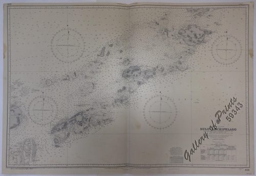
Philippine Islands. Sulu Archipelago. From the United States Government Charts to 1932. With additions and corrections to 1951.
1 x
₱
11,000.00
Bird's-eye View of Cavite, Showing the Arsenal, Fortifications, and Sunken Spanish Vessels Off the Mole.
1 x
₱
20,900.00
Übersichtskarte der Franzosischen Expedition in Hinterindien vom Me-khong bis zum Jang-tse-kiang 1867-1868. Mit Benutzung einer Skizze von Garnier … [Map of the French Expedition …based on …Garnier]
1 x
₱
6,600.00
Cascos de la Laguna, a la voile. ["Cascos" from La Laguna, under Sail]
1 x
₱
99,000.00
Philippine Islands. Anchorages in Northern Luzon and the Babuyan Islands. Insets: 1) Babuyan Is. - Fuga I. Musa Bay. From the United States Government Chart to 1931. 2) Babuyan Is. - Camiguin I. Port San Pio Quinto. From the United States Government Chart to 1931. 3) Luzon-North-East Coast Port San Vicente. From the United States Government Chart to 1938. 4) Luzon - East Coast Mauban Anchorage. From the Philippine Government Chart of 1957. 5) Luzon - West Coast. Salomague Harbour and Lapog Bay. From the United States Government Chart of 1934. 6) Luzon - West Coast Port Currimao and Gan Bay. From the United States Government Chart of 1934. 7) Luzon - West Coast Solvec Cove. From the United States Government Chart of 1934. 8) Luzon - West Coast Lingayen Gulf. Port Sual with Cabalitian Bay. From the United States Government Chart of 1922. 9) Luzon - West Coast San Fernando Harbour. From the United States Government Chart of 1936.
1 x
₱
11,000.00
Diez y Seis Años de Regencia (Maria Cristina de Hapsburgo-Lorena) [sic] (1885-1902) [Sixteen Years of Regency of Maria …]
1 x
₱
4,400.00
Port et Rade de Manille (Philippines)
1 x
₱
6,600.00
Antique Maps - Christie's Collectors Guide
1 x
₱
2,500.00
East India Archipelago [Eastern Passages to China and Japan][Chart No.5] London, Published by James Imray and Son, 89 & 89a Minories, 1898
1 x
₱
36,000.00
1. Pirogue de peche de la baie de Manille [Fishing canoe from Manila Bay] 2. Plan 3. Elevation de l'arriere [Rear Elevation] 4. Section 5. & 6. Avirons [Oars] 7. Petite pirogue [Small Canoe] 8. Plan 9. Elevation de l'arriere [Rear Elevation]
1 x
₱
50,600.00
En el archipiélago de la Especiería España y Molucas en los siglos XVI y XVII [In the Spanish Spice Archipelago and Moluccas in the 16th and 17th Centuries]
1 x
₱
4,900.00
The Philippines- Our Artist with the Firing-Line during the advance on Malolos. 1. Polo-Removing our wounded from the firing-line. 2. Brigadier-General Charles King, U.S.V. 3. Major-General Mac Arthur's headquarters at Caloocan. 4. View of San Pedro Macati from General King's headquarters.
1 x
₱
8,800.00
Typus freti Manilensis detroit de Manilles [Straits of Manila]
1 x
₱
39,600.00
Military Establishment at Tjimahl, Cantonment of the 6th Battalion of Infantry, Ground plan 1 : 500.
1 x
₱
4,400.00
View Cart
Checkout
Home
About Us
Publications
Shop Online
Framing Services
Exhibits
Picture Hanging System
Contact Us
View cart
“Typus freti Manilensis detroit de Manilles [Straits of Manila]” has been added to your cart.
View cart
“Military Establishment at Tjimahl, Cantonment of the 6th Battalion of Infantry, Ground plan 1 : 500.” has been added to your cart.
Sort by
Date
Sort by
Default Order
Sort by
Name
Sort by
Price
Sort by
Date
Sort by
Popularity
Show
30 Products
Show
30 Products
Show
60 Products
Show
90 Products
Group of Natives
₱
5,500.00
Add to cart
Details
La Presqu’Isle de L’Inde Au Dela du Gange, avec ...
₱
18,700.00
Add to cart
Details
Insulae Indiae Orientalis
₱
39,600.00
Add to cart
Details
La Baie de Manille, Selon les Observations les plus recente...
₱
29,700.00
Add to cart
Details
Les Isles Philippines Molucques et de La Sonde [inset:] Les ...
₱
30,900.00
Add to cart
Details
The Philippines
₱
8,800.00
Add to cart
Details
Philippine Islands insets: 1) Manila to Dagupan 2) Manila 3)...
₱
17,200.00
Add to cart
Details
A Filipino Street Band. A Scene in the Tondo Suburb of Manil...
₱
9,900.00
Add to cart
Details
Die Meeresströmungen und Temperaturverhältnisse in den Ost...
₱
6,600.00
Add to cart
Details
Mapa de la situacion de las Canarias Mapa de la situacion de...
₱
7,700.00
Add to cart
Details
Cedula de Fundador
₱
16,000.00
Add to cart
Details
Birds 69. E. Ignitus. Fire-backed Pheasant 70. P. Amherstiae...
₱
5,500.00
Add to cart
Details
The Operations Before Manila – A Daring Reconnoissanc...
₱
4,400.00
Add to cart
Details
Manila – Paco Cemetery and the Four Gates of the Old C...
₱
5,500.00
Add to cart
Details
The Philippines – In and about Manila 1. Corregidor Is...
₱
5,500.00
Add to cart
Details
Roads of South-Central Luzon
₱
5,500.00
Add to cart
Details
In The Philippines – A Bayonet Rush Of United States ...
₱
5,500.00
Add to cart
Details
Islas Filipinas – Mapa Orografico Observatorio de Mani...
₱
4,400.00
Add to cart
Details
Inside the churches of Manila…
₱
4,400.00
Add to cart
Details
Les Isles Philippines 1682
₱
22,000.00
Add to cart
Details
Afrique Meridionale
₱
5,500.00
Add to cart
Details
L’Insulinde
₱
9,900.00
Add to cart
Details
Philippinen – Exotische Inselwelt La vie exotique des ...
₱
5,500.00
Add to cart
Details
Philippinen – Exotische Inselwelt La vie exotique des ...
₱
4,400.00
Add to cart
Details
Philippinen – Exotische Inselwelt La vie exotique des ...
₱
5,500.00
Add to cart
Details
La Révolte aux Philippines – Voir page 798 1. Cathéd...
₱
8,800.00
Add to cart
Details
Hafen von Hong Kong [Harbour of Hong Kong]
₱
7,700.00
Add to cart
Details
Environs of Manilla
₱
6,600.00
Add to cart
Details
Military Establishment at Tjimahl, Cantonment of the 6th Bat...
₱
4,400.00
Add to cart
Details
Plan De La Baie De Bongo.
₱
6,600.00
Add to cart
Details
Previous
1
2
3
4
5
6
7
8
9
10
Next
Shopping Cart
Military Establishment at Tjimahl, Cantonment of the 6th Battalion of Infantry, Ground plan 1 : 500.
1
Typus freti Manilensis detroit de Manilles [Straits of Manila]
1
The Philippines- Our Artist with the Firing-Line during the advance on Malolos. 1. Polo-Removing our wounded from the firing-line. 2. Brigadier-General Charles King, U.S.V. 3. Major-General Mac Arthur's headquarters at Caloocan. 4. View of San Pedro Macati from General King's headquarters.
1
En el archipiélago de la Especiería España y Molucas en los siglos XVI y XVII [In the Spanish Spice Archipelago and Moluccas in the 16th and 17th Centuries]
1
1. Pirogue de peche de la baie de Manille [Fishing canoe from Manila Bay] 2. Plan 3. Elevation de l'arriere [Rear Elevation] 4. Section 5. & 6. Avirons [Oars] 7. Petite pirogue [Small Canoe] 8. Plan 9. Elevation de l'arriere [Rear Elevation]
1
East India Archipelago [Eastern Passages to China and Japan][Chart No.5] London, Published by James Imray and Son, 89 & 89a Minories, 1898
1
Antique Maps - Christie's Collectors Guide
1
Port et Rade de Manille (Philippines)
1
Diez y Seis Años de Regencia (Maria Cristina de Hapsburgo-Lorena) [sic] (1885-1902) [Sixteen Years of Regency of Maria …]
1
Philippine Islands. Anchorages in Northern Luzon and the Babuyan Islands. Insets: 1) Babuyan Is. - Fuga I. Musa Bay. From the United States Government Chart to 1931. 2) Babuyan Is. - Camiguin I. Port San Pio Quinto. From the United States Government Chart to 1931. 3) Luzon-North-East Coast Port San Vicente. From the United States Government Chart to 1938. 4) Luzon - East Coast Mauban Anchorage. From the Philippine Government Chart of 1957. 5) Luzon - West Coast. Salomague Harbour and Lapog Bay. From the United States Government Chart of 1934. 6) Luzon - West Coast Port Currimao and Gan Bay. From the United States Government Chart of 1934. 7) Luzon - West Coast Solvec Cove. From the United States Government Chart of 1934. 8) Luzon - West Coast Lingayen Gulf. Port Sual with Cabalitian Bay. From the United States Government Chart of 1922. 9) Luzon - West Coast San Fernando Harbour. From the United States Government Chart of 1936.
1
Cascos de la Laguna, a la voile. ["Cascos" from La Laguna, under Sail]
1
Übersichtskarte der Franzosischen Expedition in Hinterindien vom Me-khong bis zum Jang-tse-kiang 1867-1868. Mit Benutzung einer Skizze von Garnier … [Map of the French Expedition …based on …Garnier]
1
Bird's-eye View of Cavite, Showing the Arsenal, Fortifications, and Sunken Spanish Vessels Off the Mole.
1
Philippine Islands. Sulu Archipelago. From the United States Government Charts to 1932. With additions and corrections to 1951.
1
Discovering America. Journeys in Search of the New World
1
Rivière Sagaliud, Golfe de Sandakan
1
Dalea Bicolor [Silver Prarie Clover]
1
Sketches from Manilla and Hong-Kong. "Soiree Musicale" at Manilla.
1
Great Maps. the world's masterpieces explored and explained
1
Cart
Checkout
Continue Shopping
19