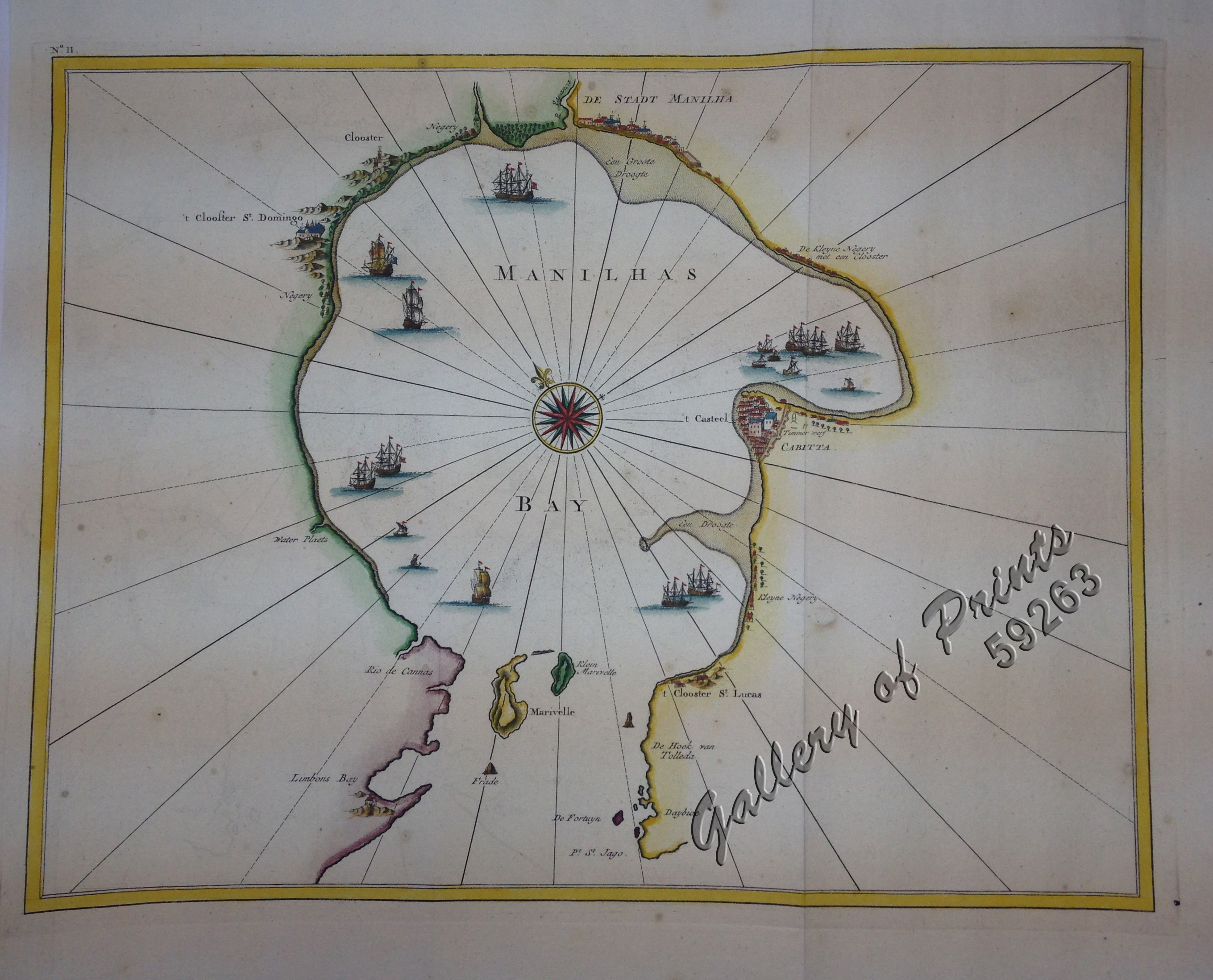
Manilhas Bay [untitled chart of Manila Bay]
₱36,500.00
In Stock
In Stock
Description
hand-coloured copper engraving.
Fascinating map of Manila Bay, apparently closely copied from an earlier manuscript by the famous VOC cartographer, Johannes Vingboons (1650 – 70). From ‘Oud en Nieuw Oost-Indien’, published by Johann van Braam and Gerard onder de Linden in Dordrecht and Amsterdam; pl. 11.
Manila Bay with the Pasig River (here called “Papanca”) and Cavite are shown, with existing cloisters either named (Sto. Domingo & St. Lucas) or marked, reflecting Valentijn’s being a Calvinist Minister in the employ of the VOC which enabled him to have access to many of the secret VOC charts. settlements and principal coastal features are identified. An attractive early chart, one of the few early Dutch maps to focus on the Philippines.
Condition
Excellent condition.

