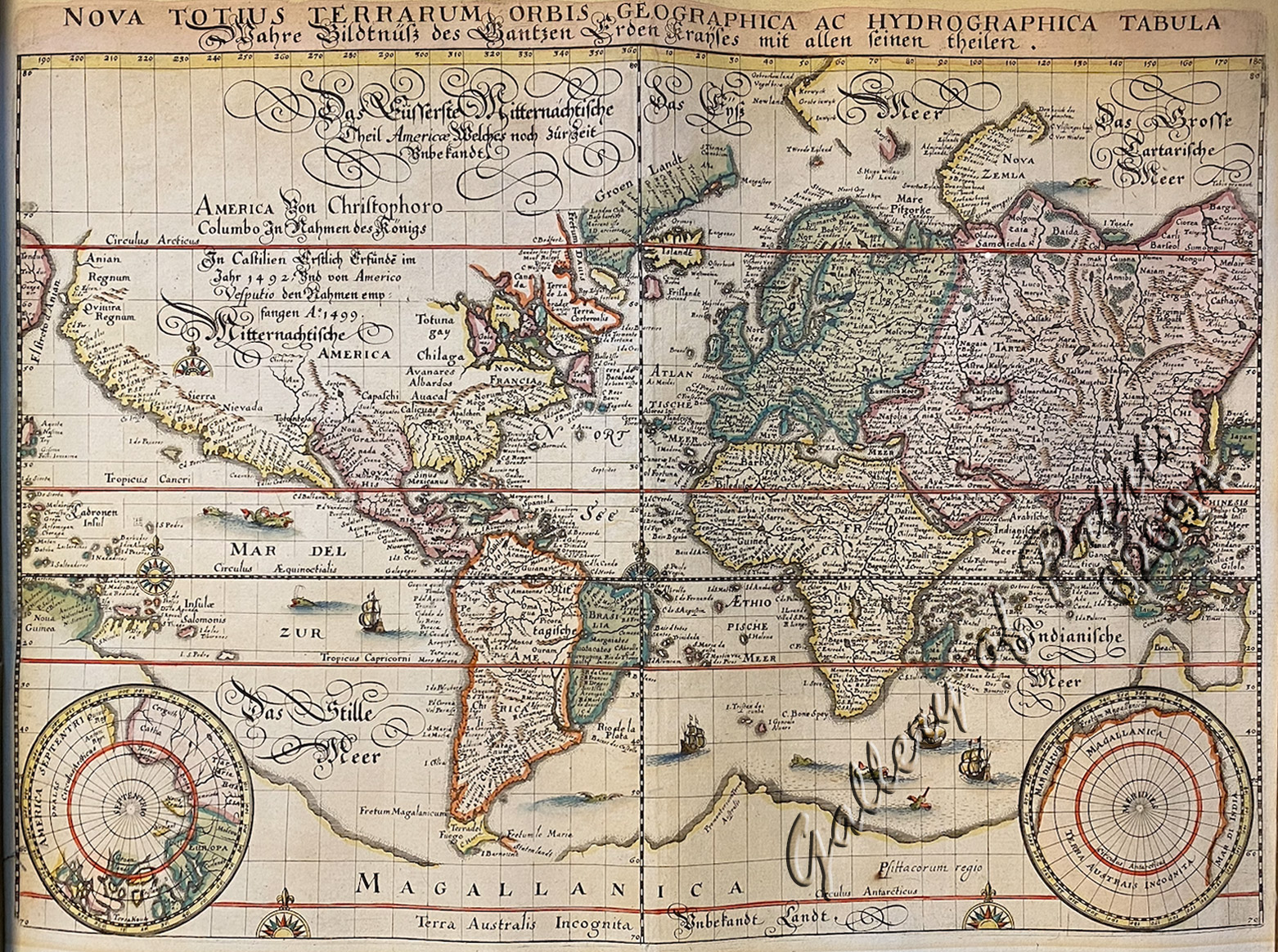
Nova totius terrarum orbis geographica ac hydrographica tabula [2 insets North Pole and South Pole views]
₱99,000.00
In Stock
In Stock
Description
hand-coloured copper engraving. RARE
A reduced version of Blaeu’s world map lacking the decorative borders. The engraving is neatly executed, with Germanic touches to the lettering, and the Latin title is repeated in gothic German script below, concerning the discovery of the Americas in 1492, which covers the unknown interior of North America. Korea is shown as an Island, Japan is shown in an early primitive model and the image of the Philippines is dramatically oversized. There is a large southern continent connected to New Guinea, California is a peninsula, and there are plenty of open ended waterways in the eastern part of North America, which leave open the question of a Northwest Passage. Two prominent polar projections in lower corners partially obscure the great southern landmass, making the map very recognizable. This is the plate, without Merian’s signature and was prepared to accompany the reprint of the Archontologia in 1646.
Condition
some light marginal discolouration due to earlier framing, dark impression. Excellent condition.

