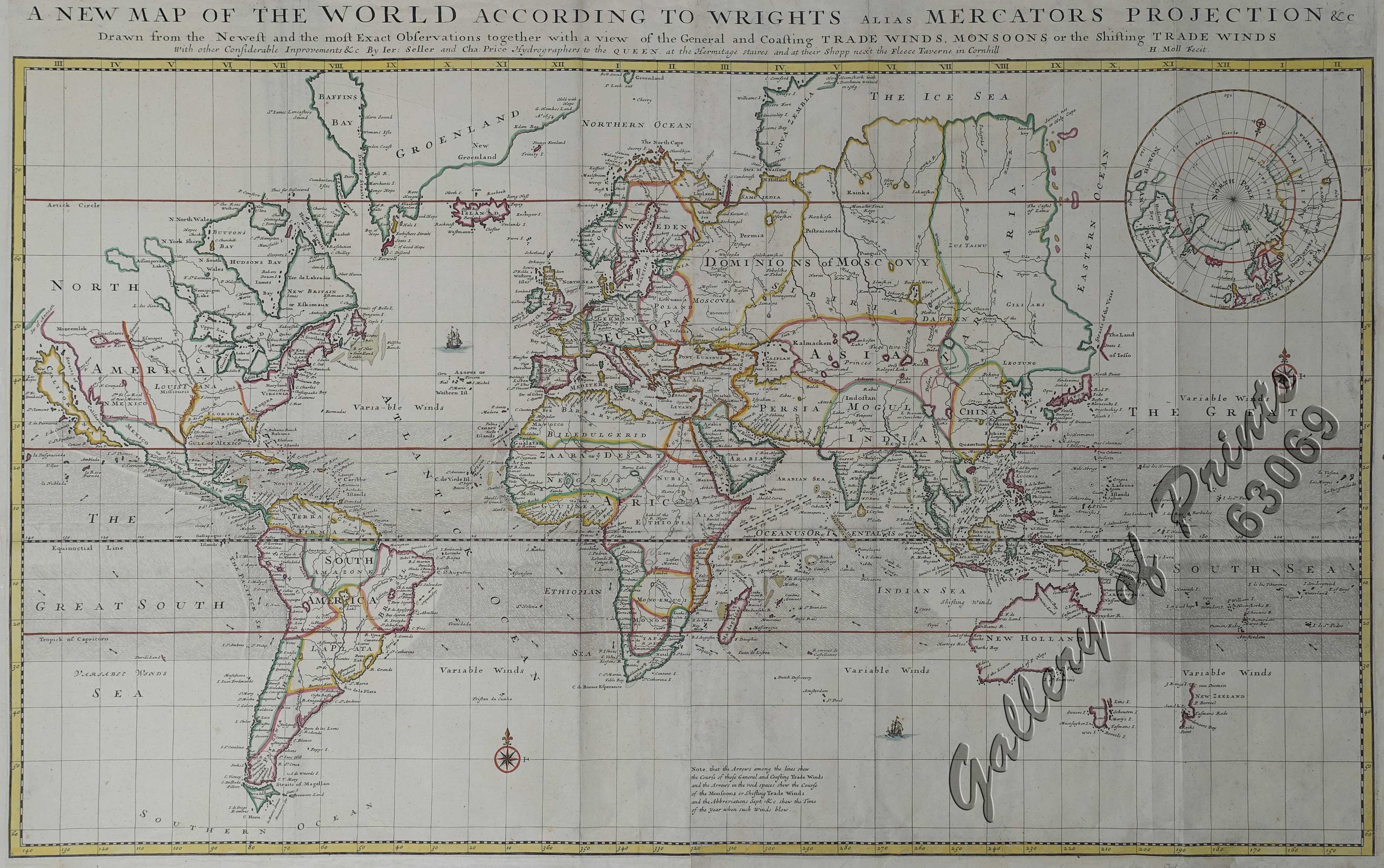
A New Map of the World according to Wright’s alias Mercator’s Projection &c : drawn from the newest and the most exact observations together with a view of the general and coasting trade winds, monsoons or the shifting trade winds with other considerable improvements &c by Ier: Seller and Cha: Price Hydrographers to the Queen at the Hermitage staires and at their shopp nex’t the Fleece Taverne in Cornhill ; H: Moll fecit. [inset: North Pole]. [In lower centre margin:] Note, that the arrows among the lines shew the Course of those General and Coasting Trade Winds and the Arrows in the void spaces shew the Course of the Monsoons or Shifting Trade Winds and the Abbreviations Sept. & c. shew the Time of the year when such winds blow.
₱125,000.00
In Stock
In Stock
Description
original outline hand-colour copper engraving, Scale [ca. 1:45,000,000];
Large striking chart of the world on Mercator’s Projection, showing wind directions; probably taken from “A System of Geography”. Sometimes bound into “Navigantium atque itinerantium bibliotheca ; Or, A complete collection of voyages and travels” by John Harris. Shows California as an island, an incomplete Australia, a hint of the West Coast of New Zealand, an interesting NE Coast of Asia, including “Iesso” but lacking NW Coast of America. Various trade winds and currents are depicted with arrows and shading. Herman Moll (c. 1654-1732) was one of the most important London mapmakers in the first half of the 18th century. Moll was probably born in Bremen, Germany. He moved to London to escape the Scanian Wars. He first worked as an engraver for Moses Pitt’s ill-fated “English Atlas”, and then worked for Sir Jonas Moore, Grenville Collins, John Adair, and – as here – for Seller & Price. His first original maps were published in the early 1680s and ultimately he founded his own shop ca. 10 years later.
Condition
professional repairs to folds and margins as is usually the case with this huge wall map; on two sheets joined.

