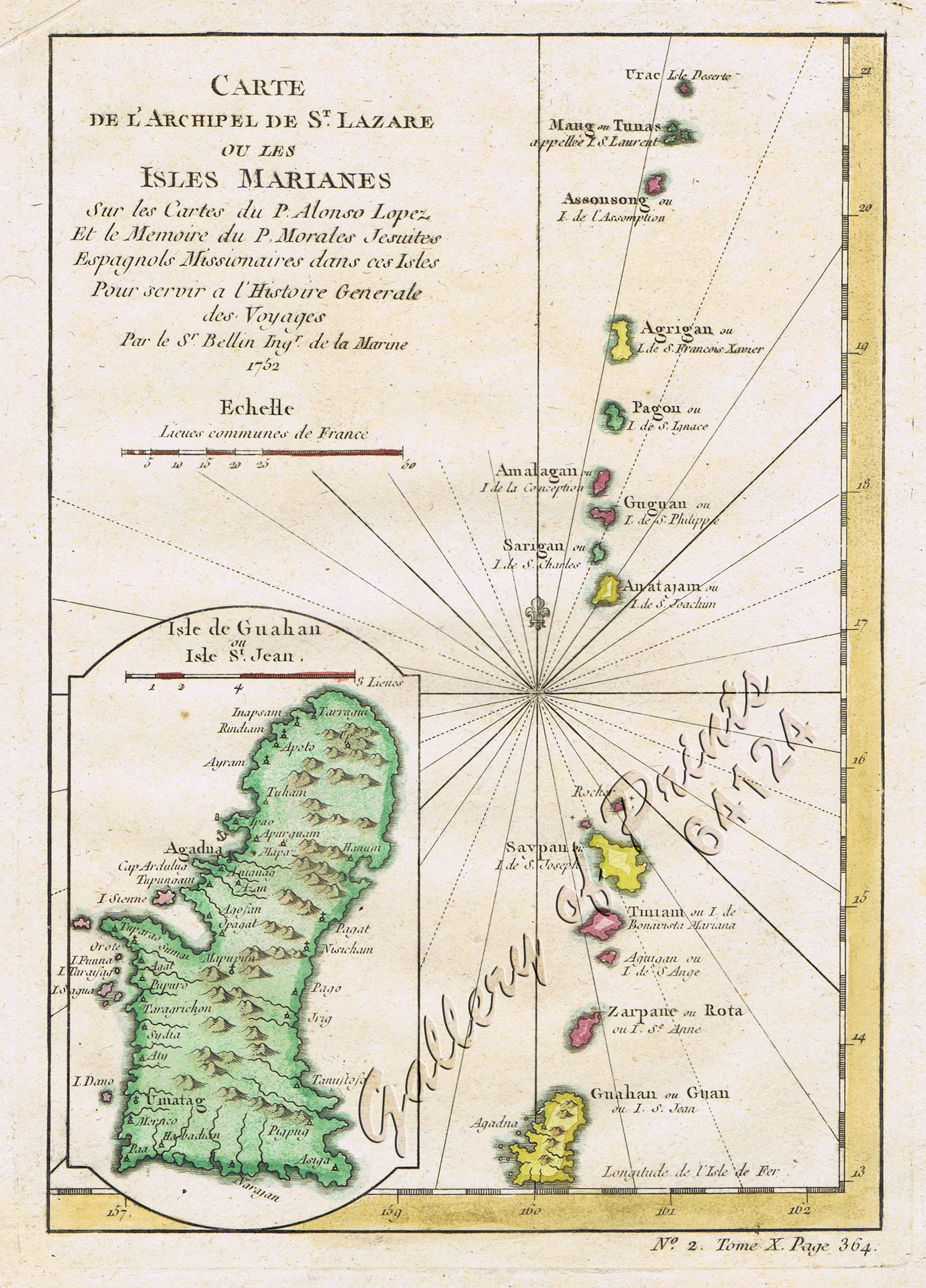
Carte de l’Archipel de St. Lazare ou Les Isles Marianes. [inset:] Isle de Guahan ou St. Jean. [Map of the St. Lazarus or Marianas Islands] [Island of Guam or St. John]
₱6,600.00
In Stock
In Stock
Description
hand-coloured copper engraving.
Map of Guam and the Marianas from ‘Histoire Generale des Voyages, ou nouvelle collection de toutes les relations de voyages…’, No. 2. Tome X, page 364.
Map of the Marianas Islands, an archipelago of fifteen islands situated in the North Pacific Ocean. The title alludes to the archipelago of St. Lazarus, which is actually a historical name given by Magellan to the Philippines, which lie just west of the Marianas.
Nicolas Bellin (1703-1772) was one of the most important and proficient French cartographers of the mid-eighteenth century. He was appointed the first Ingenieur Hydrographe de la Marine, and also Official Hydrographer to the French king. Bellin produced a substantial number of important separately issued maps, particularly reflecting continuing discoveries and political events in the Americas.
Condition
with minor fold mark on upper margin, otherwise good condition.

