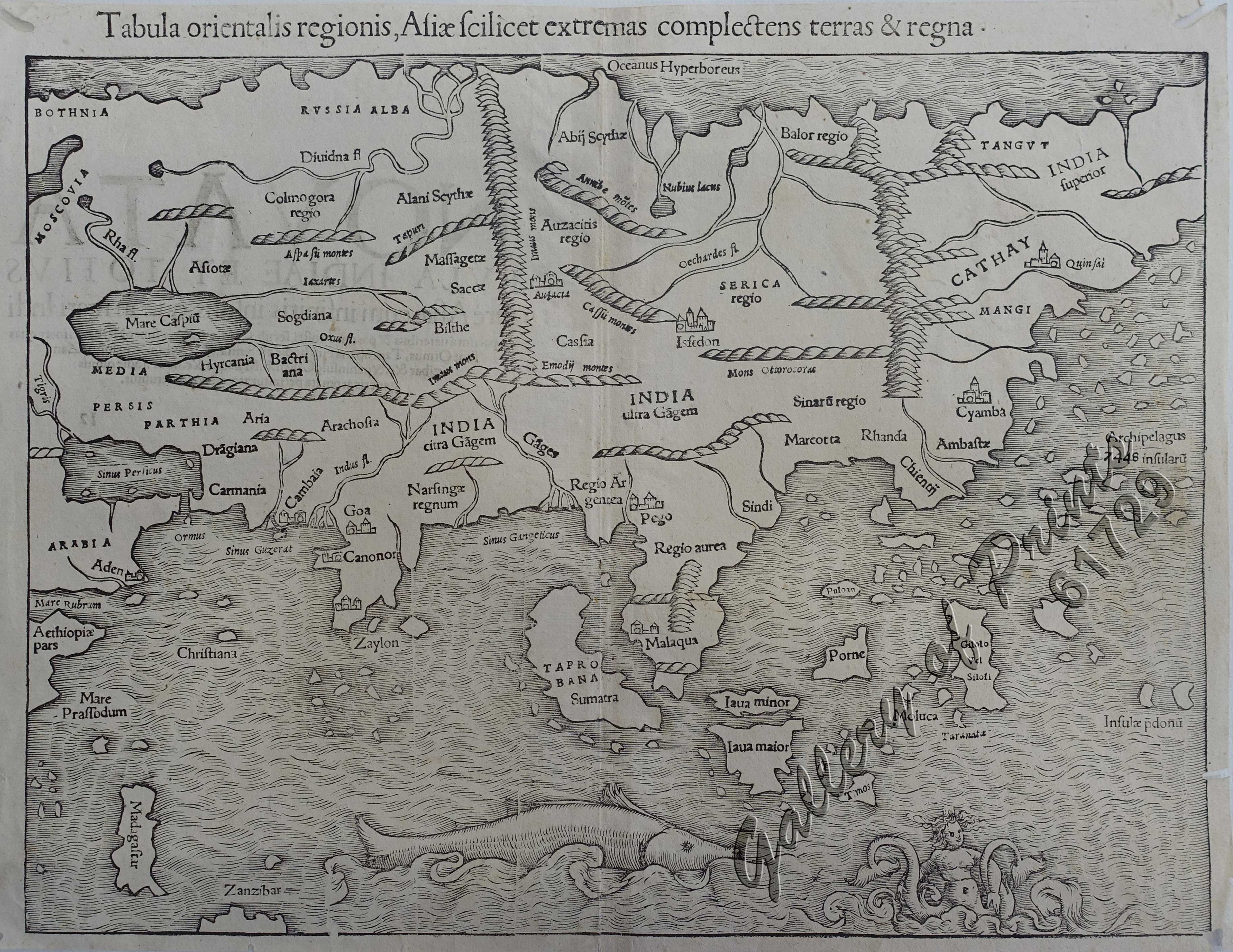
Tabula orientalis regionis, Asiae Scilicet extremas complectens terras & regna.
SOLD
Description
wood engraving, verso text ‘NOVATA’.
Map from “Cosmographia Universalis” (Latin ed.). Sebastian Münster [Munster] (1489-1552) probably was the most influential person in spreading geographical knowledge throughout Europe. First map in a then German speaking country to identify a Philippine island: Puloan [Palawan]. The first map, i.e. the earliest, of the Asia continent any collector of this area probably could commercially acquire. His Cosmographia contained not only the latest maps & views, but also included an encyclopaedic amount of detail about the known – and unknown – world. It was undoubtedly one of the most widely read books of its time, going through nearly 40 editions in 6 languages. An eminent German mathematician & linguist, Münster became Professor of Hebrew at Heidelberg & later at Basel, where he settled in 1529. He was the first to provide a separate map of each of the 4 known Continents & the first separately printed map of England. He had 2 major works, the Geographia & the Cosmographia. He died of the plague in 1552. A classic and important 16th century outline of the Asian continent. Much of the information on the map is derived from the reports of Marco Polo, including Cathay, Quinzay, and the famous 7448 islands supposed to represent the present-day Philippines. The map also shows much of the Portuguese influence in Southeast Asia in the early 16th century, including the settlement of Malacca and the emergent outline of a number of the Spice Islands. Decorative detail includes a large whale-like fish and twin-tailed mermaid in the lower section of the map.
Condition
tight margins, with small worm tracks on margins, in one case touching neat line, all professionally repaired, otherwise very good condition.

