Tel : +63(2)-7729-8168
|
Email Us : gallery@gop.com.ph
My Account
Remember Me
Register
19 Item(s)
-
₱
1,273,800.00
A Chart of the China Sea, and Philippine Islands, with the Archipelagos of Felicia and Sooloo, shewing… …Canton and Balambangan,… composed from an original drawing, communicated by Capt. Robert Carr. and compared with the map of Pedro Murillo de Velarde, engraved at Manilla in 1734…. insets: 1) The Ports of Ylocos, on the West Coast of Luzon. 2) The Bay of Subic, on the West Coast of Luzon.
1 x
₱
780,000.00
The Manila Galleon
1 x
₱
9,500.00
VII. Provintiae seu Belgiu Foederatum exhibita Iohan Michael Probst Augusta Vindelicomaro. [insets:] 1. Ost India Hollan. 2. West India Hollan
1 x
₱
5,500.00
Archipiélago Filipino - Isla de Mindanao Plano del Puerto de Pollok
1 x
₱
4,400.00
Philippine Islands. Luzon Island. North of Latitude 16° 20' North. From the United States Cost Survey Charts to 1925.
1 x
₱
11,000.00
Philippine Islands. Mindoro Strait. From the United States Government Charts of 1936.
1 x
₱
11,000.00
Chart of the Coast of China and of the Japan Islands including the Marianes and a part of the Philippines. Compiled by order of Commodore M. C. Perry. U.S.N. from the latest authorities with additions and corrections by the U.S. Japan Expedition by Lieuts. W. L. Maury and S. Bent. U.S.N.
1 x
₱
39,600.00
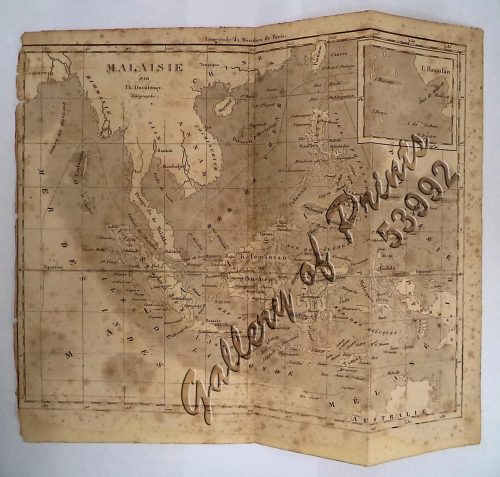
'Malaisie. inset: I. Bassilan
1 x
₱
4,400.00
1. Oriolus Vulneratus (female) [Black-and-crimson Oriole] 2. Prioniturus Cyaneiceps (female) [Blue Racket-Tailed Parakeet]
1 x
₱
13,200.00
Wanderjahre eines jungen Hamburger Kaufmannes - Eine Reise um die Erde in 1000 Tagen [Ramblings of a Young Hamburg Merchant - A Voyage Around the World in 1000 Days]
1 x
₱
5,500.00
1. Casco, bateau de transport de Manille ["Casco", cargo boat from Manila] 2. Plan 3. Elevation de l'arriere [Rear Elevation] 4. Section 5. Pirogue a double balancier de la Laguna [Double Outrigger Canoe from La Laguna] 6. Plan 7. Section
1 x
₱
49,600.00
The Luneta, Manila
1 x
₱
3,300.00
Katalog des Ethnographischen Reichsmuseums Band XX Philippinen [Catalog of the Ethnographic Reichsmuseum Volume XX Philippines]
1 x
₱
15,700.00
Mapa de Filipinas, Joló y norte de Borneo
1 x
₱
7,700.00
Carte de la Partie Occidentale des Philippines.
1 x
₱
49,500.00
A Chart of the Channel in the Philipine Islands [sic] Through which the Manila Galeon passes, with a Map of Manila Island.
1 x
₱
26,400.00
A New Map of the Philippine Islands, Drawn from the best Authorities
1 x
₱
49,500.00
A Chart of the Coast of China from Cambodia to Nanquam with part of Japan.
1 x
₱
155,000.00
Plan du Port de Subec, en I'Isle de Lucon [Plan of The Port of Subic on Luzon Island]
1 x
₱
33,000.00
View Cart
Checkout
Home
About Us
Publications
Shop Online
Framing Services
Exhibits
Picture Hanging System
Contact Us
View cart
“Plan du Port de Subec, en I’Isle de Lucon [Plan of The Port of Subic on Luzon Island]” has been added to your cart.
Sort by
Default Order
Sort by
Default Order
Sort by
Name
Sort by
Price
Sort by
Date
Sort by
Popularity
Show
30 Products
Show
30 Products
Show
60 Products
Show
90 Products
Bahia de Manila
₱
46,200.00
Add to cart
Details
Typus freti Manilensis detroit de Manilles [Straits of Manil...
₱
39,600.00
Add to cart
Details
Chart of Port IloIlo and Panay
₱
4,400.00
Add to cart
Details
Plan du Port de Subec, en I’Isle de Lucon [Plan of The...
₱
33,000.00
Add to cart
Details
East Indies
₱
4,400.00
Add to cart
Details
Les Indes Orientales et leur Archipel …
₱
26,400.00
Add to cart
Details
Luzon Island. inset : Vicinity of Manila
₱
5,500.00
Add to cart
Details
Isla de Paragua o Palawan Sur pl. 25 (Southern Palawan)
₱
6,600.00
Add to cart
Details
Les Isles Philippines, celle de Formose, le Sud de la Chine,...
₱
11,000.00
Add to cart
Details
Oriental Islands.
₱
7,700.00
Add to cart
Details
The Philippine Islands
₱
12,500.00
Add to cart
Details
Filipinas. Provincias y distritos de la isla de Luzon
₱
55,000.00
Add to cart
Details
Die Ostindischen Inseln…
₱
39,600.00
Add to cart
Details
Lucon et Palaouan [Map of Luzon / Visayas]
₱
7,700.00
Add to cart
Details
Carte des Indes et de la Chine…
₱
39,600.00
Add to cart
Details
Partie de la Mer du Sud comprise entre les Philippines et la...
₱
61,600.00
Add to cart
Details
Philippine Islands with insets: ‘1. Manila and Vicinit...
₱
4,400.00
Add to cart
Details
1) Plan du port d’ Acapulco sur la Côte du Mexique da...
₱
26,400.00
Add to cart
Details
1
2
3
4
…
20
21
22
Next
Shopping Cart
Plan du Port de Subec, en I'Isle de Lucon [Plan of The Port of Subic on Luzon Island]
1
A Chart of the Coast of China from Cambodia to Nanquam with part of Japan.
1
A New Map of the Philippine Islands, Drawn from the best Authorities
1
A Chart of the Channel in the Philipine Islands [sic] Through which the Manila Galeon passes, with a Map of Manila Island.
1
Carte de la Partie Occidentale des Philippines.
1
Mapa de Filipinas, Joló y norte de Borneo
1
Katalog des Ethnographischen Reichsmuseums Band XX Philippinen [Catalog of the Ethnographic Reichsmuseum Volume XX Philippines]
1
The Luneta, Manila
1
1. Casco, bateau de transport de Manille ["Casco", cargo boat from Manila] 2. Plan 3. Elevation de l'arriere [Rear Elevation] 4. Section 5. Pirogue a double balancier de la Laguna [Double Outrigger Canoe from La Laguna] 6. Plan 7. Section
1
Wanderjahre eines jungen Hamburger Kaufmannes - Eine Reise um die Erde in 1000 Tagen [Ramblings of a Young Hamburg Merchant - A Voyage Around the World in 1000 Days]
1
1. Oriolus Vulneratus (female) [Black-and-crimson Oriole] 2. Prioniturus Cyaneiceps (female) [Blue Racket-Tailed Parakeet]
1
'Malaisie. inset: I. Bassilan
1
Chart of the Coast of China and of the Japan Islands including the Marianes and a part of the Philippines. Compiled by order of Commodore M. C. Perry. U.S.N. from the latest authorities with additions and corrections by the U.S. Japan Expedition by Lieuts. W. L. Maury and S. Bent. U.S.N.
1
Philippine Islands. Mindoro Strait. From the United States Government Charts of 1936.
1
Philippine Islands. Luzon Island. North of Latitude 16° 20' North. From the United States Cost Survey Charts to 1925.
1
Archipiélago Filipino - Isla de Mindanao Plano del Puerto de Pollok
1
VII. Provintiae seu Belgiu Foederatum exhibita Iohan Michael Probst Augusta Vindelicomaro. [insets:] 1. Ost India Hollan. 2. West India Hollan
1
The Manila Galleon
1
A Chart of the China Sea, and Philippine Islands, with the Archipelagos of Felicia and Sooloo, shewing… …Canton and Balambangan,… composed from an original drawing, communicated by Capt. Robert Carr. and compared with the map of Pedro Murillo de Velarde, engraved at Manilla in 1734…. insets: 1) The Ports of Ylocos, on the West Coast of Luzon. 2) The Bay of Subic, on the West Coast of Luzon.
1
Cart
Checkout
Continue Shopping
19