Tel : +63(2)-7729-8168
|
Email Us : gallery@gop.com.ph
My Account
Remember Me
Register
65 Item(s)
-
₱
4,305,160.00
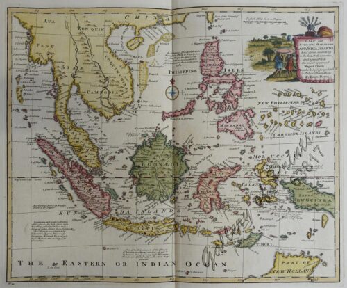
Chart of the East India Islands...
1 x
₱
6,600.00
Chart of Zamboanga
1 x
₱
4,400.00
Filipinas. Distrito de Lepanto Description general accompañada de itinerario y croquis del territorio,…
1 x
₱
99,000.00
Early Amercian Cartographies
1 x
₱
5,500.00
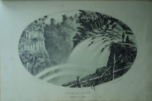
Cascada del Botocan. Provincia de la Laguna. [Botocan Falls]
1 x
₱
49,500.00
Philippine Islands. Western Part of Mindanao Sea with Bohol Strait and Part of Tañon Strait. From the United States Government Charts to 1937.
1 x
₱
11,000.00
Manila (Islas Filipinas). - Una calle de Caloocán.
1 x
₱
3,300.00
Sketches in China. - Hong-Kong Races, 1858. 1. The One-Schilling Stand 2. The Road
1 x
₱
6,600.00
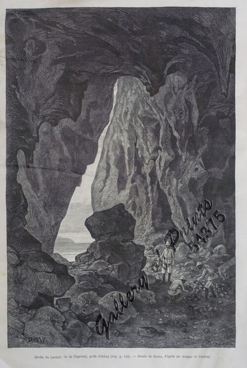
Grotte du Levant; Ile de Cagraray, Golfe d'Albay
1 x
₱
9,900.00
1) Merops Bicolor [Rufous-crowned Bee-eater]; 2) Merops Sumatranus [Blue-throated Bee-eater]
1 x
₱
14,960.00
Annual Reports of the War Department for the Fiscal Year Ended June 30, 1899. Report of the Major-General Commanding the Army. Part 2 [of 3]
1 x
₱
18,700.00
The Philippines in Ancient Chinese Maps
1 x
₱
2,400.00
Girls Bathing
1 x
₱
6,600.00
Marché de Maïbun
1 x
₱
5,500.00
Interior of the Crater of the Volcano at Taal
1 x
₱
8,800.00
The Philipine Isles
1 x
₱
77,000.00
The Bontoc Igorot. The Ethnological Survey Publications vol. 1.
1 x
₱
14,700.00
Discovering America. Journeys in Search of the New World
1 x
₱
4,400.00
Sketches in Manilla. 1. Chinese Chow-chow sellers at Manilla; 2. The Meat Market at Manilla.
1 x
₱
7,700.00
Intérieur d'une case bicole [Interior of a Bicolano House]
1 x
₱
6,600.00
Plan de La Baie de Manille
1 x
₱
39,600.00
Waterfall of the Botocan (Laguna, Luzon)
1 x
₱
5,500.00
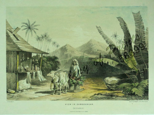
View in Samboangan. (Mindanao)
1 x
₱
17,200.00
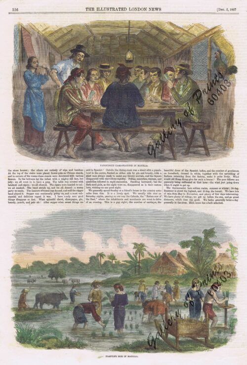
1. Panguingui (Card-playing) in Manilla; 2. Planting Rice in Manilla
1 x
₱
11,000.00
City of Manilla
1 x
₱
4,400.00
The New America and the Far East: Philippines, Japan
1 x
₱
3,300.00
Brachyurus Steerii, ad. et jur. (Steere's Pitta)
1 x
₱
22,000.00
'XIV. Von Schanghai nach Guaham und Puynipet. [Carolinen Archipel].
1 x
₱
3,300.00
Map of the United States showing the Territorial Expansion of a Century 1804 to 1904 insets: 1) The World. 2) Wake Island. 3) Territory of Alaska. 4) Guam Island. 5) Porto Rico. 6) Philippine Islands. 7) Hawaiian Islands. 8) Tutuila, Manua and Smaller Islands of the Samoan Group. 9) Plan of Panama Canal Zone. 10) Plan showing the Thirteen Original States.
1 x
₱
33,100.00
Ñora Goya.
1 x
₱
49,500.00
East India Archipelago [Eastern Passages to China and Japan][Chart No.5] London, Published by James Imray and Son, 89 & 89a Minories, 1898
1 x
₱
36,000.00
El Periodismo Filipino, 1811-1910 The First Century of Philippine Journalism Volume III Aparato Bibliografico de la Historia General de Filipinas
1 x
₱
3,500.00
Mapping the Philippine Seas
2 x
₱
5,900.00
Discovering Antique Maps
1 x
₱
1,500.00
The Jesuits in the Philippines 1581-1768
1 x
₱
6,600.00
Environs of Manila
1 x
₱
11,000.00
De Sinu Baye La Baye (Gulf of Albay]
1 x
₱
56,000.00
The Cartography of the East Indian Islands, Insulae Indiae Orientalis.
1 x
₱
6,600.00
Insulae Philippinae… [inset: Manila]
1 x
₱
1,250,000.00
Bibliography of the Philippine Islands. Printed and Manuscript. Preceded by a Descriptive Account of the most important Archives and Collections containing Philippina
1 x
₱
4,400.00
A Visual Guide to the Manila-Acapulco Galleons: 500 Fun Facts & More!
1 x
₱
900.00
Sammlung gemeinverständlicher wissenschaftlicher Vorträge [Collection of Scientific Presentations in a Generally Comprehensible Version] [INCLUDING:] Die Philippinen. Eine übersichtliche Darstellung der ethnographischen und historisch=politischen Verhältnisse des Archipels. [An Overview of the Ethnographic and Historical-Political Situation in the Archipelago] Mit einem Anhange - Die wichtigsten Paragraphen der Verfassung der philippinischen Republik. [The most important paragraphs of the Constitution of the Philippine Republic]
1 x
₱
15,700.00
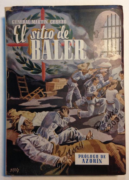
El Sitio de Baler. Prologo de Azorin
1 x
₱
9,900.00
Filipinas. Provincias y distritos de la isla de Luzon
1 x
₱
55,000.00
Katalog des Ethnographischen Reichsmuseums Band XX Philippinen [Catalog of the Ethnographic Reichsmuseum Volume XX Philippines]
1 x
₱
15,700.00
The Philippines: A Summary Account of their Ethnographical, Historical and Political Conditions [translation of “Die Philippinen. Eine übersichtliche Darstellung der ethnographischen und historisch=politischen Verhältnisse des Archipels” with an Appendix containing The Constitution of the Philippine Republic [translation of “Mit einem Anhange – Die wichtigsten Paragraphen der Verfassung der philippinischen Republik.”
1 x
₱
2,500.00
Location of Troops in the Philippine Islands March 31, 1900.
1 x
₱
16,500.00
The Philippines in the 19th Century (A Collection of Prints)
1 x
₱
3,500.00
Souvenirs d'un Voyage aux Iles Philippines par J. de Man
1 x
₱
77,000.00
Carte des Iles Philippines Pour servirà l'intelligence de l'ouvrage sur les Possessions Espagnoles dans l'Océanie, par Mr. J. Mallat. inset: Iles Batanes
1 x
₱
980,000.00
Philippine Pagans. The Autographies of Three Ifugaos
1 x
₱
5,500.00
All Over the Map. A Cartographic Odyssey
1 x
₱
5,800.00
Bridge built of bamboo, province of Albay, Luzon.
1 x
₱
2,200.00
Carte des Nouvelles Philippines - Kaart der Nieuwe Philippynsche Eylanden. [Map of the New Philippines]
1 x
₱
11,000.00
The Illustrated London News Vol. 32 - No. 897
1 x
₱
6,600.00
Oriental Islands.
1 x
₱
7,700.00
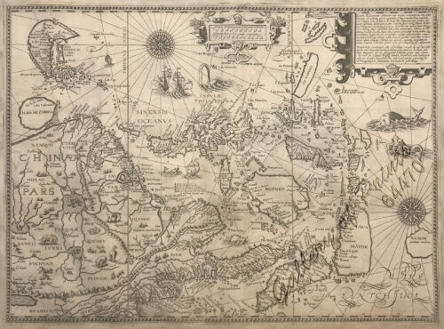
Exacta & accurata delineatio cum orarum maritimarum tum etjam locorum terrestrium quae in Regionibus China, Cauchinchina, Camboja sive Champa, Syao, Malacca, Arracan & Pegu… Waarachtige uitworpinghe ofte afbeeldinge van alle die custen ende landen van China, … [Accurate & Detailed Drawing with Borders Maritime and even Terrestrial Places Located in the Regions of China….]
1 x
₱
1,100,000.00
Documents Illustrating the British Conquest of Manila 1762-1763
1 x
₱
3,700.00
Sea Monsters on Medieval and Renaissance Maps
1 x
₱
2,200.00
Le Magasin Pittoresque
1 x
₱
5,500.00
Das Zollhaus in Manila [The Customs Building in Manila]
1 x
₱
5,500.00
Iles Philippines. Depart de Chasseurs Tagales. [Departure of Tagal Hunters] [after de la Touanne]
1 x
₱
4,400.00
Die Chinesen, Japaner und Inder auf den Philippinen [The Chinese, Japanese, and Indians in the Philippines]
1 x
₱
2,500.00
1) Plan du port d' Acapulco sur la Côte du Mexique dans la Mer du Sud. 2) Plan de la Baye de Manille
1 x
₱
26,400.00
View Cart
Checkout
Home
About Us
Publications
Shop Online
Framing Services
Exhibits
Picture Hanging System
Contact Us
View cart
“1) Plan du port d’ Acapulco sur la Côte du Mexique dans la Mer du Sud. 2) Plan de la Baye de Manille” has been added to your cart.
Sort by
Name
Sort by
Default Order
Sort by
Name
Sort by
Price
Sort by
Date
Sort by
Popularity
Show
30 Products
Show
30 Products
Show
60 Products
Show
90 Products
‘Luzon, West Coast – Port Santo Tomas – Li...
₱
2,200.00
Add to cart
Details
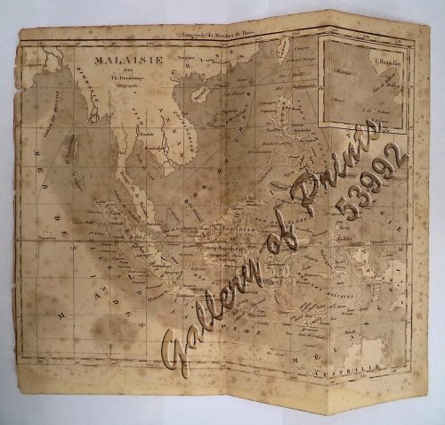
‘Malaisie. inset: I. Bassilan
₱
4,400.00
Add to cart
Details
‘XIV. Von Schanghai nach Guaham und Puynipet. [Carolin...
₱
3,300.00
Add to cart
Details
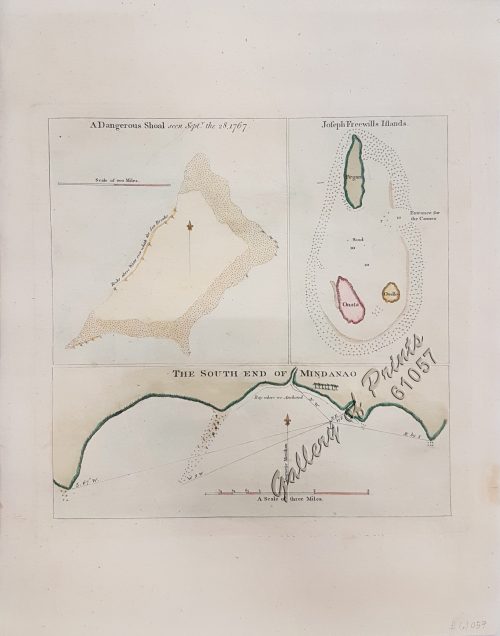
1) A Dangerous Shoal… 2) Joseph Freewills Island. 3) The S...
₱
13,500.00
Add to cart
Details
1) Carta dell’Isole Filippine [1st sheet]. 2) Carta de...
₱
61,600.00
Add to cart
Details
1) Carte des Isles Philippines (1e feuille) Kaart der Philip...
₱
77,000.00
Add to cart
Details
1) Isla de Paragua o Palawan Sur pl. 25 (Southern Palawan)
₱
7,700.00
Add to cart
Details
1) Islas Filipinas 1ª Hoja; 2) Islas Filipinas 2...
₱
39,600.00
Add to cart
Details
1) Islas Filipinas: Primera Hoja Central; 2) Islas Filipinas...
₱
99,000.00
Add to cart
Details
1) Karte der Philippinen (Nördliches Blatt), inset: Plan vo...
₱
39,600.00
Add to cart
Details
1) Mapa de las Islas Filipinas 2) Islas Carolinas 3) Islas...
₱
15,700.00
Add to cart
Details
1) Plan du port d’ Acapulco sur la Côte du Mexique da...
₱
26,400.00
Add to cart
Details
1) Plan of Solsogon Harbour on the South Coast of Luconia. 2...
₱
36,500.00
Add to cart
Details
1. Borneo. 2. The Philippine Islands.
₱
15,400.00
Add to cart
Details
1. Cap Blanc sur la Cote des Patagons,… Kaap Blanco aan de...
₱
4,400.00
Add to cart
Details
A Chart of the Channel in the Philipine Islands [sic] Throug...
₱
26,400.00
Add to cart
Details
A Chart of the Channel in the Phillippine Islands through wh...
₱
44,000.00
Add to cart
Details
A Chart of the Channel in the Phillippine [sic] Islands thro...
₱
39,600.00
Add to cart
Details
A Chart of the China Sea, and Philippine Islands, with the A...
₱
780,000.00
Add to cart
Details
A Chart of the Coast of China from Cambodia to Nanquam with ...
₱
155,000.00
Add to cart
Details
A Chart of the Pacific Ocean from the Equinoctial to the Lat...
₱
15,400.00
Add to cart
Details
A Chart of the Pelew Islands…
₱
39,600.00
Add to cart
Details
A Map of the East Indies from the latest Authorities and Obs...
₱
26,400.00
Add to cart
Details
A New and Accurate Map of the East India Islands
₱
56,100.00
Add to cart
Details
A New Map of the East Indies, Taken from Mr. de Fer’s ...
₱
49,500.00
Add to cart
Details
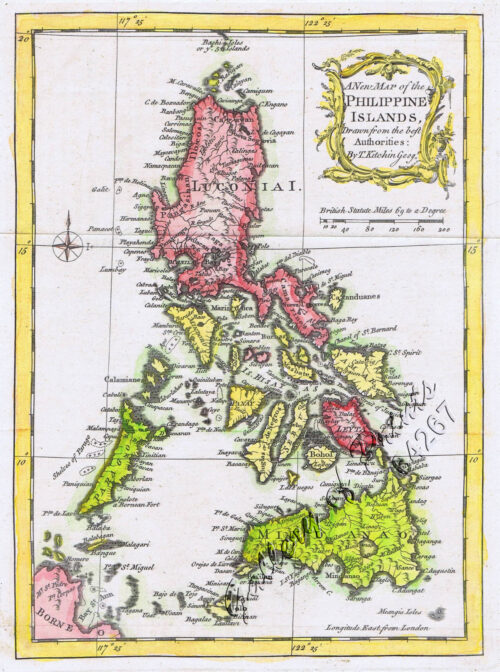
A New Map of the Philippine Islands, Drawn from the best Aut...
₱
49,500.00
Add to cart
Details
A New Map of the Philippine Islands, Drawn from the best Aut...
₱
77,000.00
Add to cart
Details
A New Map of the World according to Wright’s alias Mer...
₱
125,000.00
Add to cart
Details
A Plan of the Bay of Manila / A Plan of the Harbour of Acapu...
₱
39,600.00
Add to cart
Details
A Plan of the Bay of Manila / A Plan of the Harbour of Acapu...
₱
39,600.00
Add to cart
Details
a) bezeichnet den Lauf der Gallion Nuestra Señora de Cabado...
₱
26,400.00
Add to cart
Details
1
2
3
4
…
13
14
15
Next
Shopping Cart
1) Plan du port d' Acapulco sur la Côte du Mexique dans la Mer du Sud. 2) Plan de la Baye de Manille
1
Die Chinesen, Japaner und Inder auf den Philippinen [The Chinese, Japanese, and Indians in the Philippines]
1
Iles Philippines. Depart de Chasseurs Tagales. [Departure of Tagal Hunters] [after de la Touanne]
1
Das Zollhaus in Manila [The Customs Building in Manila]
1
Le Magasin Pittoresque
1
Sea Monsters on Medieval and Renaissance Maps
1
Documents Illustrating the British Conquest of Manila 1762-1763
1
Exacta & accurata delineatio cum orarum maritimarum tum etjam locorum terrestrium quae in Regionibus China, Cauchinchina, Camboja sive Champa, Syao, Malacca, Arracan & Pegu… Waarachtige uitworpinghe ofte afbeeldinge van alle die custen ende landen van China, … [Accurate & Detailed Drawing with Borders Maritime and even Terrestrial Places Located in the Regions of China….]
1
Oriental Islands.
1
The Illustrated London News Vol. 32 - No. 897
1
Carte des Nouvelles Philippines - Kaart der Nieuwe Philippynsche Eylanden. [Map of the New Philippines]
1
Bridge built of bamboo, province of Albay, Luzon.
1
All Over the Map. A Cartographic Odyssey
1
Philippine Pagans. The Autographies of Three Ifugaos
1
Carte des Iles Philippines Pour servirà l'intelligence de l'ouvrage sur les Possessions Espagnoles dans l'Océanie, par Mr. J. Mallat. inset: Iles Batanes
1
Souvenirs d'un Voyage aux Iles Philippines par J. de Man
1
The Philippines in the 19th Century (A Collection of Prints)
-
Quantity
+
Location of Troops in the Philippine Islands March 31, 1900.
1
The Philippines: A Summary Account of their Ethnographical, Historical and Political Conditions [translation of “Die Philippinen. Eine übersichtliche Darstellung der ethnographischen und historisch=politischen Verhältnisse des Archipels” with an Appendix containing The Constitution of the Philippine Republic [translation of “Mit einem Anhange – Die wichtigsten Paragraphen der Verfassung der philippinischen Republik.”
1
Katalog des Ethnographischen Reichsmuseums Band XX Philippinen [Catalog of the Ethnographic Reichsmuseum Volume XX Philippines]
1
Filipinas. Provincias y distritos de la isla de Luzon
1
El Sitio de Baler. Prologo de Azorin
1
Sammlung gemeinverständlicher wissenschaftlicher Vorträge [Collection of Scientific Presentations in a Generally Comprehensible Version] [INCLUDING:] Die Philippinen. Eine übersichtliche Darstellung der ethnographischen und historisch=politischen Verhältnisse des Archipels. [An Overview of the Ethnographic and Historical-Political Situation in the Archipelago] Mit einem Anhange - Die wichtigsten Paragraphen der Verfassung der philippinischen Republik. [The most important paragraphs of the Constitution of the Philippine Republic]
1
A Visual Guide to the Manila-Acapulco Galleons: 500 Fun Facts & More!
1
Bibliography of the Philippine Islands. Printed and Manuscript. Preceded by a Descriptive Account of the most important Archives and Collections containing Philippina
1
Insulae Philippinae… [inset: Manila]
1
The Cartography of the East Indian Islands, Insulae Indiae Orientalis.
1
De Sinu Baye La Baye (Gulf of Albay]
1
Environs of Manila
1
The Jesuits in the Philippines 1581-1768
1
Discovering Antique Maps
1
Mapping the Philippine Seas
-
Quantity
+
El Periodismo Filipino, 1811-1910 The First Century of Philippine Journalism Volume III Aparato Bibliografico de la Historia General de Filipinas
1
East India Archipelago [Eastern Passages to China and Japan][Chart No.5] London, Published by James Imray and Son, 89 & 89a Minories, 1898
1
Ñora Goya.
1
Map of the United States showing the Territorial Expansion of a Century 1804 to 1904 insets: 1) The World. 2) Wake Island. 3) Territory of Alaska. 4) Guam Island. 5) Porto Rico. 6) Philippine Islands. 7) Hawaiian Islands. 8) Tutuila, Manua and Smaller Islands of the Samoan Group. 9) Plan of Panama Canal Zone. 10) Plan showing the Thirteen Original States.
1
'XIV. Von Schanghai nach Guaham und Puynipet. [Carolinen Archipel].
1
Brachyurus Steerii, ad. et jur. (Steere's Pitta)
1
The New America and the Far East: Philippines, Japan
1
City of Manilla
1
1. Panguingui (Card-playing) in Manilla; 2. Planting Rice in Manilla
1
View in Samboangan. (Mindanao)
1
Waterfall of the Botocan (Laguna, Luzon)
1
Plan de La Baie de Manille
1
Intérieur d'une case bicole [Interior of a Bicolano House]
1
Sketches in Manilla. 1. Chinese Chow-chow sellers at Manilla; 2. The Meat Market at Manilla.
1
Discovering America. Journeys in Search of the New World
1
The Bontoc Igorot. The Ethnological Survey Publications vol. 1.
1
The Philipine Isles
1
Interior of the Crater of the Volcano at Taal
1
Marché de Maïbun
1
Girls Bathing
1
The Philippines in Ancient Chinese Maps
1
Annual Reports of the War Department for the Fiscal Year Ended June 30, 1899. Report of the Major-General Commanding the Army. Part 2 [of 3]
1
1) Merops Bicolor [Rufous-crowned Bee-eater]; 2) Merops Sumatranus [Blue-throated Bee-eater]
1
Grotte du Levant; Ile de Cagraray, Golfe d'Albay
1
Sketches in China. - Hong-Kong Races, 1858. 1. The One-Schilling Stand 2. The Road
1
Manila (Islas Filipinas). - Una calle de Caloocán.
1
Philippine Islands. Western Part of Mindanao Sea with Bohol Strait and Part of Tañon Strait. From the United States Government Charts to 1937.
1
Cascada del Botocan. Provincia de la Laguna. [Botocan Falls]
1
Early Amercian Cartographies
1
Filipinas. Distrito de Lepanto Description general accompañada de itinerario y croquis del territorio,…
1
Chart of Zamboanga
1
Chart of the East India Islands...
1
Cart
Checkout
Continue Shopping
65