Tel : +63(2)-7729-8168
|
Email Us : gallery@gop.com.ph
My Account
Remember Me
Register
108 Item(s)
-
₱
5,553,030.00
De Javaasche Phaisant met den Vuurkleurigen Rug. [Javanese Pheasant]
1 x
₱
9,900.00
Phyllornis Palawanensis (Fig. 1 & 2) Ptilocichla Falcata (Fig. 3), pl.50 [The Falcated Ground-Babbler]
1 x
₱
22,000.00
Les Indes Orientales et leur Archipel ...
1 x
₱
26,400.00
Environs of Manila
1 x
₱
11,000.00
Plan du Port de Subec, en I'Isle de Lucon [Plan of The Port of Subic on Luzon Island]
1 x
₱
33,000.00
Oriental Islands.
1 x
₱
7,700.00
Lucon et Palaouan [Map of Luzon / Visayas]
1 x
₱
7,700.00
Mittheilungen aus Justus Perthes' Geographischer Anstalt. über wichtige neue Erforschungen auf dem Gesammtgebiete der Geographie von Dr. A. Petermann. - Ergänzungsband VIII, 1873-74 Inhalt: [Supplement Vol. 8 contents] No. 35. Behm und Wagner, die Bevölkerung der Erde, II. No. 36. Dr. G. Radde, vier Vorträge über den Kaukasus. No. 37. Carl Mauch's Reisen im Innern von Süd-Afrika, 1865-72. No. 38. A. Wojeikof, die atmosphärische Circulation. Verbreitung des Luftdruckes, der Winde und der Regen auf der Oberfläche der Erde.
1 x
₱
6,000.00
Isles Molucques
1 x
₱
11,000.00
1. Embarquement des troupes pour Cuba, a Tampa 2. Depart du "Peking", transportant des troupes a Manille
1 x
₱
5,500.00
Amherstia Nobilis [Pride of Burma or Orchid Tree, (Fabaceae family)] [Local Name: Queen of Flowering Trees]
1 x
₱
26,400.00
Isla de Mindanao Jolo pl. 26
1 x
₱
6,600.00
Spathiphyllopsis Minahassae. T. et B. [Spathiphyllum]
1 x
₱
26,400.00
East India Archipelago [Eastern Passages to China and Japan][Chart No.5] London, Published by James Imray and Son, 89 & 89a Minories, 1898
1 x
₱
36,000.00
Descripcion de las Indias del Poniente (14)
1 x
₱
110,000.00
Marché de Maïbun
1 x
₱
5,500.00
Xanthochymus Dulcis. Roxb. [English: Gourka ] [Baniti (Tagalog) [bagalot (Bisaya)] [buneg(Ilocano)] [Thailand: Maphut] [Malaysia/Indonesia: Mundu] [India:Goraka]
1 x
₱
26,400.00
'Malaisie. inset: I. Bassilan
1 x
₱
4,400.00
Chart of Zamboanga
1 x
₱
4,400.00
Enciclopedia Hispano-Americana Manual de Barnices y Preparacion de Charoles segun los procederes mas recientes. [Manual of Varnishes and Preparation of Patent Leathers according to the most recent procedures.]
1 x
₱
6,600.00
Carte tres curieuse de la mer du sud, contenant des remarques Nouvelles et tres utiles non Seulement sur les ports et iles de cette mer. [1st and 2nd Sheet] [A Very Special Map of the Southern Sea, Containing New and Very Useful Descriptions not Only of its Ports and Islands.]
1 x
₱
790,000.00
Anona Reticulata. L. [English: Custard Apple / Sugar Apple Bullock's Heart / Sweetsop ; Tagalog: Atis]
1 x
₱
27,900.00
Manilhas Bay [untitled chart of Manila Bay]
1 x
₱
36,500.00
1) Isla de Paragua o Palawan Sur pl. 25 (Southern Palawan)
1 x
₱
7,700.00
A New Map of the Philippine Islands, Drawn from the best Authorities
1 x
₱
77,000.00
1) Le Pic de la Encenada. [The Peak of Encenada] 2) Le Pic Cardinal. [The Cardinal Peak] 3) Le Pic verd. [The Green Peak] 4) Le Pic verd de l'Isle de Luçon. [The Green Peak in the Island of Luzon]
1 x
₱
6,600.00
Nuova et Accurata Carta dell 'Isole Filippine... Celebes & c.
1 x
₱
28,600.00
Westliche und Östliche Halbkugel… [Western and Eastern Hemisphere]
1 x
₱
5,500.00
Carte des Iles Philippines Pour servirà l'intelligence de l'ouvrage sur les Possessions Espagnoles dans l'Océanie, par Mr. J. Mallat. inset: Iles Batanes
1 x
₱
980,000.00
Charte von China nach Murdochischer Projection entworfen… inset: Insel-Gruppe Lieu-Kieu oder der Likejos-Inseln Zwischen Formosa und Japan [Map of China in Murdoch Projection with inset: Riu-Kiu Islands]
1 x
₱
39,600.00
Archipel des Indes Orientales, qui comprend Les Isles de la Sonde, Moluques et Philippines… inset: Isles Marianes ou des Larons.
1 x
₱
34,100.00
'XIV. Von Schanghai nach Guaham und Puynipet. [Carolinen Archipel].
1 x
₱
3,300.00
Négritos de la sierra de Marivelès (île de Luçon) (voy. p. 107 et 108)
1 x
₱
6,600.00
Die Ostindischen Inseln...
1 x
₱
39,600.00
Provinces of Morong and Infanta inset: Polillo - Island of Polillo
1 x
₱
4,400.00
Der Neue Welt-Bott mit allerhand nachrichten deren Missionarien Soc. Iesu [The New World Herald With News from the Missionaries of the Society of Jesus.] Ich verkünde euch grosse Freüd. Luc. II, 10. [I proclaim to you good news of great joy] Sie werden kommen von Auf= und Nidergang von Mittag und Mitternacht Luc. XIII. 29 [And they shall come from the east and west, and from the north and south], [...and shall sit down in the kingdom of God.] [frontispiece]
1 x
₱
9,900.00
[Carte Reduite] Carte Réduite des Isles Philippines Pour Servir Aux Vaisseaux du Roy Dressée au Dépost des Cartes Plans et Journaux de la Marine
1 x
₱
425,000.00
A Filipino Street Band. A Scene in the Tondo Suburb of Manila.
1 x
₱
9,900.00
Sketch of Combat at Trench Near Marilao. March 27th
1 x
₱
4,400.00
Charte von Ostindien diesseits und jenseits des Ganges [Map of East Indies both Sides of the Ganges]
1 x
₱
39,600.00
Asia wie es jetziger Zeit…
1 x
₱
49,500.00
Asie orientale comprenant l'empire Chinois et le Japon les etats de l' Indo-Chine et le Grand archipel d'Asie. [Oriental Asia Comprising the Chinese and Japanese Empires]
1 x
₱
42,900.00
China
1 x
₱
33,900.00
Twenty Years in the Philippine Islands: [A critical review with excerpts from the work of P. de la Gironiere. A rare original article from the Blackwood's Edinburgh Magazine.]
1 x
₱
6,600.00
Rajah Malais et sa Femme (voy. p. 102) [Malay Rajah and Spouse]
1 x
₱
4,400.00
Ladmiral surmonte s'en allant au fond a nostre veúe
1 x
₱
49,600.00
A view of Cape Espiritu Santo, on Samal, one of the Phillippine Islands… Centurion engag'd and took the Spanish Galeon call'd Nostra Seigniora de Cabadonga, from Acapulco bound to Manila.
1 x
₱
49,000.00
1. Oriolus Vulneratus (female) [Black-and-crimson Oriole] 2. Prioniturus Cyaneiceps (female) [Blue Racket-Tailed Parakeet]
1 x
₱
13,200.00
1. Caboteur de la Laguna [Coaster from La Laguna] 2. Plan 3. Section Approchee d'un Bilallo de la riviere Passit [Enlarged section of a "Bilalo" from the river Pasig] 4. Tissu des Voiles [Fabric of the sails]
1 x
₱
49,600.00
Mapa de Filipinas, Joló y norte de Borneo
1 x
₱
7,700.00
1. Panguingui (Card-playing) in Manilla; 2. Planting Rice in Manilla
1 x
₱
11,000.00
The New America and the Far East: Philippines, Japan
1 x
₱
3,300.00
Central Luzon. inset: Manila and Vicinity
1 x
₱
4,400.00
Travelling by Palkee
1 x
₱
4,400.00
India Orientalis
1 x
₱
39,600.00
The Philipine Isles
1 x
₱
77,000.00
Islas Filipinas - Mapa Orografico pl. 4, Observatorio de Manila
1 x
₱
5,500.00
Postcards
1 x
₱
990.00
1) Mapa de las Islas Filipinas 2) Islas Carolinas 3) Islas Marianas ó de los Ladrones
1 x
₱
15,700.00
China China theilet sich: …
1 x
₱
31,900.00
Cadavres des juramentados réunis après l'attaque
1 x
₱
6,600.00
Nuestra prisión en poder de los revolucionarios filipinos. Crónica de dieciocho meses de cautiverio de más de cien religiosos del Centro de Luzón, empleados en el Ministerio de las Almas
1 x
₱
41,600.00
The Philippine Islands
1 x
₱
7,700.00
Fregatten 'Eugenies' resa omkring Jorden aren 1851 - 1853........C. A. Virgin [Circumnavigation of the Fregate Eugenie'…]
1 x
₱
33,300.00
'Luzon, West Coast - Port Santo Tomas - Lingayen Gulf
1 x
₱
2,200.00
Lettres édifiantes et curieuses, ecrites des Missions Etrangeres, par quelques Missionaires de la Compagnie de Jesus; Epitre du Halde, Lettres des…Bouchet (Inde), Taillandier), Relation …deconverte …nouvelles Philippines [pp. 75-91]…Dentrecolles, Jacquemin (Chine), Gabriel (illinois), Sepp (Paraguay)
1 x
₱
29,500.00
Harper's Weekly - A Journal of Civilization with frontispiece: The End of the Coast. - Drawn by A. B. Frost.
1 x
₱
17,600.00
A Map of the East Indies from the latest Authorities and Observations By John Blair L.L.D. & F.R.S. As a Supplement to His Tables of Chronology. [inset:] The Philippine Islands.
1 x
₱
26,400.00
De Manila á Zamboanga
1 x
₱
5,500.00
China Sea - Palawan - East Coast - Port Royalist (P.to Princesa de Asturias of the Spanish). Surveyed by Comr. W.T. Bate R.N. Assisted by Lt C. Pasco, C. Bullock, Mate & W.B. Colver 2nd Master H.M.S/ Royalist 1850
1 x
₱
6,600.00
Alegoria de los Santos Reyes (pág. 30.) [Three Kings]
1 x
₱
6,600.00
Bahia de Manila
1 x
₱
46,200.00
1. Carte de la baie de Manille. 2. Carte générale de îles Philippines. 3. Baie de Cavite. 4. Diagrame de forces respectives des eccadres américaine et espagnole au combat de Manille.
1 x
₱
6,600.00
1) Plan of Solsogon Harbour on the South Coast of Luconia. 2) Chart on the Eastern Coast of Bongo Bay in the Island of Mindanao.
1 x
₱
36,500.00
The Manila Railway Company [1906] Limited 4% "A" Debenture Bond No. A 00000 £ 20 - [with 97 coupons #2-98 ]
1 x
₱
29,980.00
A New and Accurate Map of the East India Islands
1 x
₱
56,100.00
Zeocephus Cinnamomeus (Fig. 1) [Rufous Paradise Flycatcher] Z. Cyanescens (Fig. 2), pl.48 [Blue Paradise Flycatcher]
1 x
₱
22,000.00
1) Merops Bicolor [Rufous-crowned Bee-eater]; 2) Merops Sumatranus [Blue-throated Bee-eater]
1 x
₱
14,960.00
1. Plantain. (Banana Tree), 2. Papaw Leaf and Tree, 3. Cocoanut Palms
1 x
₱
2,200.00
El Indicador del Viajero en las Islas Filipinas
1 x
₱
77,000.00
The Luneta, Manila
1 x
₱
3,300.00
Terrain Handbook 41 Manila (Philippine Series)
1 x
₱
22,000.00
Crania Ethnica Philippinica. Ein Beitrag zur Anthropologie der Philippinen auf Grund von Dr. A. Schadenberg's gesammelter Scha[e]del [Dr. A. Schadenberrg's Collection of Skulls - Basis for a Controbution to Philippine Anthopology]
1 x
₱
13,200.00
A New Map of the East Indies, Taken from Mr. de Fer's Map of Asia, Shewing their Chief Divisions, Cities, Towns, Ports, Rivers, Mountains & c. Dedicated to His Highness William Duke of Glocester.
1 x
₱
49,500.00
1. Casco, bateau de transport de Manille ["Casco", cargo boat from Manila] 2. Plan 3. Elevation de l'arriere [Rear Elevation] 4. Section 5. Pirogue a double balancier de la Laguna [Double Outrigger Canoe from La Laguna] 6. Plan 7. Section
1 x
₱
49,600.00
Arroyo sur la côte orientale de Mindanao [East Coast of Mindanao]
1 x
₱
4,400.00
Mittheilungen aus Justus Perthes' Geographischer Anstalt über Wichtige neue Erforschungen auf dem Gesammtgebiete der Geographie von Dr. A. Petermann. - Ergänzungsband V, 1867-1868. Inhalt: [Supplement Vol. 5 contents] No. 21. Spörer, Nowaja Semlä in geographischer, naturhistorischer und volkswirthschaftlicher Beziehung. No. 22. Fritsch, Reisebilder von den Canarischen Inseln. No. 23. Payer, Die westlichen Ortler-Alpen (Trafoier Gebiet). No. 24. Jeppe, Die Transvaal'sche oder Süd-Afrikanische Republik. No. 25. Rohlfs, Reise durch Nord-Afrika von Tripoli nach Kuka.
1 x
₱
6,000.00
Sitzungsberichte der Kaiserlichen Akademie der, Wissenschaften . XXXVI. Band (36th vol] No.14, Sitzung vom 19. Mai 1859. Schreiben an Alexander von Humboldt Haidinger, M.W. : Zwei Mittheilungen: 1) von Herrn k.k. Commodore B. von Wüllerstorf Zur Verteilung der Winde auf der Oberfläche der Erde. 2) von Herrn Lieutenant M.F. Maury, U.S.N. in Washington Herrn k.k. Commodore B. von Wüllerstorf
1 x
₱
13,200.00
Yesterdays in the Philippines
1 x
₱
9,900.00
Accion [stock certificate] [unnumbered] Capital 500 pesetas Desembolso 250 pesetas [Tabacalera Shares]
1 x
₱
13,200.00
Mapa General Atlas Geografico Descriptivo de la Peninsula Ibérica Yslas Baleares, Canarias y posesiones Españolas de Ultramar por el Comandte Capn de Infa auxiliar que ha sido del Deposito de la Guerra D. Emilio Valverde Y Alvarez. [insets]: 1. Islas Filipinas 2. Posesiones Españolas de golfo del Guinea 3. Antillas Españolas 4. Islas Canarias
1 x
₱
17,700.00
1. Pirogue de peche de la baie de Manille [Fishing canoe from Manila Bay] 2. Plan 3. Elevation de l'arriere [Rear Elevation] 4. Section 5. & 6. Avirons [Oars] 7. Petite pirogue [Small Canoe] 8. Plan 9. Elevation de l'arriere [Rear Elevation]
1 x
₱
50,600.00
Topographische Skizze des Bezirks Escalante auf Isla de Negros [inset:] Philippinen In. Aufgenommen von Don Enrique de Almonte [Topographical Sketch of Escalante Province On Negros Island...]
1 x
₱
30,800.00
Pêcheurs dans riviere de Passit. [Fishermen on The Pasig River]
1 x
₱
39,600.00
Exacta & accurata delineatio cum orarum maritimarum tum etjam locorum terrestrium quae in Regionibus China, Cauchinchina, Camboja sive Champa, Syao, Malacca, Arracan & Pegu… Waarachtige uitworpinghe ofte afbeeldinge van alle die custen ende landen van China, … [Accurate & Detailed Drawing with Borders Maritime and even Terrestrial Places Located in the Regions of China….]
1 x
₱
1,100,000.00
1) Carta dell'Isole Filippine [1st sheet]. 2) Carta dell'Isole Filippine di Mr. Bellin Ingegnere della Marine Foglio 1 mo [2nd sheet]
1 x
₱
61,600.00
Puerto de Surigao
1 x
₱
3,300.00
1) Pélicans. 2) Grèbe Cornu.
1 x
₱
5,500.00
Found in the Philippines: The Story of a Woman's Letters
1 x
₱
6,600.00
The Revolt in the Philippine Islands. 1. Philippine Aborigines. 2. View of the River Pasig at Manila. 3. Gate Leading Within the Walls. 4. Village of San Juento. 5. Types of the Native Soldiery.
1 x
₱
5,500.00
Philippine Islands. Leyte Gulf To Mayo Bay. Including Leyte,Parts of Sebu and Bohol and the North-Eastern Cost of Mindanao. From the United States Cost Survey Charts to 1922.
1 x
₱
11,000.00
Comintang de la Conquista. Indian Song of the Philippines.
1 x
₱
4,400.00
Philippine Pagans. The Autographies of Three Ifugaos
1 x
₱
5,500.00
Archipel de Jolo
1 x
₱
3,300.00
Isles Philippines dites autrement de Manilhe
1 x
₱
49,500.00
Übersichtskarte der Franzosischen Expedition in Hinterindien vom Me-khong bis zum Jang-tse-kiang 1867-1868. Mit Benutzung einer Skizze von Garnier … [Map of the French Expedition …based on …Garnier]
1 x
₱
6,600.00
La Vie Illustrée No. 18 16 Février 1899
1 x
₱
12,900.00
Quaint Corners of Ancient Empires: Southern India, Burma and Manila
1 x
₱
9,900.00
View Cart
Checkout
Home
About Us
Publications
Shop Online
Framing Services
Exhibits
Picture Hanging System
Contact Us
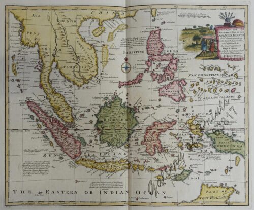
View cart
You cannot add another "A New Map of the East Indies, Taken from Mr. de Fer's Map of Asia, Shewing their Chief Divisions, Cities, Towns, Ports, Rivers, Mountains & c. Dedicated to His Highness William Duke of Glocester." to your cart.
Sort by
Name
Sort by
Default Order
Sort by
Name
Sort by
Price
Sort by
Date
Sort by
Popularity
Show
30 Products
Show
30 Products
Show
60 Products
Show
90 Products
‘Luzon, West Coast – Port Santo Tomas – Li...
₱
2,200.00
Add to cart
Details
‘Malaisie. inset: I. Bassilan
₱
4,400.00
Add to cart
Details
‘XIV. Von Schanghai nach Guaham und Puynipet. [Carolin...
₱
3,300.00
Add to cart
Details
1) A Dangerous Shoal… 2) Joseph Freewills Island. 3) The S...
₱
13,500.00
Add to cart
Details
1) Carta dell’Isole Filippine [1st sheet]. 2) Carta de...
₱
61,600.00
Add to cart
Details
1) Carte des Isles Philippines (1e feuille) Kaart der Philip...
₱
77,000.00
Add to cart
Details
1) Isla de Paragua o Palawan Sur pl. 25 (Southern Palawan)
₱
7,700.00
Add to cart
Details
1) Islas Filipinas 1ª Hoja; 2) Islas Filipinas 2...
₱
39,600.00
Add to cart
Details
1) Islas Filipinas: Primera Hoja Central; 2) Islas Filipinas...
₱
99,000.00
Add to cart
Details
1) Karte der Philippinen (Nördliches Blatt), inset: Plan vo...
₱
39,600.00
Add to cart
Details
1) Mapa de las Islas Filipinas 2) Islas Carolinas 3) Islas...
₱
15,700.00
Add to cart
Details
1) Plan du port d’ Acapulco sur la Côte du Mexique da...
₱
26,400.00
Add to cart
Details
1) Plan of Solsogon Harbour on the South Coast of Luconia. 2...
₱
36,500.00
Add to cart
Details
1. Borneo. 2. The Philippine Islands.
₱
15,400.00
Add to cart
Details
1. Cap Blanc sur la Cote des Patagons,… Kaap Blanco aan de...
₱
4,400.00
Add to cart
Details
A Chart of the Channel in the Philipine Islands [sic] Throug...
₱
26,400.00
Add to cart
Details
A Chart of the Channel in the Phillippine Islands through wh...
₱
44,000.00
Add to cart
Details
A Chart of the Channel in the Phillippine [sic] Islands thro...
₱
39,600.00
Add to cart
Details
A Chart of the China Sea, and Philippine Islands, with the A...
₱
780,000.00
Add to cart
Details
A Chart of the Coast of China from Cambodia to Nanquam with ...
₱
155,000.00
Add to cart
Details
A Chart of the Pacific Ocean from the Equinoctial to the Lat...
₱
15,400.00
Add to cart
Details
A Chart of the Pelew Islands…
₱
39,600.00
Add to cart
Details
A Map of the East Indies from the latest Authorities and Obs...
₱
26,400.00
Add to cart
Details
A New and Accurate Map of the East India Islands
₱
56,100.00
Add to cart
Details
A New Map of the East Indies, Taken from Mr. de Fer’s ...
₱
49,500.00
Add to cart
Details
A New Map of the Philippine Islands, Drawn from the best Aut...
₱
49,500.00
Add to cart
Details
1
2
3
4
…
15
16
17
Next
Shopping Cart
Quaint Corners of Ancient Empires: Southern India, Burma and Manila
1
La Vie Illustrée No. 18 16 Février 1899
1
Übersichtskarte der Franzosischen Expedition in Hinterindien vom Me-khong bis zum Jang-tse-kiang 1867-1868. Mit Benutzung einer Skizze von Garnier … [Map of the French Expedition …based on …Garnier]
1
Isles Philippines dites autrement de Manilhe
1
Archipel de Jolo
1
Philippine Pagans. The Autographies of Three Ifugaos
1
Comintang de la Conquista. Indian Song of the Philippines.
1
Philippine Islands. Leyte Gulf To Mayo Bay. Including Leyte,Parts of Sebu and Bohol and the North-Eastern Cost of Mindanao. From the United States Cost Survey Charts to 1922.
1
The Revolt in the Philippine Islands. 1. Philippine Aborigines. 2. View of the River Pasig at Manila. 3. Gate Leading Within the Walls. 4. Village of San Juento. 5. Types of the Native Soldiery.
1
Found in the Philippines: The Story of a Woman's Letters
1
1) Pélicans. 2) Grèbe Cornu.
1
Puerto de Surigao
1
1) Carta dell'Isole Filippine [1st sheet]. 2) Carta dell'Isole Filippine di Mr. Bellin Ingegnere della Marine Foglio 1 mo [2nd sheet]
1
Exacta & accurata delineatio cum orarum maritimarum tum etjam locorum terrestrium quae in Regionibus China, Cauchinchina, Camboja sive Champa, Syao, Malacca, Arracan & Pegu… Waarachtige uitworpinghe ofte afbeeldinge van alle die custen ende landen van China, … [Accurate & Detailed Drawing with Borders Maritime and even Terrestrial Places Located in the Regions of China….]
1
Pêcheurs dans riviere de Passit. [Fishermen on The Pasig River]
1
Topographische Skizze des Bezirks Escalante auf Isla de Negros [inset:] Philippinen In. Aufgenommen von Don Enrique de Almonte [Topographical Sketch of Escalante Province On Negros Island...]
1
1. Pirogue de peche de la baie de Manille [Fishing canoe from Manila Bay] 2. Plan 3. Elevation de l'arriere [Rear Elevation] 4. Section 5. & 6. Avirons [Oars] 7. Petite pirogue [Small Canoe] 8. Plan 9. Elevation de l'arriere [Rear Elevation]
1
Mapa General Atlas Geografico Descriptivo de la Peninsula Ibérica Yslas Baleares, Canarias y posesiones Españolas de Ultramar por el Comandte Capn de Infa auxiliar que ha sido del Deposito de la Guerra D. Emilio Valverde Y Alvarez. [insets]: 1. Islas Filipinas 2. Posesiones Españolas de golfo del Guinea 3. Antillas Españolas 4. Islas Canarias
1
Accion [stock certificate] [unnumbered] Capital 500 pesetas Desembolso 250 pesetas [Tabacalera Shares]
1
Yesterdays in the Philippines
1
Sitzungsberichte der Kaiserlichen Akademie der, Wissenschaften . XXXVI. Band (36th vol] No.14, Sitzung vom 19. Mai 1859. Schreiben an Alexander von Humboldt Haidinger, M.W. : Zwei Mittheilungen: 1) von Herrn k.k. Commodore B. von Wüllerstorf Zur Verteilung der Winde auf der Oberfläche der Erde. 2) von Herrn Lieutenant M.F. Maury, U.S.N. in Washington Herrn k.k. Commodore B. von Wüllerstorf
1
Mittheilungen aus Justus Perthes' Geographischer Anstalt über Wichtige neue Erforschungen auf dem Gesammtgebiete der Geographie von Dr. A. Petermann. - Ergänzungsband V, 1867-1868. Inhalt: [Supplement Vol. 5 contents] No. 21. Spörer, Nowaja Semlä in geographischer, naturhistorischer und volkswirthschaftlicher Beziehung. No. 22. Fritsch, Reisebilder von den Canarischen Inseln. No. 23. Payer, Die westlichen Ortler-Alpen (Trafoier Gebiet). No. 24. Jeppe, Die Transvaal'sche oder Süd-Afrikanische Republik. No. 25. Rohlfs, Reise durch Nord-Afrika von Tripoli nach Kuka.
1
Arroyo sur la côte orientale de Mindanao [East Coast of Mindanao]
1
1. Casco, bateau de transport de Manille ["Casco", cargo boat from Manila] 2. Plan 3. Elevation de l'arriere [Rear Elevation] 4. Section 5. Pirogue a double balancier de la Laguna [Double Outrigger Canoe from La Laguna] 6. Plan 7. Section
1
A New Map of the East Indies, Taken from Mr. de Fer's Map of Asia, Shewing their Chief Divisions, Cities, Towns, Ports, Rivers, Mountains & c. Dedicated to His Highness William Duke of Glocester.
1
Crania Ethnica Philippinica. Ein Beitrag zur Anthropologie der Philippinen auf Grund von Dr. A. Schadenberg's gesammelter Scha[e]del [Dr. A. Schadenberrg's Collection of Skulls - Basis for a Controbution to Philippine Anthopology]
1
Terrain Handbook 41 Manila (Philippine Series)
1
The Luneta, Manila
1
El Indicador del Viajero en las Islas Filipinas
1
1. Plantain. (Banana Tree), 2. Papaw Leaf and Tree, 3. Cocoanut Palms
1
1) Merops Bicolor [Rufous-crowned Bee-eater]; 2) Merops Sumatranus [Blue-throated Bee-eater]
1
Zeocephus Cinnamomeus (Fig. 1) [Rufous Paradise Flycatcher] Z. Cyanescens (Fig. 2), pl.48 [Blue Paradise Flycatcher]
1
A New and Accurate Map of the East India Islands
1
The Manila Railway Company [1906] Limited 4% "A" Debenture Bond No. A 00000 £ 20 - [with 97 coupons #2-98 ]
1
1) Plan of Solsogon Harbour on the South Coast of Luconia. 2) Chart on the Eastern Coast of Bongo Bay in the Island of Mindanao.
1
1. Carte de la baie de Manille. 2. Carte générale de îles Philippines. 3. Baie de Cavite. 4. Diagrame de forces respectives des eccadres américaine et espagnole au combat de Manille.
1
Bahia de Manila
1
Alegoria de los Santos Reyes (pág. 30.) [Three Kings]
1
China Sea - Palawan - East Coast - Port Royalist (P.to Princesa de Asturias of the Spanish). Surveyed by Comr. W.T. Bate R.N. Assisted by Lt C. Pasco, C. Bullock, Mate & W.B. Colver 2nd Master H.M.S/ Royalist 1850
1
De Manila á Zamboanga
1
A Map of the East Indies from the latest Authorities and Observations By John Blair L.L.D. & F.R.S. As a Supplement to His Tables of Chronology. [inset:] The Philippine Islands.
1
Harper's Weekly - A Journal of Civilization with frontispiece: The End of the Coast. - Drawn by A. B. Frost.
1
Lettres édifiantes et curieuses, ecrites des Missions Etrangeres, par quelques Missionaires de la Compagnie de Jesus; Epitre du Halde, Lettres des…Bouchet (Inde), Taillandier), Relation …deconverte …nouvelles Philippines [pp. 75-91]…Dentrecolles, Jacquemin (Chine), Gabriel (illinois), Sepp (Paraguay)
1
'Luzon, West Coast - Port Santo Tomas - Lingayen Gulf
1
Fregatten 'Eugenies' resa omkring Jorden aren 1851 - 1853........C. A. Virgin [Circumnavigation of the Fregate Eugenie'…]
1
The Philippine Islands
1
Nuestra prisión en poder de los revolucionarios filipinos. Crónica de dieciocho meses de cautiverio de más de cien religiosos del Centro de Luzón, empleados en el Ministerio de las Almas
1
Cadavres des juramentados réunis après l'attaque
1
China China theilet sich: …
1
1) Mapa de las Islas Filipinas 2) Islas Carolinas 3) Islas Marianas ó de los Ladrones
1
Postcards
-
Quantity
+
Islas Filipinas - Mapa Orografico pl. 4, Observatorio de Manila
1
The Philipine Isles
1
India Orientalis
1
Travelling by Palkee
1
Central Luzon. inset: Manila and Vicinity
1
The New America and the Far East: Philippines, Japan
1
1. Panguingui (Card-playing) in Manilla; 2. Planting Rice in Manilla
1
Mapa de Filipinas, Joló y norte de Borneo
1
1. Caboteur de la Laguna [Coaster from La Laguna] 2. Plan 3. Section Approchee d'un Bilallo de la riviere Passit [Enlarged section of a "Bilalo" from the river Pasig] 4. Tissu des Voiles [Fabric of the sails]
1
1. Oriolus Vulneratus (female) [Black-and-crimson Oriole] 2. Prioniturus Cyaneiceps (female) [Blue Racket-Tailed Parakeet]
1
A view of Cape Espiritu Santo, on Samal, one of the Phillippine Islands… Centurion engag'd and took the Spanish Galeon call'd Nostra Seigniora de Cabadonga, from Acapulco bound to Manila.
1
Ladmiral surmonte s'en allant au fond a nostre veúe
1
Rajah Malais et sa Femme (voy. p. 102) [Malay Rajah and Spouse]
1
Twenty Years in the Philippine Islands: [A critical review with excerpts from the work of P. de la Gironiere. A rare original article from the Blackwood's Edinburgh Magazine.]
1
China
1
Asie orientale comprenant l'empire Chinois et le Japon les etats de l' Indo-Chine et le Grand archipel d'Asie. [Oriental Asia Comprising the Chinese and Japanese Empires]
1
Asia wie es jetziger Zeit…
1
Charte von Ostindien diesseits und jenseits des Ganges [Map of East Indies both Sides of the Ganges]
1
Sketch of Combat at Trench Near Marilao. March 27th
1
A Filipino Street Band. A Scene in the Tondo Suburb of Manila.
1
[Carte Reduite] Carte Réduite des Isles Philippines Pour Servir Aux Vaisseaux du Roy Dressée au Dépost des Cartes Plans et Journaux de la Marine
1
Der Neue Welt-Bott mit allerhand nachrichten deren Missionarien Soc. Iesu [The New World Herald With News from the Missionaries of the Society of Jesus.] Ich verkünde euch grosse Freüd. Luc. II, 10. [I proclaim to you good news of great joy] Sie werden kommen von Auf= und Nidergang von Mittag und Mitternacht Luc. XIII. 29 [And they shall come from the east and west, and from the north and south], [...and shall sit down in the kingdom of God.] [frontispiece]
1
Provinces of Morong and Infanta inset: Polillo - Island of Polillo
1
Die Ostindischen Inseln...
1
Négritos de la sierra de Marivelès (île de Luçon) (voy. p. 107 et 108)
1
'XIV. Von Schanghai nach Guaham und Puynipet. [Carolinen Archipel].
1
Archipel des Indes Orientales, qui comprend Les Isles de la Sonde, Moluques et Philippines… inset: Isles Marianes ou des Larons.
1
Charte von China nach Murdochischer Projection entworfen… inset: Insel-Gruppe Lieu-Kieu oder der Likejos-Inseln Zwischen Formosa und Japan [Map of China in Murdoch Projection with inset: Riu-Kiu Islands]
1
Carte des Iles Philippines Pour servirà l'intelligence de l'ouvrage sur les Possessions Espagnoles dans l'Océanie, par Mr. J. Mallat. inset: Iles Batanes
1
Westliche und Östliche Halbkugel… [Western and Eastern Hemisphere]
1
Nuova et Accurata Carta dell 'Isole Filippine... Celebes & c.
1
1) Le Pic de la Encenada. [The Peak of Encenada] 2) Le Pic Cardinal. [The Cardinal Peak] 3) Le Pic verd. [The Green Peak] 4) Le Pic verd de l'Isle de Luçon. [The Green Peak in the Island of Luzon]
1
A New Map of the Philippine Islands, Drawn from the best Authorities
1
1) Isla de Paragua o Palawan Sur pl. 25 (Southern Palawan)
1
Manilhas Bay [untitled chart of Manila Bay]
1
Anona Reticulata. L. [English: Custard Apple / Sugar Apple Bullock's Heart / Sweetsop ; Tagalog: Atis]
1
Carte tres curieuse de la mer du sud, contenant des remarques Nouvelles et tres utiles non Seulement sur les ports et iles de cette mer. [1st and 2nd Sheet] [A Very Special Map of the Southern Sea, Containing New and Very Useful Descriptions not Only of its Ports and Islands.]
1
Enciclopedia Hispano-Americana Manual de Barnices y Preparacion de Charoles segun los procederes mas recientes. [Manual of Varnishes and Preparation of Patent Leathers according to the most recent procedures.]
1
Chart of Zamboanga
1
'Malaisie. inset: I. Bassilan
1
Xanthochymus Dulcis. Roxb. [English: Gourka ] [Baniti (Tagalog) [bagalot (Bisaya)] [buneg(Ilocano)] [Thailand: Maphut] [Malaysia/Indonesia: Mundu] [India:Goraka]
1
Marché de Maïbun
1
Descripcion de las Indias del Poniente (14)
1
East India Archipelago [Eastern Passages to China and Japan][Chart No.5] London, Published by James Imray and Son, 89 & 89a Minories, 1898
1
Spathiphyllopsis Minahassae. T. et B. [Spathiphyllum]
1
Isla de Mindanao Jolo pl. 26
1
Amherstia Nobilis [Pride of Burma or Orchid Tree, (Fabaceae family)] [Local Name: Queen of Flowering Trees]
1
1. Embarquement des troupes pour Cuba, a Tampa 2. Depart du "Peking", transportant des troupes a Manille
1
Isles Molucques
1
Mittheilungen aus Justus Perthes' Geographischer Anstalt. über wichtige neue Erforschungen auf dem Gesammtgebiete der Geographie von Dr. A. Petermann. - Ergänzungsband VIII, 1873-74 Inhalt: [Supplement Vol. 8 contents] No. 35. Behm und Wagner, die Bevölkerung der Erde, II. No. 36. Dr. G. Radde, vier Vorträge über den Kaukasus. No. 37. Carl Mauch's Reisen im Innern von Süd-Afrika, 1865-72. No. 38. A. Wojeikof, die atmosphärische Circulation. Verbreitung des Luftdruckes, der Winde und der Regen auf der Oberfläche der Erde.
1
Lucon et Palaouan [Map of Luzon / Visayas]
1
Oriental Islands.
1
Plan du Port de Subec, en I'Isle de Lucon [Plan of The Port of Subic on Luzon Island]
1
Environs of Manila
1
Les Indes Orientales et leur Archipel ...
1
Phyllornis Palawanensis (Fig. 1 & 2) Ptilocichla Falcata (Fig. 3), pl.50 [The Falcated Ground-Babbler]
1
De Javaasche Phaisant met den Vuurkleurigen Rug. [Javanese Pheasant]
1
Cart
Checkout
Continue Shopping
108