Tel : +63(2)-7729-8168
|
Email Us : gallery@gop.com.ph
My Account
Remember Me
Register
120 Item(s)
-
₱
6,769,260.00
Chart of the Coasts of America & Asia from California to Macao
1 x
₱
9,900.00
1) Plan of Solsogon Harbour on the South Coast of Luconia. 2) Chart on the Eastern Coast of Bongo Bay in the Island of Mindanao.
1 x
₱
36,500.00
The Luneta, Manila
1 x
₱
3,300.00
The New America and the Far East: Philippines, Japan
1 x
₱
3,300.00
Danse du mariage chez les Négritos (voy. p. 110) [Marriage Dance of the Negritoes]
1 x
₱
5,500.00
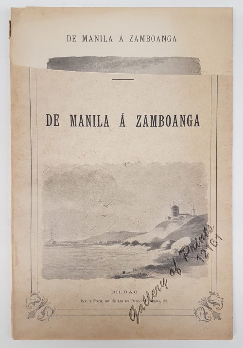
De Manila á Zamboanga
1 x
₱
5,500.00
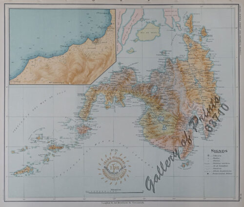
Les Isles Philippines, celle de Formose, le Sud de la Chine, les Royaumes de Tunkin, de Cochinchine, de Camboge, de Siam, des Laos… inset: 1) Isle de Guam. 2) [Isles Marianes]
1 x
₱
11,000.00
Nieuwe Kaart van de Filippynsche, Ladrones, Moluccos of Specery Eilanden, als mede Celebes etc.
1 x
₱
34,000.00
A Plan of the Bay of Manila / A Plan of the Harbour of Acapulco / A View of 2 of the Ladrone Islands
1 x
₱
39,600.00
Les Philippines
1 x
₱
7,700.00
Plan du Port de Subec, en I'Isle de Lucon [Plan of The Port of Subic on Luzon Island]
1 x
₱
33,000.00
1) Le Grimpereau des Philippines. [The Philippine Creeper] 2) Le Grimpereau de Ceylan. [The Ceylon Creeper] 3) Le Grimpereau olive des Philippines. [The Olive Creeper of the Philippines] a) [Anthreptes Malacensis] [Plain-throated sunbird] [Pipit] b) [Nectarinia Jugularis] [Olive-Backed sunbird] [Pipit-puso] 4) Le Grimpereau á tète víolette. [The Climbing Creeper] 5) Le Grimpereau á longue queue du Sénégal. [The long-tailed creeper of Senegal]
1 x
₱
6,600.00
Typus freti Manilensis detroit de Manilles [Straits of Manila]
1 x
₱
39,600.00
Lucon et Palaouan [Map of Luzon / Visayas]
1 x
₱
7,700.00
Salmon
1 x
₱
5,500.00
Marché de Maïbun
1 x
₱
5,500.00
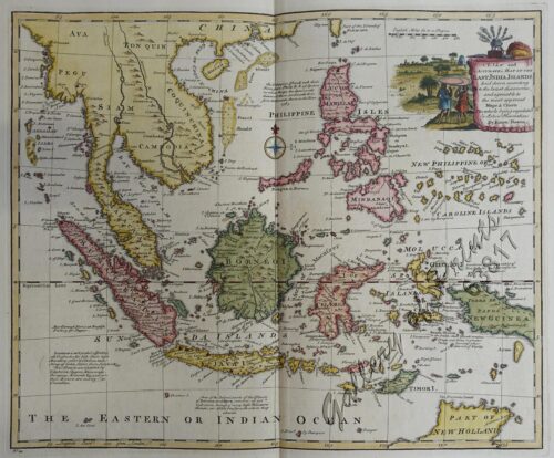
Archipel des Indes Orientales, qui comprend Les Isles de la Sonde, Moluques et Philippines… inset: Isles Marianes ou des Larons.
1 x
₱
34,100.00
A Filipino Street Band. A Scene in the Tondo Suburb of Manila.
1 x
₱
9,900.00
The Charting of the Oceans; Ten Centuries of Maritime Maps
1 x
₱
3,700.00
Interior of the Crater of the Volcano at Taal
1 x
₱
8,800.00
Chinesische Keramik auf den Philippinen Die Sammlung Eric E. Geiling [Katalog zur Ausstellung im Museum für Ostasiatische Kunst, Köln] [Chinese Ceramics in the Philippines - The Collection Eric E. Geiling in the Museum for East Asiatic Art in Cologne]
1 x
₱
3,300.00
1. Carte de la baie de Manille. 2. Carte générale de îles Philippines. 3. Baie de Cavite. 4. Diagrame de forces respectives des eccadres américaine et espagnole au combat de Manille.
1 x
₱
6,600.00
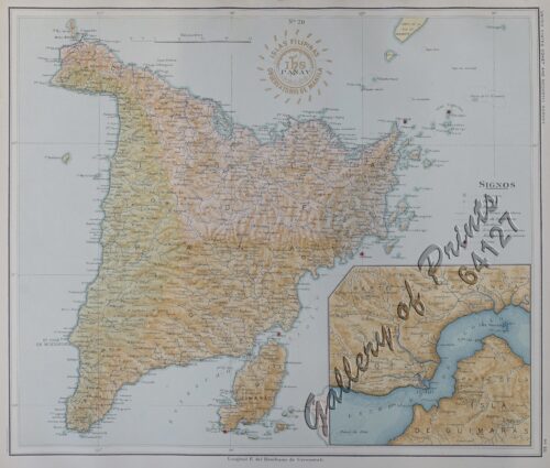
Isla de Panay pl. 20 (Antique, Capiz, Iloilo, Guimaras …………with inset of Guimaras Strait)
1 x
₱
6,600.00
Amarantus Tricolor. L. [English: Joseph's Coat] [Belongs to the Kolitis Family]
1 x
₱
26,400.00
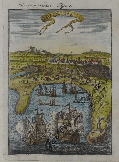
Manille - Die Stadt Manille [reverse picture] [City of Manila]
1 x
₱
22,000.00
De Sinu Baye La Baye (Gulf of Albay]
1 x
₱
56,000.00
Islas de Romblón, Tablas y Sibuyán pl. 16, inset: Isla Alad, I. Lugbung
1 x
₱
6,600.00
Theobroma Cacao. (Var. Alba) L. [English: Cacao]
1 x
₱
34,100.00
Cuadro de costumbres
1 x
₱
59,600.00
Carte des Isles Philippines, Celebes et Moluques [Kaart van de Filippynse, Celebes, en Molukse-Eilanden]
1 x
₱
13,200.00
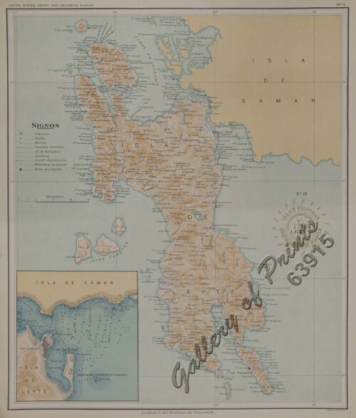
Islas de Leyte pl. 19, inset: Tacloban
1 x
₱
6,600.00
Mittheilungen aus Justus Perthes' Geographischer Anstalt über Wichtige neue Erforschungen auf dem Gesammtgebiete der Geographie von Dr. A. Petermann. - Ergänzungsband I, 1860 u. 1861. Inhalt: [Supplement Vol. 1 contents] No. 1. A. Vibe, Küsten and Meer Norwegens. No. 2. J. J. v. Tschudi, Reise durch die Andes von Sud- Amerika, 1858. No. 3. Dr. H. Barth, Reise durch Kleinasien, 1858. No. 4. G. Lejean, Ethnographie de Europäischen Türkei, mit französischem und deutschem Text. No. 5. Dr. Moritz Wagner, Physisch - geographische Skizze des Isthmus von Panama. No. 6. Petermann und Hassenstein, Ost - Afrika zwischen Chartum, Sauakin and Massaua.
1 x
₱
8,600.00
Anona Reticulata. L. [English: Custard Apple / Sugar Apple Bullock's Heart / Sweetsop ; Tagalog: Atis]
1 x
₱
27,900.00
Philippine Islands with insets: '1. Manila and Vicinity, 2. Manila, 3. Philippine Islands and the China Sea, 4. Batan and Babuyan Is., 5. Sulu Archipelago
1 x
₱
4,400.00
The Philipine Isles
1 x
₱
77,000.00
L'Illustration, Journal Universel. No. 650 Vol. XXVI 11 Aout 1855
1 x
₱
11,000.00
Die Ostindischen Inseln...
1 x
₱
39,600.00
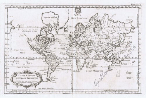
Carte Reduite du Globe Terrestre
1 x
₱
55,900.00
Lettres édifiantes et curieuses, ecrites des Missions Etrangeres, par quelques Missionaires de la Compagnie de Jesus; Epitre du Halde, Lettres des…Bouchet (Inde), Taillandier), Relation …deconverte …nouvelles Philippines [pp. 75-91]…Dentrecolles, Jacquemin (Chine), Gabriel (illinois), Sepp (Paraguay)
1 x
₱
29,500.00
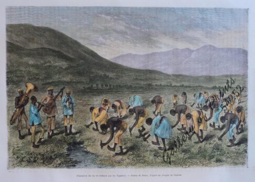
Plantation du riz en cadence par les Tagalocs [Tagalogs Planting Rice in Musical Tact]
1 x
₱
5,500.00
Sketches in Manilla. 1. Chinese Chow-chow sellers at Manilla; 2. The Meat Market at Manilla.
1 x
₱
7,700.00
Sterculia Nobilis. Smith. [English: Chinese Chestnut, Thai Chestnut] [Tagalog: Kalumpang] [China: Ping po] [also: Sterculia monosperma]
1 x
₱
26,400.00
a) bezeichnet den Lauf der Gallion Nuestra Señora de Cabadongo von Manila nach Acapulco.; b) Lauf der Gallion von Acapulco bis nach Guam, und von da nach den Philippinischen Inseln, wo diese Gallion am 30 Jun. 1743 von dem Ober Befehlshaber Anson erobert ward.
1 x
₱
26,400.00
Ethnography of the Major Ethnolinguistic Groups in the Cordillera
1 x
₱
1,100.00
Paradies-Amome. Fig. 302. [Paradise-Amome]; Lange Curcume. Fig. 303. [Long Curcume][Bromeliad]; Gemürzhafte Curcume. Fig. 304. [Herby Curcume]; Rohrartige Marante. Fig. 305. [Rod-like Marant]; Cardamom-Amome. Fig. 306 [Cardamon-Amome]
1 x
₱
5,500.00
Islas de Infanta y Polillo pl. 12 [Quezon Prov., Polilio Is., Pananongan I., Jomalig I.]
1 x
₱
4,400.00
1. Borneo. 2. The Philippine Islands.
1 x
₱
15,400.00
Chart of the East India Islands...
1 x
₱
6,600.00
Rajah Malais et sa Femme (voy. p. 102) [Malay Rajah and Spouse]
1 x
₱
4,400.00
Isla de Mindanao Jolo pl. 26
1 x
₱
6,600.00
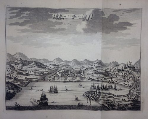
De Stad Manilha
1 x
₱
61,600.00
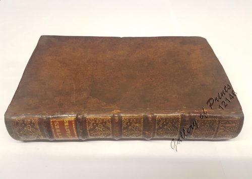
La Sainte Bible, contenant l'ancien et le nouveau testament. [The Holy Bible, Containing the Old and the New Testament] Version Revue sur les Originaux
1 x
₱
7,700.00
Pisonia Sylvestris. T. et B. Pisonia Alba. Spink [English: Lettuce Tree. Tagalog: Maluko] [Named after the Dutch Botanist - Willem Pison]
1 x
₱
26,400.00
Un Village de Lucon (voy. p. 114) [Luzon Village] [Naga]
1 x
₱
7,700.00
Sketches from Manilla and Hongkong. 1. "Soiree Musicale" at Manilla; 2. Chinese Nursemaid on the Parade- Ground, Hongkong
1 x
₱
9,900.00
Carte de la Partie Occidentale des Philippines.
1 x
₱
49,500.00
Islas Filipinas - Mapa Etnografico pl. 3, Observatorio de Manila
1 x
₱
6,600.00
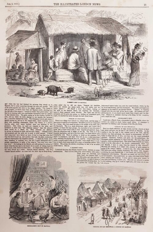
Sketches in Manilla. 1. Barber's shop in Manilla; 2. Shoemaker's Shop in Manilla; 3. Calzada de San Sebastian, a suburb of Manilla
1 x
₱
7,700.00
Une Rue de Libog [Albay] [Road in Libog Albay]
1 x
₱
4,400.00
Carte d' Espagne et des principaux etats appartments a Cette Monarchie dans les Parties du Monde. 1. Isles Philipines. 2. Duche de Millan. 3. Royaume de Naples. 4. Royaume de Sicille. 5. Isles Antilles. 6. Nouveau Mexique. 7. Nouvelle Espagne. 8. Terre Ferme. 9. Le Perou. 10. Chili. 11. Rio de Plata ou Paraguay. 12. Pais Bas Catolique. 13. Isles de Sardaigne. 14. Isles Canaries ou Isles Fortunees. 15. Espagne.
1 x
₱
39,600.00
1) Merops Bicolor [Rufous-crowned Bee-eater]; 2) Merops Sumatranus [Blue-throated Bee-eater]
1 x
₱
14,960.00
Bahia de Manila
1 x
₱
46,200.00
Carte de l'Archipel de St. Lazare ou Les Isles Marianes. [inset:] Isle de Guahan ou St. Jean. [Map of the St. Lazarus or Marianas Islands] [Island of Guam or St. John]
1 x
₱
6,600.00
A Chart of the China Sea, and Philippine Islands, with the Archipelagos of Felicia and Sooloo, shewing… …Canton and Balambangan,… composed from an original drawing, communicated by Capt. Robert Carr. and compared with the map of Pedro Murillo de Velarde, engraved at Manilla in 1734…. insets: 1) The Ports of Ylocos, on the West Coast of Luzon. 2) The Bay of Subic, on the West Coast of Luzon.
1 x
₱
780,000.00
1) Islas Filipinas: Primera Hoja Central; 2) Islas Filipinas: Segunda Hoja Central; 3) Posesiones de Ultramar (Oceania) - Islas Filipinas
1 x
₱
99,000.00
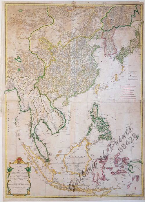
Seconde partie de la Carte d'Asie contenant la Chine et partie de la Tartarie, l'Inde au delà du Gange, les Isles Sumatra, Java, Borneo, Moluques, Philippines, et du Japon.
1 x
₱
39,600.00
1) Le Pic de la Encenada. [The Peak of Encenada] 2) Le Pic Cardinal. [The Cardinal Peak] 3) Le Pic verd. [The Green Peak] 4) Le Pic verd de l'Isle de Luçon. [The Green Peak in the Island of Luzon]
1 x
₱
6,600.00
Zeocephus Cinnamomeus (Fig. 1) [Rufous Paradise Flycatcher] Z. Cyanescens (Fig. 2), pl.48 [Blue Paradise Flycatcher]
1 x
₱
22,000.00
1. Cap Blanc sur la Cote des Patagons,… Kaap Blanco aan de kust van Patagonian… 2. Cap Blanc, restant au S.O. …. Kaap Blanco strekkende Zuid len ….
1 x
₱
4,400.00
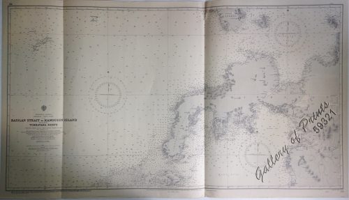
Philippine Islands Mindanao - West Coast - Basilan Strait to Kamiguin Island Including Tubbataha Reefs. From the United States Coast Survey Charts to 1924 with corrections to 1929
1 x
₱
11,000.00
Aechte Zuckerpalme. Fig. 314. [Genuine Palm Suger]; Rumph's Lapiapalme. Fig. 315. [Rumph's Lapiapalm]; Rundblättrige Saribupalme. Fig. 316. [Round-leaved Saribupalm]
1 x
₱
5,500.00
Manila Harbor Complimentary Map of the City of Manila.
1 x
₱
22,000.00
[Boy and Girl Sewing] Manila
1 x
₱
3,300.00
China Sea - Palawan - East Coast - Port Royalist (P.to Princesa de Asturias of the Spanish). Surveyed by Comr. W.T. Bate R.N. Assisted by Lt C. Pasco, C. Bullock, Mate & W.B. Colver 2nd Master H.M.S/ Royalist 1850
1 x
₱
6,600.00
Typus Fpeti Manilensis [sic], Detroit de Manilles, [Straits of Manila]
1 x
₱
39,600.00
A Chart of the Pelew Islands…
1 x
₱
39,600.00
Ladmiral surmonte s'en allant au fond a nostre veúe
1 x
₱
49,600.00
Entrée de la baie de Manille, (Iles Philippines) Entrevue nocturne de l'Auteur avec les petits noirs des Montagnes. [Entrance of Manila Bay (Philippine Islands) Nocturnal Meeting of the Author With the Native Mountain People]
1 x
₱
298,000.00
1) Carte des Isles Philippines (1e feuille) Kaart der Philippines Eilanden, Geschikt op de Spaansche Kaart van Pater Murillo de Velarde 1.ste Blad. Door den Hr. Bellin Ingr. des Fransen Zeevaards. 2) Carte des Isles Philippines (2e feuille) Kaart der Philippines Eilanden, Geschikt op de Spaansche Kaart van Pater Murillo de Velarde 2.de Blad. Door den Hr. Bellin Ingr. des Fransen Zeevaards.
1 x
₱
77,000.00
Asien. (Übersicht.)
1 x
₱
6,600.00
[Carte Reduite] Carte Réduite des Isles Philippines Pour Servir Aux Vaisseaux du Roy Dressée au Dépost des Cartes Plans et Journaux de la Marine
1 x
₱
425,000.00
Sammlung gemeinverständlicher wissenschaftlicher Vorträge [Collection of Scientific Presentations in a Generally Comprehensible Version] [INCLUDING:] Die Philippinen. Eine übersichtliche Darstellung der ethnographischen und historisch=politischen Verhältnisse des Archipels. [An Overview of the Ethnographic and Historical-Political Situation in the Archipelago] Mit einem Anhange - Die wichtigsten Paragraphen der Verfassung der philippinischen Republik. [The most important paragraphs of the Constitution of the Philippine Republic]
1 x
₱
15,700.00
Terrain Handbook 41 Manila (Philippine Series)
1 x
₱
22,000.00
The Revolt in the Philippine Islands. 1. Philippine Aborigines. 2. View of the River Pasig at Manila. 3. Gate Leading Within the Walls. 4. Village of San Juento. 5. Types of the Native Soldiery.
1 x
₱
5,500.00
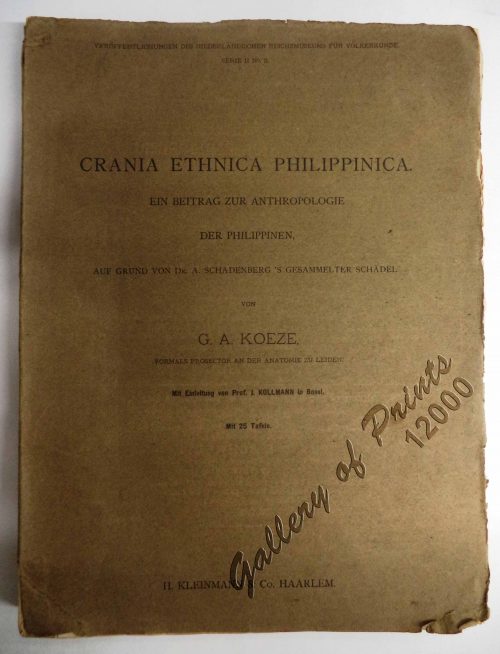
Crania Ethnica Philippinica. Ein Beitrag zur Anthropologie der Philippinen auf Grund von Dr. A. Schadenberg's gesammelter Scha[e]del [Dr. A. Schadenberrg's Collection of Skulls - Basis for a Controbution to Philippine Anthopology]
1 x
₱
13,200.00
Philippine Islands. Anchorages in Northern Luzon and the Babuyan Islands. Insets: 1) Babuyan Is. - Fuga I. Musa Bay. From the United States Government Chart to 1931. 2) Babuyan Is. - Camiguin I. Port San Pio Quinto. From the United States Government Chart to 1931. 3) Luzon-North-East Coast Port San Vicente. From the United States Government Chart to 1938. 4) Luzon - East Coast Mauban Anchorage. From the Philippine Government Chart of 1957. 5) Luzon - West Coast. Salomague Harbour and Lapog Bay. From the United States Government Chart of 1934. 6) Luzon - West Coast Port Currimao and Gan Bay. From the United States Government Chart of 1934. 7) Luzon - West Coast Solvec Cove. From the United States Government Chart of 1934. 8) Luzon - West Coast Lingayen Gulf. Port Sual with Cabalitian Bay. From the United States Government Chart of 1922. 9) Luzon - West Coast San Fernando Harbour. From the United States Government Chart of 1936.
1 x
₱
11,000.00
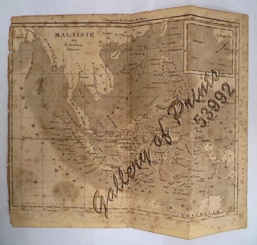
'Malaisie. inset: I. Bassilan
1 x
₱
4,400.00
A Chart of the Channel in the Phillippine [sic] Islands through which the Manila Galleon Passes Together with the Adjacent Islands
1 x
₱
39,600.00
The Bontoc Igorot. The Ethnological Survey Publications vol. 1.
1 x
₱
14,700.00
Wanderjahre eines jungen Hamburger Kaufmannes - Eine Reise um die Erde in 1000 Tagen [Ramblings of a Young Hamburg Merchant - A Voyage Around the World in 1000 Days]
1 x
₱
5,500.00
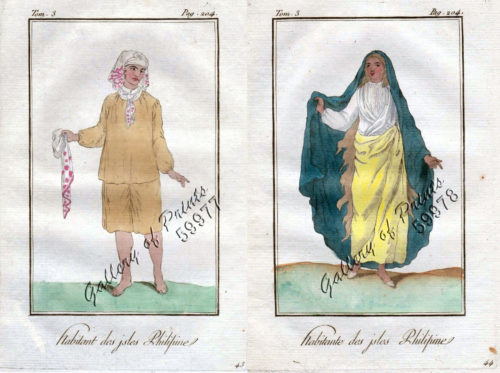
1) Habitant des Isles Philipine. 2) Femme des Isles Philipine [sic]
1 x
₱
18,700.00
New Butterflies from Kina-Balu Fig. 1&2 Papilio stratiotes. 3, 4 procles 5, 6 Appias whiteheadi. 7, 8 Sithon kiana.
1 x
₱
13,200.00
1) Carta dell'Isole Filippine [1st sheet]. 2) Carta dell'Isole Filippine di Mr. Bellin Ingegnere della Marine Foglio 1 mo [2nd sheet]
1 x
₱
61,600.00
Philippine Islands. The Passages Between Panay. Negros and Cebu. North of Latitude 10° 17' North. From the United States Government Charts of 1933. With Additions and Corrections from the Philippine Gov't. Charts to 1963.
1 x
₱
11,000.00
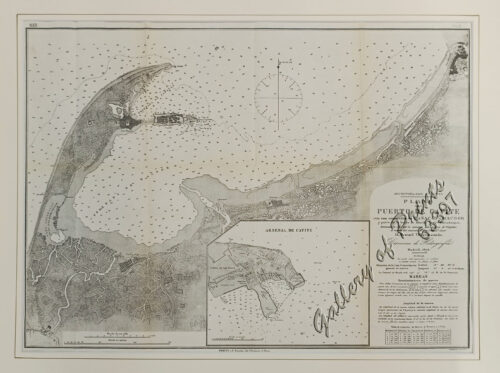
Archipiélago Filipino. Plano del Puerto de Cavite con sus ensenadas de Cañacao y Bacoor y parte de la bahia de Manila hasta Parañaque, levantado en 1872 por la comision hidrográfica de Filipinas al mando del teniente de Navio de 1a. clase [inset:] Arsenal de Cavite
1 x
₱
9,900.00
1. Casco, bateau de transport de Manille ["Casco", cargo boat from Manila] 2. Plan 3. Elevation de l'arriere [Rear Elevation] 4. Section 5. Pirogue a double balancier de la Laguna [Double Outrigger Canoe from La Laguna] 6. Plan 7. Section
1 x
₱
49,600.00
Mapa General Atlas Geografico Descriptivo de la Peninsula Ibérica Yslas Baleares, Canarias y posesiones Españolas de Ultramar por el Comandte Capn de Infa auxiliar que ha sido del Deposito de la Guerra D. Emilio Valverde Y Alvarez. [insets]: 1. Islas Filipinas 2. Posesiones Españolas de golfo del Guinea 3. Antillas Españolas 4. Islas Canarias
1 x
₱
17,700.00
Philippine Islands. Tagolo Point to Cuyo Islands. Including Sebu , Negros and Parts of Panay and Palawan. From the United States Coast Survey Charts to 1923.
1 x
₱
11,000.00
[Carte Reduite] Carte Réduite des Isles Philippines Pour Servir Aux Vaisseaux du Roy Dressée au Dépost des Cartes Plans et Journaux de la Marine
1 x
₱
450,000.00
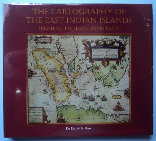
The Cartography of the East Indian Islands, Insulae Indiae Orientalis.
1 x
₱
6,600.00
1) Constitucion de la Monarquia Española. [Constitution of the Spanish Monarchy] 2) Ley Electoral para el nombramiento de diputados a cortes. [Electoral Law for the appointment of deputies to courts] 3) Reglamento para el gobierno interior del senado. [Regulations for the internal government of the Senate] 4) Reglamento del congreso de diputados; [Regulations of the Congress of Deputies] y ley de 19 de Julio de 1837. [and law of July 19, 1837.]
1 x
₱
6,600.00
Found in the Philippines: The Story of a Woman's Letters
1 x
₱
6,600.00
[Cloudless Sulphur Butterfly and Caterpillar with Moth]
1 x
₱
6,600.00
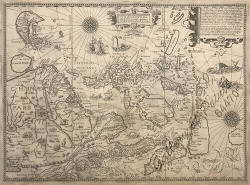
Exacta & accurata delineatio cum orarum maritimarum tum etjam locorum terrestrium quae in Regionibus China, Cauchinchina, Camboja sive Champa, Syao, Malacca, Arracan & Pegu… Waarachtige uitworpinghe ofte afbeeldinge van alle die custen ende landen van China, … [Accurate & Detailed Drawing with Borders Maritime and even Terrestrial Places Located in the Regions of China….]
1 x
₱
1,100,000.00
Insulae Philippinae… [inset: Manila]
1 x
₱
1,250,000.00
A Plan of the Bay of Manila / A Plan of the Harbour of Acapulco / A View of 2 of the Ladrone Islands
1 x
₱
39,600.00
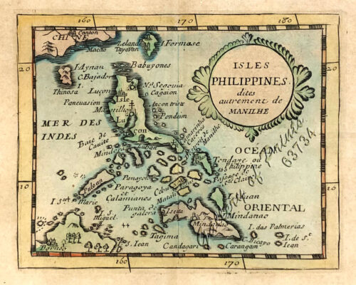
Isles Philippines dites autrement de Manilhe
1 x
₱
49,500.00
1) Philentoma Cyaniceps [Flycatcher]; 2) Pycnonotus Urostictus [Wattled Bulbul]
1 x
₱
11,000.00
Annual Report to the Board of Regents of the Smithsonian Institution...... [containing a.o.]. 1.List of Native Tribes of the Phils. and of the Languages Spoken By Them. 2.The Peopling of the Philippines.
1 x
₱
3,300.00
14. Spotted Kingfisher. (Alcedo guttatus)
1 x
₱
3,300.00
Manille - Die Stadt Manille
1 x
₱
25,500.00
Plan De La Baie De Bongo.
1 x
₱
6,600.00
El Indicador del Viajero en las Islas Filipinas
1 x
₱
77,000.00
La Danese [The Danish]
1 x
₱
6,600.00
Töchter eines Tagabawahäuptlings im Ballkostüme. [Daughters of a Tagbanua Chief in Festive Costume]
1 x
₱
7,700.00
[Luzon & Visayas]]
1 x
₱
165,000.00
Filipinas. Provincias y distritos de la isla de Luzon
1 x
₱
55,000.00
Philippine Pagans. The Autographies of Three Ifugaos
1 x
₱
5,500.00
Acciones y operaciones sobre Silang. (Desde el 15 al 18 Febrero - 1897.)
1 x
₱
7,700.00
A Chart of the Pacific Ocean from the Equinoctial to the Latitude of 39 1/2 d. No
1 x
₱
15,400.00
View Cart
Checkout
Home
About Us
Publications
Shop Online
Framing Services
Exhibits
Picture Hanging System
Contact Us
View cart
“A Chart of the Pacific Ocean from the Equinoctial to the Latitude of 39 1/2 d. No” has been added to your cart.
Sort by
Name
Sort by
Default Order
Sort by
Name
Sort by
Price
Sort by
Date
Sort by
Popularity
Show
30 Products
Show
30 Products
Show
60 Products
Show
90 Products
‘Luzon, West Coast – Port Santo Tomas – Li...
₱
2,200.00
Add to cart
Details
‘Malaisie. inset: I. Bassilan
₱
4,400.00
Add to cart
Details
‘XIV. Von Schanghai nach Guaham und Puynipet. [Carolin...
₱
3,300.00
Add to cart
Details
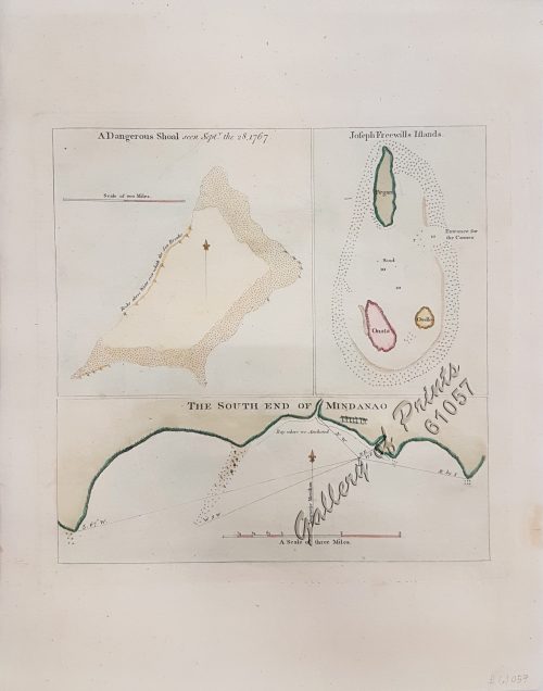
1) A Dangerous Shoal… 2) Joseph Freewills Island. 3) The S...
₱
13,500.00
Add to cart
Details
1) Carta dell’Isole Filippine [1st sheet]. 2) Carta de...
₱
61,600.00
Add to cart
Details
1) Carte des Isles Philippines (1e feuille) Kaart der Philip...
₱
77,000.00
Add to cart
Details
1) Isla de Paragua o Palawan Sur pl. 25 (Southern Palawan)
₱
7,700.00
Add to cart
Details
1) Islas Filipinas 1ª Hoja; 2) Islas Filipinas 2...
₱
39,600.00
Add to cart
Details
1) Islas Filipinas: Primera Hoja Central; 2) Islas Filipinas...
₱
99,000.00
Add to cart
Details
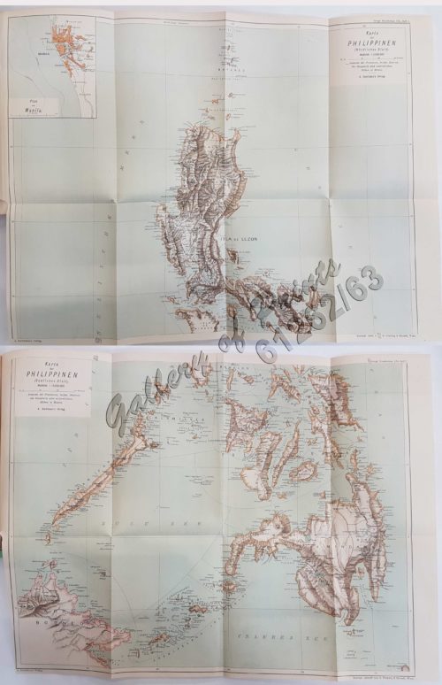
1) Karte der Philippinen (Nördliches Blatt), inset: Plan vo...
₱
39,600.00
Add to cart
Details
1) Mapa de las Islas Filipinas 2) Islas Carolinas 3) Islas...
₱
15,700.00
Add to cart
Details
1) Plan du port d’ Acapulco sur la Côte du Mexique da...
₱
26,400.00
Add to cart
Details
1) Plan of Solsogon Harbour on the South Coast of Luconia. 2...
₱
36,500.00
Add to cart
Details
1. Borneo. 2. The Philippine Islands.
₱
15,400.00
Add to cart
Details
1. Cap Blanc sur la Cote des Patagons,… Kaap Blanco aan de...
₱
4,400.00
Add to cart
Details
A Chart of the Channel in the Philipine Islands [sic] Throug...
₱
26,400.00
Add to cart
Details
A Chart of the Channel in the Phillippine Islands through wh...
₱
44,000.00
Add to cart
Details
A Chart of the Channel in the Phillippine [sic] Islands thro...
₱
39,600.00
Add to cart
Details
A Chart of the China Sea, and Philippine Islands, with the A...
₱
780,000.00
Add to cart
Details
A Chart of the Coast of China from Cambodia to Nanquam with ...
₱
155,000.00
Add to cart
Details
A Chart of the Pacific Ocean from the Equinoctial to the Lat...
₱
15,400.00
Add to cart
Details
A Chart of the Pelew Islands…
₱
39,600.00
Add to cart
Details
A Map of the East Indies from the latest Authorities and Obs...
₱
26,400.00
Add to cart
Details
A New and Accurate Map of the East India Islands
₱
56,100.00
Add to cart
Details
A New Map of the East Indies, Taken from Mr. de Fer’s ...
₱
49,500.00
Add to cart
Details
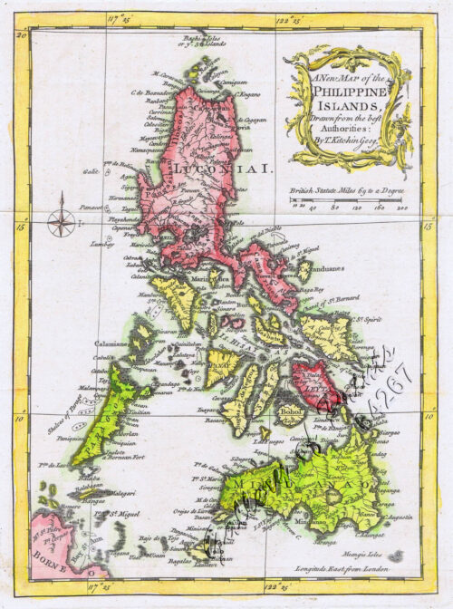
A New Map of the Philippine Islands, Drawn from the best Aut...
₱
49,500.00
Add to cart
Details
A New Map of the Philippine Islands, Drawn from the best Aut...
₱
77,000.00
Add to cart
Details
A New Map of the World according to Wright’s alias Mer...
₱
125,000.00
Add to cart
Details
A Plan of the Bay of Manila / A Plan of the Harbour of Acapu...
₱
39,600.00
Add to cart
Details
A Plan of the Bay of Manila / A Plan of the Harbour of Acapu...
₱
39,600.00
Add to cart
Details
a) bezeichnet den Lauf der Gallion Nuestra Señora de Cabado...
₱
26,400.00
Add to cart
Details
AAF Aeronautical Chart No. 620, Babuyan Islands Scale 1:1,...
₱
11,000.00
Add to cart
Details
AAF Cloth Chart – Philippine Series No. C-41, Mindoro ...
₱
46,500.00
Add to cart
Details
Acciones y operaciones sobre Silang. (Desde el 15 al 18 Febr...
₱
7,700.00
Add to cart
Details
Action between 28″ Inf. U.S.V. and Filipino Rebels Jul...
₱
5,500.00
Add to cart
Details
Afrique Meridionale
₱
5,500.00
Add to cart
Details
America Septentrionalis Coloniis in Interiorem Virginiam ded...
₱
15,700.00
Add to cart
Details
Archipel Asiatique. inset maps: 1. Manille et Environs. 2. L...
₱
15,700.00
Add to cart
Details
Archipel de Jolo
₱
3,300.00
Add to cart
Details
Archipel des Indes Orientales, qui comprend Les Isles de la ...
₱
34,100.00
Add to cart
Details
Archipiélago Filipino – Isla de Mindanao Plano del Pu...
₱
4,400.00
Add to cart
Details
Archipiélago Filipino. Plano del Puerto de Cavite con sus e...
₱
9,900.00
Add to cart
Details
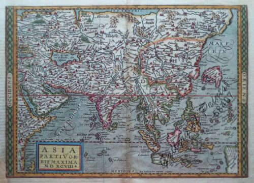
Asia partiu orbis maxima. MDXCVIII.
₱
61,600.00
Add to cart
Details
Asia wie es jetziger Zeit…
₱
49,500.00
Add to cart
Details
Asiae Recentissima Delineatio, Qua Status ex Imperia Totius...
₱
39,600.00
Add to cart
Details
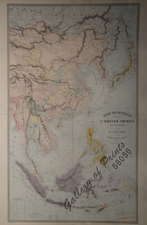
Asie orientale comprenant l’empire Chinois et le Japon...
₱
42,900.00
Add to cart
Details
Asie: Partie de la Chine pl. 88
₱
19,700.00
Add to cart
Details
Asien Politische Übersicht [Asia Political Overview]
₱
5,500.00
Add to cart
Details
Asien. (Übersicht.)
₱
6,600.00
Add to cart
Details
Bacolod Fort
₱
3,300.00
Add to cart
Details
Bahia de Manila
₱
46,200.00
Add to cart
Details
Bahia de Manila pl. 29 inset: Manila
₱
7,700.00
Add to cart
Details
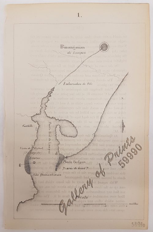
Binangonan
₱
6,600.00
Add to cart
Details
1
2
3
4
…
7
8
9
Next
Shopping Cart
A Chart of the Pacific Ocean from the Equinoctial to the Latitude of 39 1/2 d. No
1
Acciones y operaciones sobre Silang. (Desde el 15 al 18 Febrero - 1897.)
1
Philippine Pagans. The Autographies of Three Ifugaos
1
Filipinas. Provincias y distritos de la isla de Luzon
1
[Luzon & Visayas]]
1
Töchter eines Tagabawahäuptlings im Ballkostüme. [Daughters of a Tagbanua Chief in Festive Costume]
1
La Danese [The Danish]
1
El Indicador del Viajero en las Islas Filipinas
1
Plan De La Baie De Bongo.
1
Manille - Die Stadt Manille
1
14. Spotted Kingfisher. (Alcedo guttatus)
1
Annual Report to the Board of Regents of the Smithsonian Institution...... [containing a.o.]. 1.List of Native Tribes of the Phils. and of the Languages Spoken By Them. 2.The Peopling of the Philippines.
1
1) Philentoma Cyaniceps [Flycatcher]; 2) Pycnonotus Urostictus [Wattled Bulbul]
1
Isles Philippines dites autrement de Manilhe
1
A Plan of the Bay of Manila / A Plan of the Harbour of Acapulco / A View of 2 of the Ladrone Islands
1
Insulae Philippinae… [inset: Manila]
1
Exacta & accurata delineatio cum orarum maritimarum tum etjam locorum terrestrium quae in Regionibus China, Cauchinchina, Camboja sive Champa, Syao, Malacca, Arracan & Pegu… Waarachtige uitworpinghe ofte afbeeldinge van alle die custen ende landen van China, … [Accurate & Detailed Drawing with Borders Maritime and even Terrestrial Places Located in the Regions of China….]
1
[Cloudless Sulphur Butterfly and Caterpillar with Moth]
1
Found in the Philippines: The Story of a Woman's Letters
1
1) Constitucion de la Monarquia Española. [Constitution of the Spanish Monarchy] 2) Ley Electoral para el nombramiento de diputados a cortes. [Electoral Law for the appointment of deputies to courts] 3) Reglamento para el gobierno interior del senado. [Regulations for the internal government of the Senate] 4) Reglamento del congreso de diputados; [Regulations of the Congress of Deputies] y ley de 19 de Julio de 1837. [and law of July 19, 1837.]
1
The Cartography of the East Indian Islands, Insulae Indiae Orientalis.
1
[Carte Reduite] Carte Réduite des Isles Philippines Pour Servir Aux Vaisseaux du Roy Dressée au Dépost des Cartes Plans et Journaux de la Marine
1
Philippine Islands. Tagolo Point to Cuyo Islands. Including Sebu , Negros and Parts of Panay and Palawan. From the United States Coast Survey Charts to 1923.
1
Mapa General Atlas Geografico Descriptivo de la Peninsula Ibérica Yslas Baleares, Canarias y posesiones Españolas de Ultramar por el Comandte Capn de Infa auxiliar que ha sido del Deposito de la Guerra D. Emilio Valverde Y Alvarez. [insets]: 1. Islas Filipinas 2. Posesiones Españolas de golfo del Guinea 3. Antillas Españolas 4. Islas Canarias
1
1. Casco, bateau de transport de Manille ["Casco", cargo boat from Manila] 2. Plan 3. Elevation de l'arriere [Rear Elevation] 4. Section 5. Pirogue a double balancier de la Laguna [Double Outrigger Canoe from La Laguna] 6. Plan 7. Section
1
Archipiélago Filipino. Plano del Puerto de Cavite con sus ensenadas de Cañacao y Bacoor y parte de la bahia de Manila hasta Parañaque, levantado en 1872 por la comision hidrográfica de Filipinas al mando del teniente de Navio de 1a. clase [inset:] Arsenal de Cavite
1
Philippine Islands. The Passages Between Panay. Negros and Cebu. North of Latitude 10° 17' North. From the United States Government Charts of 1933. With Additions and Corrections from the Philippine Gov't. Charts to 1963.
1
1) Carta dell'Isole Filippine [1st sheet]. 2) Carta dell'Isole Filippine di Mr. Bellin Ingegnere della Marine Foglio 1 mo [2nd sheet]
1
New Butterflies from Kina-Balu Fig. 1&2 Papilio stratiotes. 3, 4 procles 5, 6 Appias whiteheadi. 7, 8 Sithon kiana.
1
1) Habitant des Isles Philipine. 2) Femme des Isles Philipine [sic]
1
Wanderjahre eines jungen Hamburger Kaufmannes - Eine Reise um die Erde in 1000 Tagen [Ramblings of a Young Hamburg Merchant - A Voyage Around the World in 1000 Days]
1
The Bontoc Igorot. The Ethnological Survey Publications vol. 1.
1
A Chart of the Channel in the Phillippine [sic] Islands through which the Manila Galleon Passes Together with the Adjacent Islands
1
'Malaisie. inset: I. Bassilan
1
Philippine Islands. Anchorages in Northern Luzon and the Babuyan Islands. Insets: 1) Babuyan Is. - Fuga I. Musa Bay. From the United States Government Chart to 1931. 2) Babuyan Is. - Camiguin I. Port San Pio Quinto. From the United States Government Chart to 1931. 3) Luzon-North-East Coast Port San Vicente. From the United States Government Chart to 1938. 4) Luzon - East Coast Mauban Anchorage. From the Philippine Government Chart of 1957. 5) Luzon - West Coast. Salomague Harbour and Lapog Bay. From the United States Government Chart of 1934. 6) Luzon - West Coast Port Currimao and Gan Bay. From the United States Government Chart of 1934. 7) Luzon - West Coast Solvec Cove. From the United States Government Chart of 1934. 8) Luzon - West Coast Lingayen Gulf. Port Sual with Cabalitian Bay. From the United States Government Chart of 1922. 9) Luzon - West Coast San Fernando Harbour. From the United States Government Chart of 1936.
1
Crania Ethnica Philippinica. Ein Beitrag zur Anthropologie der Philippinen auf Grund von Dr. A. Schadenberg's gesammelter Scha[e]del [Dr. A. Schadenberrg's Collection of Skulls - Basis for a Controbution to Philippine Anthopology]
1
The Revolt in the Philippine Islands. 1. Philippine Aborigines. 2. View of the River Pasig at Manila. 3. Gate Leading Within the Walls. 4. Village of San Juento. 5. Types of the Native Soldiery.
1
Terrain Handbook 41 Manila (Philippine Series)
1
Sammlung gemeinverständlicher wissenschaftlicher Vorträge [Collection of Scientific Presentations in a Generally Comprehensible Version] [INCLUDING:] Die Philippinen. Eine übersichtliche Darstellung der ethnographischen und historisch=politischen Verhältnisse des Archipels. [An Overview of the Ethnographic and Historical-Political Situation in the Archipelago] Mit einem Anhange - Die wichtigsten Paragraphen der Verfassung der philippinischen Republik. [The most important paragraphs of the Constitution of the Philippine Republic]
1
[Carte Reduite] Carte Réduite des Isles Philippines Pour Servir Aux Vaisseaux du Roy Dressée au Dépost des Cartes Plans et Journaux de la Marine
1
Asien. (Übersicht.)
1
1) Carte des Isles Philippines (1e feuille) Kaart der Philippines Eilanden, Geschikt op de Spaansche Kaart van Pater Murillo de Velarde 1.ste Blad. Door den Hr. Bellin Ingr. des Fransen Zeevaards. 2) Carte des Isles Philippines (2e feuille) Kaart der Philippines Eilanden, Geschikt op de Spaansche Kaart van Pater Murillo de Velarde 2.de Blad. Door den Hr. Bellin Ingr. des Fransen Zeevaards.
1
Entrée de la baie de Manille, (Iles Philippines) Entrevue nocturne de l'Auteur avec les petits noirs des Montagnes. [Entrance of Manila Bay (Philippine Islands) Nocturnal Meeting of the Author With the Native Mountain People]
1
Ladmiral surmonte s'en allant au fond a nostre veúe
1
A Chart of the Pelew Islands…
1
Typus Fpeti Manilensis [sic], Detroit de Manilles, [Straits of Manila]
1
China Sea - Palawan - East Coast - Port Royalist (P.to Princesa de Asturias of the Spanish). Surveyed by Comr. W.T. Bate R.N. Assisted by Lt C. Pasco, C. Bullock, Mate & W.B. Colver 2nd Master H.M.S/ Royalist 1850
1
[Boy and Girl Sewing] Manila
1
Manila Harbor Complimentary Map of the City of Manila.
1
Aechte Zuckerpalme. Fig. 314. [Genuine Palm Suger]; Rumph's Lapiapalme. Fig. 315. [Rumph's Lapiapalm]; Rundblättrige Saribupalme. Fig. 316. [Round-leaved Saribupalm]
1
Philippine Islands Mindanao - West Coast - Basilan Strait to Kamiguin Island Including Tubbataha Reefs. From the United States Coast Survey Charts to 1924 with corrections to 1929
1
1. Cap Blanc sur la Cote des Patagons,… Kaap Blanco aan de kust van Patagonian… 2. Cap Blanc, restant au S.O. …. Kaap Blanco strekkende Zuid len ….
1
Zeocephus Cinnamomeus (Fig. 1) [Rufous Paradise Flycatcher] Z. Cyanescens (Fig. 2), pl.48 [Blue Paradise Flycatcher]
1
1) Le Pic de la Encenada. [The Peak of Encenada] 2) Le Pic Cardinal. [The Cardinal Peak] 3) Le Pic verd. [The Green Peak] 4) Le Pic verd de l'Isle de Luçon. [The Green Peak in the Island of Luzon]
1
Seconde partie de la Carte d'Asie contenant la Chine et partie de la Tartarie, l'Inde au delà du Gange, les Isles Sumatra, Java, Borneo, Moluques, Philippines, et du Japon.
1
1) Islas Filipinas: Primera Hoja Central; 2) Islas Filipinas: Segunda Hoja Central; 3) Posesiones de Ultramar (Oceania) - Islas Filipinas
1
A Chart of the China Sea, and Philippine Islands, with the Archipelagos of Felicia and Sooloo, shewing… …Canton and Balambangan,… composed from an original drawing, communicated by Capt. Robert Carr. and compared with the map of Pedro Murillo de Velarde, engraved at Manilla in 1734…. insets: 1) The Ports of Ylocos, on the West Coast of Luzon. 2) The Bay of Subic, on the West Coast of Luzon.
1
Carte de l'Archipel de St. Lazare ou Les Isles Marianes. [inset:] Isle de Guahan ou St. Jean. [Map of the St. Lazarus or Marianas Islands] [Island of Guam or St. John]
1
Bahia de Manila
1
1) Merops Bicolor [Rufous-crowned Bee-eater]; 2) Merops Sumatranus [Blue-throated Bee-eater]
1
Carte d' Espagne et des principaux etats appartments a Cette Monarchie dans les Parties du Monde. 1. Isles Philipines. 2. Duche de Millan. 3. Royaume de Naples. 4. Royaume de Sicille. 5. Isles Antilles. 6. Nouveau Mexique. 7. Nouvelle Espagne. 8. Terre Ferme. 9. Le Perou. 10. Chili. 11. Rio de Plata ou Paraguay. 12. Pais Bas Catolique. 13. Isles de Sardaigne. 14. Isles Canaries ou Isles Fortunees. 15. Espagne.
1
Une Rue de Libog [Albay] [Road in Libog Albay]
1
Sketches in Manilla. 1. Barber's shop in Manilla; 2. Shoemaker's Shop in Manilla; 3. Calzada de San Sebastian, a suburb of Manilla
1
Islas Filipinas - Mapa Etnografico pl. 3, Observatorio de Manila
1
Carte de la Partie Occidentale des Philippines.
1
Sketches from Manilla and Hongkong. 1. "Soiree Musicale" at Manilla; 2. Chinese Nursemaid on the Parade- Ground, Hongkong
1
Un Village de Lucon (voy. p. 114) [Luzon Village] [Naga]
1
Pisonia Sylvestris. T. et B. Pisonia Alba. Spink [English: Lettuce Tree. Tagalog: Maluko] [Named after the Dutch Botanist - Willem Pison]
1
La Sainte Bible, contenant l'ancien et le nouveau testament. [The Holy Bible, Containing the Old and the New Testament] Version Revue sur les Originaux
1
De Stad Manilha
1
Isla de Mindanao Jolo pl. 26
1
Rajah Malais et sa Femme (voy. p. 102) [Malay Rajah and Spouse]
1
Chart of the East India Islands...
1
1. Borneo. 2. The Philippine Islands.
1
Islas de Infanta y Polillo pl. 12 [Quezon Prov., Polilio Is., Pananongan I., Jomalig I.]
1
Paradies-Amome. Fig. 302. [Paradise-Amome]; Lange Curcume. Fig. 303. [Long Curcume][Bromeliad]; Gemürzhafte Curcume. Fig. 304. [Herby Curcume]; Rohrartige Marante. Fig. 305. [Rod-like Marant]; Cardamom-Amome. Fig. 306 [Cardamon-Amome]
1
Ethnography of the Major Ethnolinguistic Groups in the Cordillera
1
a) bezeichnet den Lauf der Gallion Nuestra Señora de Cabadongo von Manila nach Acapulco.; b) Lauf der Gallion von Acapulco bis nach Guam, und von da nach den Philippinischen Inseln, wo diese Gallion am 30 Jun. 1743 von dem Ober Befehlshaber Anson erobert ward.
1
Sterculia Nobilis. Smith. [English: Chinese Chestnut, Thai Chestnut] [Tagalog: Kalumpang] [China: Ping po] [also: Sterculia monosperma]
1
Sketches in Manilla. 1. Chinese Chow-chow sellers at Manilla; 2. The Meat Market at Manilla.
1
Plantation du riz en cadence par les Tagalocs [Tagalogs Planting Rice in Musical Tact]
1
Lettres édifiantes et curieuses, ecrites des Missions Etrangeres, par quelques Missionaires de la Compagnie de Jesus; Epitre du Halde, Lettres des…Bouchet (Inde), Taillandier), Relation …deconverte …nouvelles Philippines [pp. 75-91]…Dentrecolles, Jacquemin (Chine), Gabriel (illinois), Sepp (Paraguay)
1
Carte Reduite du Globe Terrestre
1
Die Ostindischen Inseln...
1
L'Illustration, Journal Universel. No. 650 Vol. XXVI 11 Aout 1855
1
The Philipine Isles
1
Philippine Islands with insets: '1. Manila and Vicinity, 2. Manila, 3. Philippine Islands and the China Sea, 4. Batan and Babuyan Is., 5. Sulu Archipelago
1
Anona Reticulata. L. [English: Custard Apple / Sugar Apple Bullock's Heart / Sweetsop ; Tagalog: Atis]
1
Mittheilungen aus Justus Perthes' Geographischer Anstalt über Wichtige neue Erforschungen auf dem Gesammtgebiete der Geographie von Dr. A. Petermann. - Ergänzungsband I, 1860 u. 1861. Inhalt: [Supplement Vol. 1 contents] No. 1. A. Vibe, Küsten and Meer Norwegens. No. 2. J. J. v. Tschudi, Reise durch die Andes von Sud- Amerika, 1858. No. 3. Dr. H. Barth, Reise durch Kleinasien, 1858. No. 4. G. Lejean, Ethnographie de Europäischen Türkei, mit französischem und deutschem Text. No. 5. Dr. Moritz Wagner, Physisch - geographische Skizze des Isthmus von Panama. No. 6. Petermann und Hassenstein, Ost - Afrika zwischen Chartum, Sauakin and Massaua.
1
Islas de Leyte pl. 19, inset: Tacloban
1
Carte des Isles Philippines, Celebes et Moluques [Kaart van de Filippynse, Celebes, en Molukse-Eilanden]
1
Cuadro de costumbres
1
Theobroma Cacao. (Var. Alba) L. [English: Cacao]
1
Islas de Romblón, Tablas y Sibuyán pl. 16, inset: Isla Alad, I. Lugbung
1
De Sinu Baye La Baye (Gulf of Albay]
1
Manille - Die Stadt Manille [reverse picture] [City of Manila]
1
Amarantus Tricolor. L. [English: Joseph's Coat] [Belongs to the Kolitis Family]
1
Isla de Panay pl. 20 (Antique, Capiz, Iloilo, Guimaras …………with inset of Guimaras Strait)
1
1. Carte de la baie de Manille. 2. Carte générale de îles Philippines. 3. Baie de Cavite. 4. Diagrame de forces respectives des eccadres américaine et espagnole au combat de Manille.
1
Chinesische Keramik auf den Philippinen Die Sammlung Eric E. Geiling [Katalog zur Ausstellung im Museum für Ostasiatische Kunst, Köln] [Chinese Ceramics in the Philippines - The Collection Eric E. Geiling in the Museum for East Asiatic Art in Cologne]
1
Interior of the Crater of the Volcano at Taal
1
The Charting of the Oceans; Ten Centuries of Maritime Maps
1
A Filipino Street Band. A Scene in the Tondo Suburb of Manila.
1
Archipel des Indes Orientales, qui comprend Les Isles de la Sonde, Moluques et Philippines… inset: Isles Marianes ou des Larons.
1
Marché de Maïbun
1
Salmon
1
Lucon et Palaouan [Map of Luzon / Visayas]
1
Typus freti Manilensis detroit de Manilles [Straits of Manila]
1
1) Le Grimpereau des Philippines. [The Philippine Creeper] 2) Le Grimpereau de Ceylan. [The Ceylon Creeper] 3) Le Grimpereau olive des Philippines. [The Olive Creeper of the Philippines] a) [Anthreptes Malacensis] [Plain-throated sunbird] [Pipit] b) [Nectarinia Jugularis] [Olive-Backed sunbird] [Pipit-puso] 4) Le Grimpereau á tète víolette. [The Climbing Creeper] 5) Le Grimpereau á longue queue du Sénégal. [The long-tailed creeper of Senegal]
1
Plan du Port de Subec, en I'Isle de Lucon [Plan of The Port of Subic on Luzon Island]
1
Les Philippines
1
A Plan of the Bay of Manila / A Plan of the Harbour of Acapulco / A View of 2 of the Ladrone Islands
1
Nieuwe Kaart van de Filippynsche, Ladrones, Moluccos of Specery Eilanden, als mede Celebes etc.
1
Les Isles Philippines, celle de Formose, le Sud de la Chine, les Royaumes de Tunkin, de Cochinchine, de Camboge, de Siam, des Laos… inset: 1) Isle de Guam. 2) [Isles Marianes]
1
De Manila á Zamboanga
1
Danse du mariage chez les Négritos (voy. p. 110) [Marriage Dance of the Negritoes]
1
The New America and the Far East: Philippines, Japan
1
The Luneta, Manila
1
1) Plan of Solsogon Harbour on the South Coast of Luconia. 2) Chart on the Eastern Coast of Bongo Bay in the Island of Mindanao.
1
Chart of the Coasts of America & Asia from California to Macao
1
Cart
Checkout
Continue Shopping
120