- Sorry, this product cannot be purchased.
View cart “Map of the United States showing the Territorial Expansion of a Century 1804 to 1904 insets: 1) The World. 2) Wake Island. 3) Territory of Alaska. 4) Guam Island. 5) Porto Rico. 6) Philippine Islands. 7) Hawaiian Islands. 8) Tutuila, Manua and Smaller Islands of the Samoan Group. 9) Plan of Panama Canal Zone. 10) Plan showing the Thirteen Original States.” has been added to your cart.
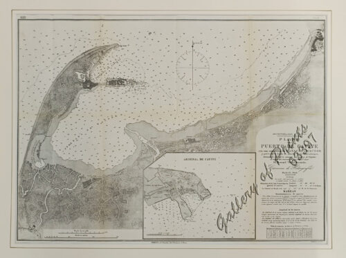
View cart “Archipiélago Filipino. Plano del Puerto de Cavite con sus ensenadas de Cañacao y Bacoor y parte de la bahia de Manila hasta Parañaque, levantado en 1872 por la comision hidrográfica de Filipinas al mando del teniente de Navio de 1a. clase [inset:] Arsenal de Cavite” has been added to your cart.
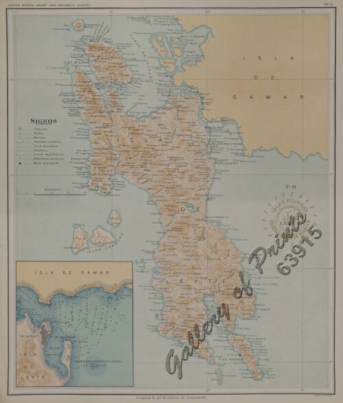
View cart “Islas de Leyte pl. 19, inset: Tacloban” has been added to your cart.