Tel : +63(2)-7729-8168
|
Email Us : gallery@gop.com.ph
My Account
Remember Me
Register
3 Item(s)
-
₱
48,500.00
Map of the United States showing the Territorial Expansion of a Century 1804 to 1904 insets: 1) The World. 2) Wake Island. 3) Territory of Alaska. 4) Guam Island. 5) Porto Rico. 6) Philippine Islands. 7) Hawaiian Islands. 8) Tutuila, Manua and Smaller Islands of the Samoan Group. 9) Plan of Panama Canal Zone. 10) Plan showing the Thirteen Original States.
1 x
₱
33,100.00
[Woman in National Costume Sewing] Philippine Islands. "Manila."
1 x
₱
6,600.00
The Earthquake at Manilla: 3 views. 1) Nave of the Cathedral after the Earthquake. 2) Tower of Binondo Church after the Earthquake. 3) Ruins of the Danish Consulate
1 x
₱
8,800.00
View Cart
Checkout
Home
About Us
Publications
Shop Online
Framing Services
Exhibits
Picture Hanging System
Contact Us
View cart
“The Earthquake at Manilla: 3 views. 1) Nave of the Cathedral after the Earthquake. 2) Tower of Binondo Church after the Earthquake. 3) Ruins of the Danish Consulate” has been added to your cart.
Sort by
Price
Sort by
Default Order
Sort by
Name
Sort by
Price
Sort by
Date
Sort by
Popularity
Show
30 Products
Show
30 Products
Show
60 Products
Show
90 Products
Engagement between the Crew of the Waaksamheyd Transport, &a...
Details
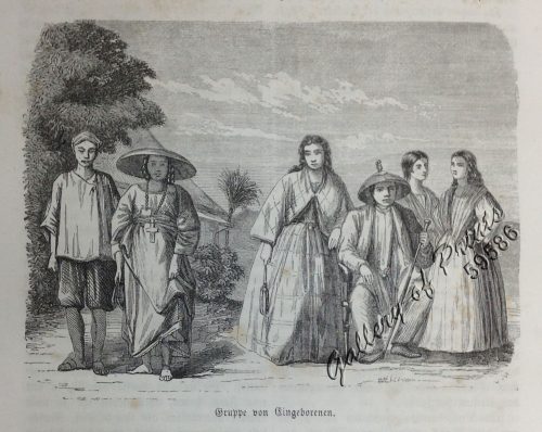
Gruppe von Eingeborenen. [Group of Natives]
₱
2,200.00
Add to cart
Details
Begräbniβ [Funeral]
₱
2,200.00
Add to cart
Details
‘Philippines. Philippinen. – Trombe et Typhon. W...
₱
2,200.00
Add to cart
Details
Geologie der Insel Luzon
₱
2,200.00
Add to cart
Details
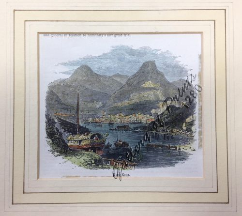
Hong Kong
₱
2,200.00
Add to cart
Details
An Old-style Culvert
₱
2,200.00
Add to cart
Details
Hot Springs at Tivi [Tiwi, Albay]
₱
2,200.00
Add to cart
Details
Waterfall of the Botocan (Laguna, Luzon)
₱
2,200.00
Add to cart
Details
1) Mus callitrichus. [Beautiful-tailed Rat, Lovely-haired Ra...
₱
2,200.00
Add to cart
Details
Gehörnte Enten. [Hornbill Ducks]
₱
2,200.00
Add to cart
Details
1
2
3
4
…
10
11
12
Next
Shopping Cart
The Earthquake at Manilla: 3 views. 1) Nave of the Cathedral after the Earthquake. 2) Tower of Binondo Church after the Earthquake. 3) Ruins of the Danish Consulate
1
[Woman in National Costume Sewing] Philippine Islands. "Manila."
1
Map of the United States showing the Territorial Expansion of a Century 1804 to 1904 insets: 1) The World. 2) Wake Island. 3) Territory of Alaska. 4) Guam Island. 5) Porto Rico. 6) Philippine Islands. 7) Hawaiian Islands. 8) Tutuila, Manua and Smaller Islands of the Samoan Group. 9) Plan of Panama Canal Zone. 10) Plan showing the Thirteen Original States.
1
Cart
Checkout
Continue Shopping
3