- View Cart You cannot add that amount to the cart — we have 1 in stock and you already have 1 in your cart.
- View cart You cannot add another "1. Pirogue de peche de la baie de Manille [Fishing canoe from Manila Bay] 2. Plan 3. Elevation de l'arriere [Rear Elevation] 4. Section 5. & 6. Avirons [Oars] 7. Petite pirogue [Small Canoe] 8. Plan 9. Elevation de l'arriere [Rear Elevation]" to your cart.
View cart “Terrain Handbook 41 Manila (Philippine Series)” has been added to your cart.
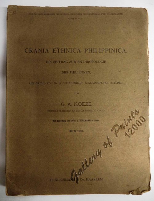
View cart “Crania Ethnica Philippinica. Ein Beitrag zur Anthropologie der Philippinen auf Grund von Dr. A. Schadenberg’s gesammelter Scha[e]del [Dr. A. Schadenberrg’s Collection of Skulls – Basis for a Controbution to Philippine Anthopology]” has been added to your cart.
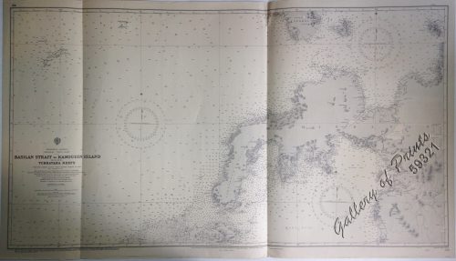
View cart “Philippine Islands. Anchorages in Northern Luzon and the Babuyan Islands. Insets: 1) Babuyan Is. – Fuga I. Musa Bay. From the United States Government Chart to 1931. 2) Babuyan Is. – Camiguin I. Port San Pio Quinto. From the United States Government Chart to 1931. 3) Luzon-North-East Coast Port San Vicente. From the United States Government Chart to 1938. 4) Luzon – East Coast Mauban Anchorage. From the Philippine Government Chart of 1957. 5) Luzon – West Coast. Salomague Harbour and Lapog Bay. From the United States Government Chart of 1934. 6) Luzon – West Coast Port Currimao and Gan Bay. From the United States Government Chart of 1934. 7) Luzon – West Coast Solvec Cove. From the United States Government Chart of 1934. 8) Luzon – West Coast Lingayen Gulf. Port Sual with Cabalitian Bay. From the United States Government Chart of 1922. 9) Luzon – West Coast San Fernando Harbour. From the United States Government Chart of 1936.” has been added to your cart.
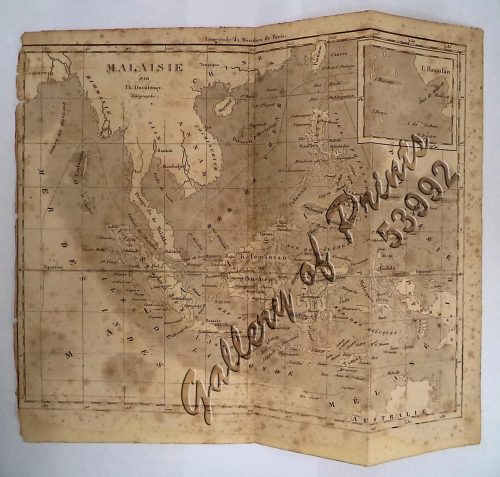
View cart “‘Malaisie. inset: I. Bassilan” has been added to your cart.