- View cart You cannot add another "Map of the United States showing the Territorial Expansion of a Century 1804 to 1904 insets: 1) The World. 2) Wake Island. 3) Territory of Alaska. 4) Guam Island. 5) Porto Rico. 6) Philippine Islands. 7) Hawaiian Islands. 8) Tutuila, Manua and Smaller Islands of the Samoan Group. 9) Plan of Panama Canal Zone. 10) Plan showing the Thirteen Original States." to your cart.
- View cart You cannot add another "Embarcaciones Antiguas [Old Boats] 1. Tronco labrado en forma de canoa. [Trunk carved in the shape of a canoe]. 2. Embarcación de mimbres recubierta de cuero. [Wicker boat covered in leather]. 3. Barco de cuero. [Leather Boat]. 4. Nave romana. [Roman ship]. 5 y 6. Galera y galeaza del siglo XVI. [Galley and galleass from the 16th century]. 7. Galeón del siglo XVII. [17th century galleon.]." to your cart.
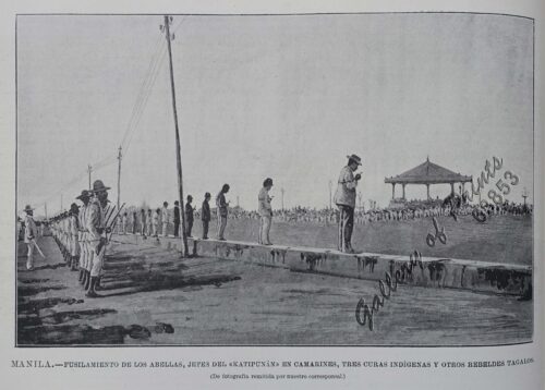
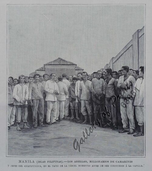
- View cart You cannot add another "La Guerra en Filipinas. - Las Canteras de Montalbán (Manila), donde fueron derrotados los insurrectos por la columna del comandante Olaguer. [The War in the Philippines. - The Montalban Quarries (Manila), where the insurgents were defeated by Commander Olaguer's column.]" to your cart.
Tel : +63(2)-7729-8168|Email Us : gallery@gop.com.ph