Tel : +63(2)-7729-8168
|
Email Us : gallery@gop.com.ph
My Account
Remember Me
Register
75 Item(s)
-
₱
3,000,910.00
Manila (Islas Filipinas). - Una calle de Caloocán.
1 x
₱
3,300.00
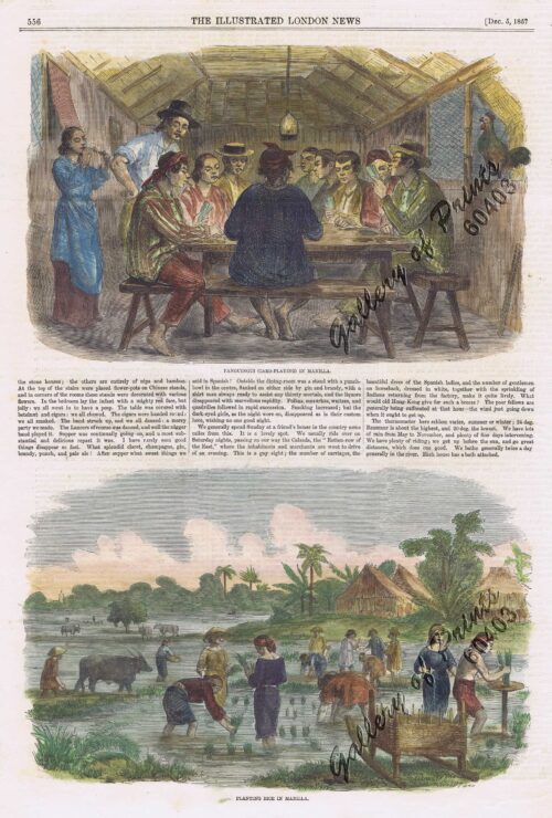
1. Panguingui (Card-playing) in Manilla; 2. Planting Rice in Manilla
1 x
₱
11,000.00
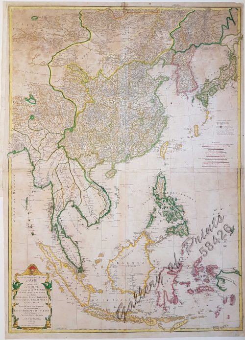
Seconde partie de la Carte d'Asie contenant la Chine et partie de la Tartarie, l'Inde au delà du Gange, les Isles Sumatra, Java, Borneo, Moluques, Philippines, et du Japon.
1 x
₱
39,600.00
Japanese Page
1 x
₱
4,400.00
Négritos de la sierra de Marivelès (île de Luçon) (voy. p. 107 et 108)
1 x
₱
6,600.00
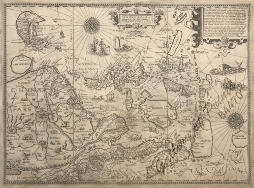
Exacta & accurata delineatio cum orarum maritimarum tum etjam locorum terrestrium quae in Regionibus China, Cauchinchina, Camboja sive Champa, Syao, Malacca, Arracan & Pegu… Waarachtige uitworpinghe ofte afbeeldinge van alle die custen ende landen van China, … [Accurate & Detailed Drawing with Borders Maritime and even Terrestrial Places Located in the Regions of China….]
1 x
₱
1,100,000.00
Entrée de la baie de Manille, (Iles Philippines) Entrevue nocturne de l'Auteur avec les petits noirs des Montagnes. [Entrance of Manila Bay (Philippine Islands) Nocturnal Meeting of the Author With the Native Mountain People]
1 x
₱
298,000.00
Palais du Sultan de Soulou… [Palace of the Sultan of Sulu]
1 x
₱
13,200.00
The Story of Maps. Putting the World in Perspective
1 x
₱
3,900.00
1) Radeaux de Peche a Manille (Fishraft), 2) Banka, Bateau de Passage [Outrigger Boat Ferry]
1 x
₱
4,400.00
Philippines - Interieur de L'Ile de Loucon Philippinen - Inneres der Insel Loucon [the Interior of the Island of Luzon][per text: Jala-Jala]
1 x
₱
4,400.00
Philippine Islands. Western Part of Mindanao Sea with Bohol Strait and Part of Tañon Strait. From the United States Government Charts to 1937.
1 x
₱
11,000.00
Sketches from Manilla and Hongkong. 1. "Soiree Musicale" at Manilla; 2. Chinese Nursemaid on the Parade- Ground, Hongkong
1 x
₱
9,900.00
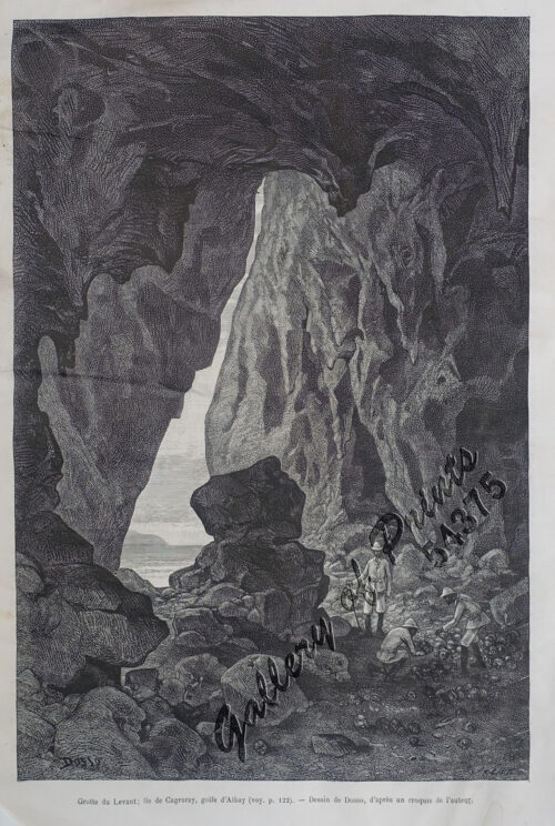
Grotte du Levant; Ile de Cagraray, Golfe d'Albay
1 x
₱
9,900.00
Girls Bathing
1 x
₱
6,600.00
Great Maps. the world's masterpieces explored and explained
1 x
₱
3,300.00
Courtiers and Cannibals, Angels and Amazons. The Art of the Decorative Cartographic Titlepage.
1 x
₱
5,500.00
Antique Maps - Christie's Collectors Guide
1 x
₱
2,500.00
[Sailing Boat] [illegible title]
1 x
₱
5,500.00
Isla de Paragua o Palawan Sur pl. 25 (Southern Palawan)
1 x
₱
6,600.00
The Murillo Bulletin, Journal of PHIMCOS, Issue No. 14
1 x
₱
790.00
Sketches in Manilla. 1. Chinese Chow-chow sellers at Manilla; 2. The Meat Market at Manilla.
1 x
₱
7,700.00
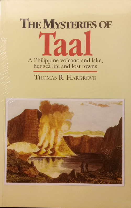
The Mysteries of Taal: A Philippine Volcano and Lake, Her Sea Life and Lost Towns
1 x
₱
900.00
The Spanish - American War In the Spanish Trenches at Manila: Midday
1 x
₱
4,400.00
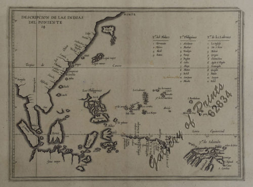
Descripcion de las Indias del Poniente (14)
1 x
₱
110,000.00
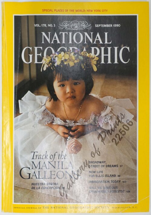
National Geographic September, 1990, Vol. 178, No. 3. Track of the Manila Galleons
1 x
₱
3,300.00
Luzon Island. inset : Vicinity of Manila
1 x
₱
5,500.00
Tipos Filipinos. Una Mestiza
1 x
₱
4,400.00
Cadavres des juramentados réunis après l'attaque
1 x
₱
6,600.00
The Murillo Bulletin, Journal of PHIMCOS, Issue No. 12
1 x
₱
750.00
Détroit de Bassilan (Iles Philippines) [sic] [Strait of Basilan] [Passage…]
1 x
₱
140,000.00
Une Rue de Libog [Albay] [Road in Libog Albay]
1 x
₱
4,400.00
Manila [Sketch and Description of Manila Port] [with a fleet of Adm. Joris van Spilberghen & a smoking Taal]
1 x
₱
110,000.00
Philippine Islands. insets: 1) Manila to Dagupan; 2) Manila; 3) Philippine Islands and the China Sea; 4) Batanes (Bashee) and Babuyanes Is.; 5) Sulu Archipelago
1 x
₱
13,200.00
Bird's-eye view of Manilla, Luzon, Philippine Islands.
1 x
₱
4,400.00
Die Chinesen, Japaner und Inder auf den Philippinen [The Chinese, Japanese, and Indians in the Philippines]
1 x
₱
2,500.00
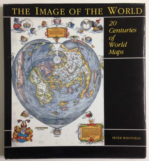
The Image of the World. 20 Centuries of World Maps
1 x
₱
3,300.00
Embarcaciones Antiguas [Old Boats] 1. Tronco labrado en forma de canoa. [Trunk carved in the shape of a canoe]. 2. Embarcación de mimbres recubierta de cuero. [Wicker boat covered in leather]. 3. Barco de cuero. [Leather Boat]. 4. Nave romana. [Roman ship]. 5 y 6. Galera y galeaza del siglo XVI. [Galley and galleass from the 16th century]. 7. Galeón del siglo XVII. [17th century galleon.].
1 x
₱
7,700.00
Aux Îles Philippines. [Pictures from the Philippines]. 1) Le port de Manille. [Harbour of Manila]. 2) Un marché. [In the Market]. 3) La rue du rosaire a Manille. [Manila Street]. 4) Indigènes broyant du riz. [Natives Pounding Rice]. 5) Forge primitive dans un village. [Dwellings of Islanders with Smithy]. 6) Promenade en hamac. [In a Sedan]
1 x
₱
4,400.00
Indo-Chine et Archipel D'Asie. inset: Saïgon, Palais du Gouvernement.
1 x
₱
13,200.00
An Old-style Culvert
1 x
₱
2,200.00
Sketches from Manilla and Hong-Kong. "Soiree Musicale" at Manilla.
1 x
₱
5,500.00
Bahia de Manila
1 x
₱
46,200.00
Islas Filipinas. - Grupo de Luzon. inset: [Batanes and Babuyan Islands]
1 x
₱
11,000.00
[Rear Page #254 with many great advertisements including The Improved Boston Garter and "Six Trains Daily for Chicago - New York Central" [at the bottom]
1 x
₱
4,400.00
1. Panguingui (Card-playing) in Manilla; 2. Planting Rice in Manilla.
1 x
₱
7,700.00
Paradies-Amome. Fig. 302. [Paradise-Amome]; Lange Curcume. Fig. 303. [Long Curcume][Bromeliad]; Gemürzhafte Curcume. Fig. 304. [Herby Curcume]; Rohrartige Marante. Fig. 305. [Rod-like Marant]; Cardamom-Amome. Fig. 306 [Cardamon-Amome]
1 x
₱
5,500.00
Marché de Maïbun
1 x
₱
5,500.00
Philippine Islands. Tablas Strait with Part of Sibuyan Sea…Sources: United States Government Charts to 1935
1 x
₱
6,600.00
A Visit to Manila & Its Environs
1 x
₱
2,800.00
Acacia Linifolia [White Wattle or Flax Wattle]
1 x
₱
5,500.00
Brains of the Nation. Pedro Paterno, T.H. Pardo de Tavera, Isabelo de los Reyes, and the Production of Modern Knowledge.
1 x
₱
1,200.00
Dalea Bicolor [Silver Prarie Clover]
1 x
₱
5,500.00
China in Those Days. Insights into Historical China through Postcards of the Time
1 x
₱
7,700.00
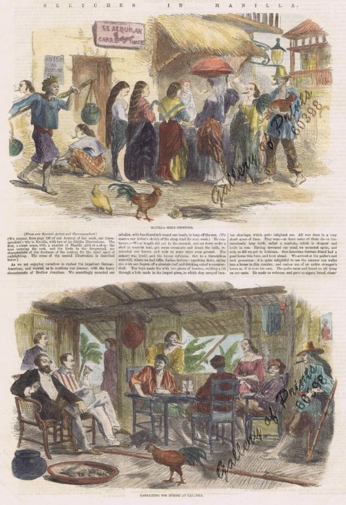
Sketches in Manilla. 1.] Manilla Girl Shopping; 2.] Bargaining for Horses in Calamba
1 x
₱
8,800.00
1. Quartier Chinois a Manille [Chinese Quarters in Manila]; 2. Combat de Coqs [Cockfights]
1 x
₱
4,400.00
Carte Hydrographique & Chorographique des Isles Philippines Carta Hydrographica y Chorographica de las Ysles Filipinas
1 x
₱
520,000.00
Pike and Perch
1 x
₱
5,500.00
The Murillo Bulletin, Journal of PHIMCOS, Issue No.7
1 x
₱
570.00
Shipwrecks & Sunken Treasures in Southeast Asia
1 x
₱
4,400.00
East India Archipelago [Eastern Passages to China and Japan][Chart No.5] London, Published by James Imray and Son, 89 & 89a Minories, 1898
1 x
₱
36,000.00
Ilo-Ilo (Filipinas) - El Puerto.
1 x
₱
5,500.00
Archipel Asiatique. inset maps: 1. Manille et Environs. 2. Les Détroits. 3. Java
1 x
₱
15,700.00
Vue de Cavite dans la Baie de Manille [View of Cavite in the Bay of Manila]
1 x
₱
39,600.00
Philippine Islands. Luzon-West and East Coasts. Cabra I. to San Fernando Pt. and Diapitan B. to San Miguel B. From the United States Coast Survey Charts 1909-23. with additions and corrections to 1933.
1 x
₱
11,000.00
1) Members of the Ifugao Tribe of Luzon, The Largest Island of the Philippines, at Work in a Rice-Field: Natives who employ the Marvellous System of Terrace Culvation Constructed on the Hill-Sides by their Ancestors centuries ago. 2) With a row of baskets slung from a beam beneath the hut to receive the heads of his enemies: The Pyramidal and Eat-proof Home of an Ifugao Head-Hunter. 3) "Dogs, Dogs for Sale! Nice Dogs, Excellent Meat; Come Buy Dogs, Dogs, Dogs!": A Dog-Market Among the Ifugao, Who Love Dog Meat, and consider it better still if the animal has been killed slowly by torture. 4) The Strange Funerary Customs of the Ifugao: A Dead Man arranged in a sitting position before his hut, and exposed for twenty-four days before burial. 5) With an enemy's severed head fixed between a buffalo's horns on the top of an upright rod; An Ifugao Priest in a trance beneath the trophy, and Tribesmen clustered round him.
1 x
₱
6,600.00
De Sinu Baye La Baye (Gulf of Albay]
1 x
₱
56,000.00
India Orientalis
1 x
₱
39,600.00
La bataille d'autre nous et contre cieux de Manille faicte le 14 Decembre ano 1600 [The battle between us and those of Manila on 14 December of the year 1600]
1 x
₱
77,000.00
Carte du Canal des Isles Philippines par lequel passe le Galion de Manille et les Iles voisines de ce Canal [A Chart of the Channel in the Philippine Islands Through which the Manila Galeon passes, and the Islands Visible in that Channel]
1 x
₱
33,000.00
Prout's Microcosm Plate 11
1 x
₱
4,400.00
Anchorages of Luzon, Mindoro and Marinduque. insets: 1) Luzon - West Coast. Bolinao Harbour. From the United States Government Survey of 1904. With additions and corrections from Philippine Gov't. Charts to 1964. 2) Luzon - West Coast. Port Masinloc and Port Matalvi. From the United States Government Surveys of 1937. With additions and corrections from Philippine Gov't. Charts to 1964. 3) Luzon - West Coast. Mariveles Harbour. From the United States Government Chart of 1940. With additions and corrections from Philippine Gov't. Charts to 1964. 4) Luzon - South - West Coast. Batangas. From the Philippine Government Chart of 1956. With additions and corrections to 1964. 5) Luzon - South - West Coast. Nasugbu Bay. From the Philippine Government Chart of 1956. 6) Marinduque. Port Balanacan. From the United States Government Survey of 1908. With additions and corrections from Philippine Gov't. Charts to 1964. 7) Marinduque. Santa Cruz Harbour. From the United States Government Survey of 1908. With additions and corrections from Philippine Gov't. Charts to 1964. 8) Mindoro - North Coast. Port Galera and Varadero Bay. From the United States Government Surveys to 1939. With additions and corrections from Philippine Gov't. Charts to 1964.
1 x
₱
11,000.00
Begräbniβ [Funeral]
1 x
₱
2,200.00
A Boat Girl at Canton
1 x
₱
4,400.00
Another Report About Magellan's Circumnavigation of the World. The Compilation by Fernando Oliveira. Revised and Expanded Edition
1 x
₱
900.00
View Cart
Checkout
Home
About Us
Publications
Shop Online
Framing Services
Exhibits
Picture Hanging System
Contact Us
View cart
“Another Report About Magellan’s Circumnavigation of the World. The Compilation by Fernando Oliveira. Revised and Expanded Edition” has been added to your cart.
Sort by
Date
Sort by
Default Order
Sort by
Name
Sort by
Price
Sort by
Date
Sort by
Popularity
Show
30 Products
Show
30 Products
Show
60 Products
Show
90 Products
The Chinese in Philippine Life 1850-1898
₱
9,900.00
Add to cart
Details
The Murillo Bulletin, Journal of PHIMCOS, Issue No. 16
₱
790.00
Add to cart
Details
Discovering America. Journeys in Search of the New World
₱
4,400.00
Add to cart
Details
Cartographia, Mapping Civilizations
₱
4,900.00
Add to cart
Details
Mapping the World: Maps and Their History
₱
5,500.00
Add to cart
Details
Atlas of Military History. An Illustrated Global Survey of ...
₱
4,400.00
Add to cart
Details
Yo vi la caida de Filipinas [I Saw The Fall of the Philippi...
₱
5,500.00
Add to cart
Details
The Sea Chart: The Illustrated History of Nautical Maps and ...
₱
3,500.00
Add to cart
Details
The Philippines. History, Geography, Customs, Agriculture, I...
₱
900.00
Add to cart
Details
A Visual Guide to the Manila-Acapulco Galleons: 500 Fun Fact...
₱
900.00
Add to cart
Details
Expedición a Joló, 1876: Bocetos del Cronista del Diario d...
₱
4,500.00
Add to cart
Details
Bibliography of the Philippine Islands. Printed and Manuscri...
₱
4,400.00
Add to cart
Details
Sea Monsters on Medieval and Renaissance Maps
₱
2,200.00
Add to cart
Details
Manila and the Philippines
₱
11,000.00
Add to cart
Details
All Over the Map. A Cartographic Odyssey
₱
5,800.00
Add to cart
Details
Lost Islands : The Story of Islands That Have Vanished from ...
₱
3,500.00
Add to cart
Details
Vingboons-Atlas
₱
49,500.00
Add to cart
Details
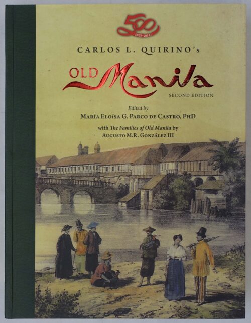
Old Manila
₱
4,500.00
Add to cart
Details
En el archipiélago de la Especiería España y Molucas en l...
₱
4,900.00
Add to cart
Details
Die Igorot Bergvölker in den Philippinen heute [Mountain ...
₱
2,900.00
Add to cart
Details
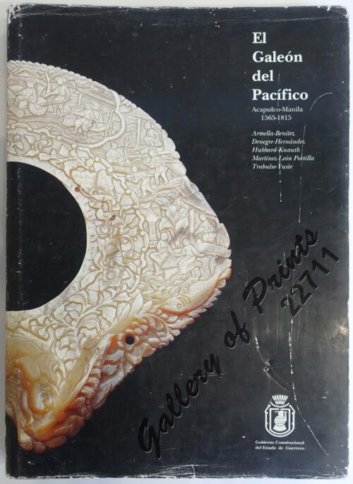
El Galeón del Pacífico Manila Acapulco-Manila 1565-1815
₱
15,000.00
Add to cart
Details
Log of the Centurion
₱
4,400.00
Add to cart
Details
The Story of Maps. Putting the World in Perspective
₱
3,900.00
Add to cart
Details
Early Mapping of Southeast Asia
₱
9,600.00
Add to cart
Details
The Image of the World. 20 Centuries of World Maps
₱
3,300.00
Add to cart
Details
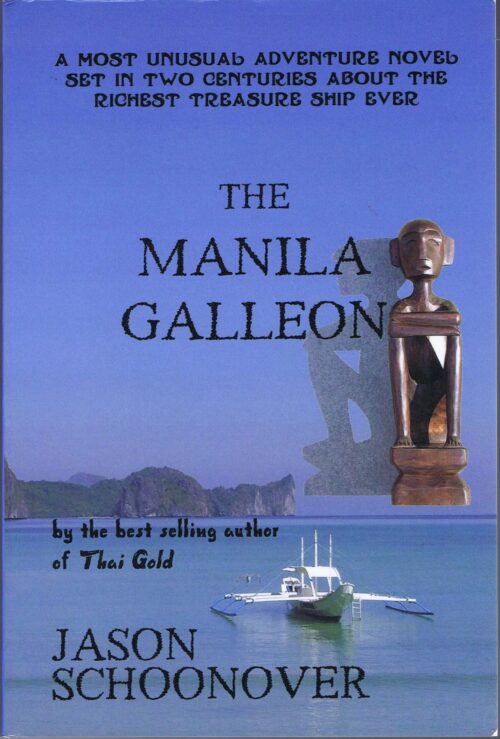
The Manila Galleon
₱
2,900.00
Add to cart
Details
Adventures and Encounters – Europeans in Southeast Asia Wi...
₱
2,900.00
Add to cart
Details
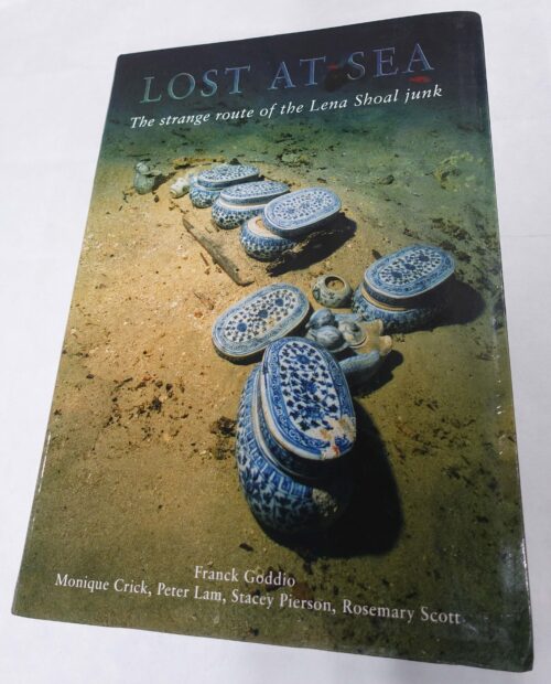
Lost at Sea. The strange route of the Lena Shoal junk
₱
5,900.00
Add to cart
Details
Fifty Shades of Philippine Art: Damián Domingo
₱
1,500.00
Add to cart
Details
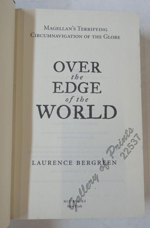
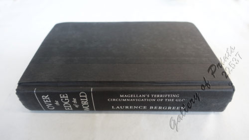
Over the Edge of the World Magellan’s Terrifying Circ...
₱
4,400.00
Add to cart
Details
1
2
3
4
5
Next
Shopping Cart
Another Report About Magellan's Circumnavigation of the World. The Compilation by Fernando Oliveira. Revised and Expanded Edition
1
A Boat Girl at Canton
1
Begräbniβ [Funeral]
1
Anchorages of Luzon, Mindoro and Marinduque. insets: 1) Luzon - West Coast. Bolinao Harbour. From the United States Government Survey of 1904. With additions and corrections from Philippine Gov't. Charts to 1964. 2) Luzon - West Coast. Port Masinloc and Port Matalvi. From the United States Government Surveys of 1937. With additions and corrections from Philippine Gov't. Charts to 1964. 3) Luzon - West Coast. Mariveles Harbour. From the United States Government Chart of 1940. With additions and corrections from Philippine Gov't. Charts to 1964. 4) Luzon - South - West Coast. Batangas. From the Philippine Government Chart of 1956. With additions and corrections to 1964. 5) Luzon - South - West Coast. Nasugbu Bay. From the Philippine Government Chart of 1956. 6) Marinduque. Port Balanacan. From the United States Government Survey of 1908. With additions and corrections from Philippine Gov't. Charts to 1964. 7) Marinduque. Santa Cruz Harbour. From the United States Government Survey of 1908. With additions and corrections from Philippine Gov't. Charts to 1964. 8) Mindoro - North Coast. Port Galera and Varadero Bay. From the United States Government Surveys to 1939. With additions and corrections from Philippine Gov't. Charts to 1964.
1
Prout's Microcosm Plate 11
1
Carte du Canal des Isles Philippines par lequel passe le Galion de Manille et les Iles voisines de ce Canal [A Chart of the Channel in the Philippine Islands Through which the Manila Galeon passes, and the Islands Visible in that Channel]
1
La bataille d'autre nous et contre cieux de Manille faicte le 14 Decembre ano 1600 [The battle between us and those of Manila on 14 December of the year 1600]
1
India Orientalis
1
De Sinu Baye La Baye (Gulf of Albay]
1
1) Members of the Ifugao Tribe of Luzon, The Largest Island of the Philippines, at Work in a Rice-Field: Natives who employ the Marvellous System of Terrace Culvation Constructed on the Hill-Sides by their Ancestors centuries ago. 2) With a row of baskets slung from a beam beneath the hut to receive the heads of his enemies: The Pyramidal and Eat-proof Home of an Ifugao Head-Hunter. 3) "Dogs, Dogs for Sale! Nice Dogs, Excellent Meat; Come Buy Dogs, Dogs, Dogs!": A Dog-Market Among the Ifugao, Who Love Dog Meat, and consider it better still if the animal has been killed slowly by torture. 4) The Strange Funerary Customs of the Ifugao: A Dead Man arranged in a sitting position before his hut, and exposed for twenty-four days before burial. 5) With an enemy's severed head fixed between a buffalo's horns on the top of an upright rod; An Ifugao Priest in a trance beneath the trophy, and Tribesmen clustered round him.
1
Philippine Islands. Luzon-West and East Coasts. Cabra I. to San Fernando Pt. and Diapitan B. to San Miguel B. From the United States Coast Survey Charts 1909-23. with additions and corrections to 1933.
1
Vue de Cavite dans la Baie de Manille [View of Cavite in the Bay of Manila]
1
Archipel Asiatique. inset maps: 1. Manille et Environs. 2. Les Détroits. 3. Java
1
Ilo-Ilo (Filipinas) - El Puerto.
1
East India Archipelago [Eastern Passages to China and Japan][Chart No.5] London, Published by James Imray and Son, 89 & 89a Minories, 1898
1
Shipwrecks & Sunken Treasures in Southeast Asia
1
The Murillo Bulletin, Journal of PHIMCOS, Issue No.7
1
Pike and Perch
1
Carte Hydrographique & Chorographique des Isles Philippines Carta Hydrographica y Chorographica de las Ysles Filipinas
1
1. Quartier Chinois a Manille [Chinese Quarters in Manila]; 2. Combat de Coqs [Cockfights]
1
Sketches in Manilla. 1.] Manilla Girl Shopping; 2.] Bargaining for Horses in Calamba
1
China in Those Days. Insights into Historical China through Postcards of the Time
1
Dalea Bicolor [Silver Prarie Clover]
1
Brains of the Nation. Pedro Paterno, T.H. Pardo de Tavera, Isabelo de los Reyes, and the Production of Modern Knowledge.
1
Acacia Linifolia [White Wattle or Flax Wattle]
1
A Visit to Manila & Its Environs
1
Philippine Islands. Tablas Strait with Part of Sibuyan Sea…Sources: United States Government Charts to 1935
1
Marché de Maïbun
1
Paradies-Amome. Fig. 302. [Paradise-Amome]; Lange Curcume. Fig. 303. [Long Curcume][Bromeliad]; Gemürzhafte Curcume. Fig. 304. [Herby Curcume]; Rohrartige Marante. Fig. 305. [Rod-like Marant]; Cardamom-Amome. Fig. 306 [Cardamon-Amome]
1
1. Panguingui (Card-playing) in Manilla; 2. Planting Rice in Manilla.
1
[Rear Page #254 with many great advertisements including The Improved Boston Garter and "Six Trains Daily for Chicago - New York Central" [at the bottom]
1
Islas Filipinas. - Grupo de Luzon. inset: [Batanes and Babuyan Islands]
1
Bahia de Manila
1
Sketches from Manilla and Hong-Kong. "Soiree Musicale" at Manilla.
1
An Old-style Culvert
1
Indo-Chine et Archipel D'Asie. inset: Saïgon, Palais du Gouvernement.
1
Aux Îles Philippines. [Pictures from the Philippines]. 1) Le port de Manille. [Harbour of Manila]. 2) Un marché. [In the Market]. 3) La rue du rosaire a Manille. [Manila Street]. 4) Indigènes broyant du riz. [Natives Pounding Rice]. 5) Forge primitive dans un village. [Dwellings of Islanders with Smithy]. 6) Promenade en hamac. [In a Sedan]
1
Embarcaciones Antiguas [Old Boats] 1. Tronco labrado en forma de canoa. [Trunk carved in the shape of a canoe]. 2. Embarcación de mimbres recubierta de cuero. [Wicker boat covered in leather]. 3. Barco de cuero. [Leather Boat]. 4. Nave romana. [Roman ship]. 5 y 6. Galera y galeaza del siglo XVI. [Galley and galleass from the 16th century]. 7. Galeón del siglo XVII. [17th century galleon.].
1
The Image of the World. 20 Centuries of World Maps
1
Die Chinesen, Japaner und Inder auf den Philippinen [The Chinese, Japanese, and Indians in the Philippines]
1
Bird's-eye view of Manilla, Luzon, Philippine Islands.
1
Philippine Islands. insets: 1) Manila to Dagupan; 2) Manila; 3) Philippine Islands and the China Sea; 4) Batanes (Bashee) and Babuyanes Is.; 5) Sulu Archipelago
1
Manila [Sketch and Description of Manila Port] [with a fleet of Adm. Joris van Spilberghen & a smoking Taal]
1
Une Rue de Libog [Albay] [Road in Libog Albay]
1
Détroit de Bassilan (Iles Philippines) [sic] [Strait of Basilan] [Passage…]
1
The Murillo Bulletin, Journal of PHIMCOS, Issue No. 12
-
Quantity
+
Cadavres des juramentados réunis après l'attaque
1
Tipos Filipinos. Una Mestiza
1
Luzon Island. inset : Vicinity of Manila
1
National Geographic September, 1990, Vol. 178, No. 3. Track of the Manila Galleons
1
Descripcion de las Indias del Poniente (14)
1
The Spanish - American War In the Spanish Trenches at Manila: Midday
1
The Mysteries of Taal: A Philippine Volcano and Lake, Her Sea Life and Lost Towns
1
Sketches in Manilla. 1. Chinese Chow-chow sellers at Manilla; 2. The Meat Market at Manilla.
1
The Murillo Bulletin, Journal of PHIMCOS, Issue No. 14
1
Isla de Paragua o Palawan Sur pl. 25 (Southern Palawan)
1
[Sailing Boat] [illegible title]
1
Antique Maps - Christie's Collectors Guide
1
Courtiers and Cannibals, Angels and Amazons. The Art of the Decorative Cartographic Titlepage.
1
Great Maps. the world's masterpieces explored and explained
1
Girls Bathing
1
Grotte du Levant; Ile de Cagraray, Golfe d'Albay
1
Sketches from Manilla and Hongkong. 1. "Soiree Musicale" at Manilla; 2. Chinese Nursemaid on the Parade- Ground, Hongkong
1
Philippine Islands. Western Part of Mindanao Sea with Bohol Strait and Part of Tañon Strait. From the United States Government Charts to 1937.
1
Philippines - Interieur de L'Ile de Loucon Philippinen - Inneres der Insel Loucon [the Interior of the Island of Luzon][per text: Jala-Jala]
1
1) Radeaux de Peche a Manille (Fishraft), 2) Banka, Bateau de Passage [Outrigger Boat Ferry]
1
The Story of Maps. Putting the World in Perspective
1
Palais du Sultan de Soulou… [Palace of the Sultan of Sulu]
1
Entrée de la baie de Manille, (Iles Philippines) Entrevue nocturne de l'Auteur avec les petits noirs des Montagnes. [Entrance of Manila Bay (Philippine Islands) Nocturnal Meeting of the Author With the Native Mountain People]
1
Exacta & accurata delineatio cum orarum maritimarum tum etjam locorum terrestrium quae in Regionibus China, Cauchinchina, Camboja sive Champa, Syao, Malacca, Arracan & Pegu… Waarachtige uitworpinghe ofte afbeeldinge van alle die custen ende landen van China, … [Accurate & Detailed Drawing with Borders Maritime and even Terrestrial Places Located in the Regions of China….]
1
Négritos de la sierra de Marivelès (île de Luçon) (voy. p. 107 et 108)
1
Japanese Page
1
Seconde partie de la Carte d'Asie contenant la Chine et partie de la Tartarie, l'Inde au delà du Gange, les Isles Sumatra, Java, Borneo, Moluques, Philippines, et du Japon.
1
1. Panguingui (Card-playing) in Manilla; 2. Planting Rice in Manilla
1
Manila (Islas Filipinas). - Una calle de Caloocán.
1
Cart
Checkout
Continue Shopping
75