Tel : +63(2)-7729-8168
|
Email Us : gallery@gop.com.ph
My Account
Remember Me
Register
15 Item(s)
-
₱
242,700.00
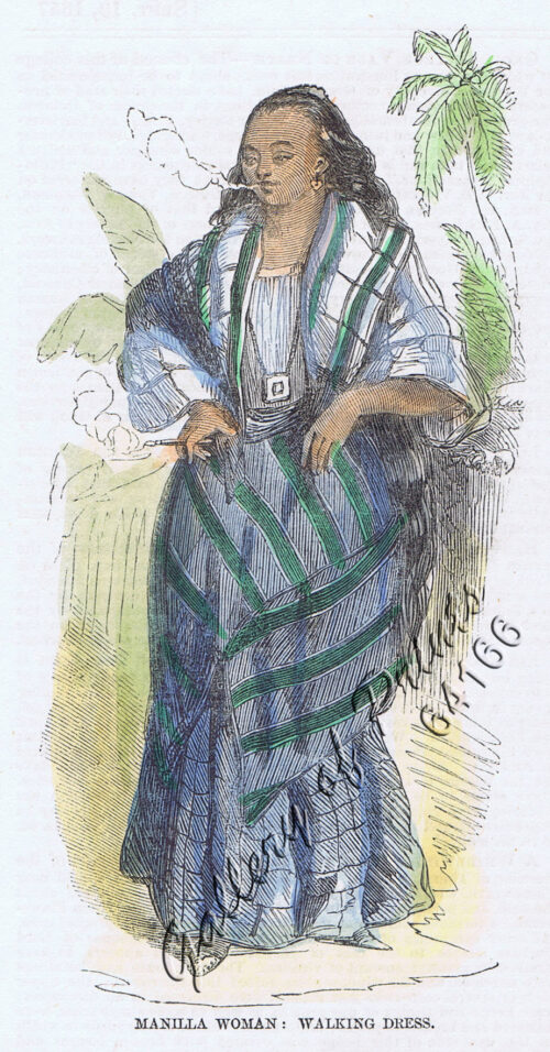
Manilla Woman: Walking Dress.
1 x
₱
4,400.00
Plumiera Alba. - Blanco. - Plumeria Acutifolia. - Poir. - DC. [English: White Frangipani] [Local Name: White Kalachuchi]
1 x
₱
39,600.00
Plans in the Philippine Island. insets: 1) Luzon - North Coast. Aparri. From the Philippine Government Chart of 1954. 2) Bataan I. Basco. From the Philippine Government Chart of 1954. 3) Luzon - West Coast. Santa Cruz. From the Philippine Government Chart of 1952. 4) Bataan I. Balugan Bay. From the Philippine Government Chart of 1953.
1 x
₱
11,000.00
Anchorages of Luzon, Mindoro and Marinduque. insets: 1) Luzon - West Coast. Bolinao Harbour. From the United States Government Survey of 1904. With additions and corrections from Philippine Gov't. Charts to 1964. 2) Luzon - West Coast. Port Masinloc and Port Matalvi. From the United States Government Surveys of 1937. With additions and corrections from Philippine Gov't. Charts to 1964. 3) Luzon - West Coast. Mariveles Harbour. From the United States Government Chart of 1940. With additions and corrections from Philippine Gov't. Charts to 1964. 4) Luzon - South - West Coast. Batangas. From the Philippine Government Chart of 1956. With additions and corrections to 1964. 5) Luzon - South - West Coast. Nasugbu Bay. From the Philippine Government Chart of 1956. 6) Marinduque. Port Balanacan. From the United States Government Survey of 1908. With additions and corrections from Philippine Gov't. Charts to 1964. 7) Marinduque. Santa Cruz Harbour. From the United States Government Survey of 1908. With additions and corrections from Philippine Gov't. Charts to 1964. 8) Mindoro - North Coast. Port Galera and Varadero Bay. From the United States Government Surveys to 1939. With additions and corrections from Philippine Gov't. Charts to 1964.
1 x
₱
11,000.00
Philippine Islands. Western Part of Mindanao Sea with Bohol Strait and Part of Tañon Strait. From the United States Government Charts to 1937.
1 x
₱
11,000.00
The United States of America Including all its Newly Acquired Territory
1 x
₱
46,200.00
Philippine Islands. Samar and Leyte. San Juanico Strait and Approaches. From the United States Government Surveys to 1935. With Additions and Corrections from the Philippine Gov't. Charts to 1957. inset: 1) Northern Entrance to San Juanico Strait. From the United States Government Surveys of 1925. With Additions and Corrections from the Philippine Gov't. Charts to 1957.
1 x
₱
11,000.00
Philippine Islands. Luzon-West and East Coasts. Cabra I. to San Fernando Pt. and Diapitan B. to San Miguel B. From the United States Coast Survey Charts 1909-23. with additions and corrections to 1933.
1 x
₱
11,000.00
Asie: Partie de la Chine pl. 88
1 x
₱
19,700.00
Philippine Islands. Luzon Island. North of Latitude 16° 20' North. From the United States Cost Survey Charts to 1925.
1 x
₱
11,000.00
Geschäftstraße der heimischen Hândler in Manila (Rosario St.) [Commercial Street of the Native Retailers]
1 x
₱
4,400.00
Philippine Islands - Mindanao. Davao Gulf. From the Philippine Government Charts to 1956. With additions and corrections to 1962. insets: 1) Talomo Bay. From U.S Government Chart of 1933. With additions and corrections to 1962. 2) Lais. From U.S Government Chart of 1933. With additions and corrections to 1962. 3) Malita. From U.S Government Chart of 1933. With additions and corrections to 1962. 4) Port of Davao. From the Philippine Government Chart of 1956. With additions and corrections to 1962. 5) Pakiputan Strait. From U.S Government Chart of 1933. With additions and corrections to 1962.
1 x
₱
11,000.00
Philippine Islands. Tagolo Point to Cuyo Islands. Including Sebu Negros and Parts of Panay and Palawan. From the United States Coast Survey Charts to 1923.
1 x
₱
11,000.00
Philippinen - Exotische Inselwelt La vie exotique des îles Philippines La vita exotica dell'isola Filipina [Philippines - Exotic Island World] 1) [Coconut Trees] 2) [An Old Farmer] 3) [Children Playing with Carabao] 4) [Harvesting Coconut]
1 x
₱
4,400.00
East India Archipelago [Eastern Passages to China and Japan][Chart No.5] London, Published by James Imray and Son, 89 & 89a Minories, 1898
1 x
₱
36,000.00
View Cart
Checkout
Home
About Us
Publications
Shop Online
Framing Services
Exhibits
Picture Hanging System
Contact Us
View cart
“East India Archipelago [Eastern Passages to China and Japan][Chart No.5] London, Published by James Imray and Son, 89 & 89a Minories, 1898” has been added to your cart.
Sort by
Price
Sort by
Default Order
Sort by
Name
Sort by
Price
Sort by
Date
Sort by
Popularity
Show
30 Products
Show
30 Products
Show
60 Products
Show
90 Products
Marilandische Cassie. Fig. 1178. [Marylandian Cassie]; Rohre...
₱
5,500.00
Add to cart
Details
Doldentraubige Bauhinie. Fig. 1182. [Raceme bauhinia]; Schar...
₱
5,500.00
Add to cart
Details
Krautartige Baumwolle. Fig. 1528. [Herb-like Cotton]; Scwefe...
₱
5,500.00
Add to cart
Details
Wiesen-Storchschnabel. Fig. 1534. [Grass-Geranium]; Moritz-K...
₱
5,500.00
Add to cart
Details
Länglichblättriger Stinkbaum. Fig. 1541. [Long-leafed Trop...
₱
5,500.00
Add to cart
Details
Haselblaettriger Schraubenbaum. Fig. 1546. [Hazel-leaved Pan...
₱
5,500.00
Add to cart
Details
Gefingerte Adansonie. Fig. 1552. [Fingered Adansonie]; Rothe...
₱
5,500.00
Add to cart
Details
Japanische Camellie. Fig. 1571. [Japanese Camellie]; Ausgeze...
₱
5,500.00
Add to cart
Details
Indische Vaterie. Fig. 1577. [Indian Vaterie]; Kleinblättri...
₱
5,500.00
Add to cart
Details
Intérieur d’une case bicole [Interior of a Bicolano H...
₱
5,500.00
Add to cart
Details
Men and Women of St. John (one of the Philippine Islands) in...
₱
5,500.00
Add to cart
Details
Filipinas. – El General Lawton y su séquito en un des...
₱
5,500.00
Add to cart
Details
Flamants.
₱
5,500.00
Add to cart
Details
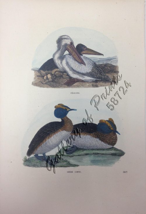
1) Pélicans. 2) Grèbe Cornu.
₱
5,500.00
Add to cart
Details
Canards Boschas.
₱
5,500.00
Add to cart
Details
Indischer Archipel Philippinischer Malaye nebst Frau. Uhrein...
₱
5,500.00
Add to cart
Details
Islas Filipinas – Mapa General pl. 2, Observatorio d...
₱
5,500.00
Add to cart
Details
Islas Filipinas – Mapa Orografico pl. 4, Observatorio...
₱
5,500.00
Add to cart
Details
Le Magasin Pittoresque
₱
5,500.00
Add to cart
Details
Wanderjahre eines jungen Hamburger Kaufmannes – Eine R...
₱
5,500.00
Add to cart
Details
Malaiischer Archipel. insets: 1. Java, 2. Mittel – Luz...
₱
5,500.00
Add to cart
Details
Le Port de Manille. [Manila Harbour]
₱
5,500.00
Add to cart
Details
Manille (pl.112)
₱
5,500.00
Add to cart
Details
Iles Philippines, Groupe de Negritos
₱
5,500.00
Add to cart
Details
Carte de L’Ocean Meridional (Atlantic Ocean)
₱
5,500.00
Add to cart
Details
Vom amerikanisch=spanischen Kriegsschauplatz – Befesti...
₱
5,500.00
Add to cart
Details
Le Combat Naval Devant Manille … 1. L’ <>, cro...
₱
5,500.00
Add to cart
Details
Vue generale du village de Bahele (voy. p. 378). [General Vu...
₱
5,500.00
Add to cart
Details
Pangolin et ecureuil. [Pangolin and Squirrel]
₱
5,500.00
Add to cart
Details
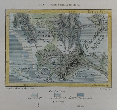
Partie Centrale de Luzon
₱
5,500.00
Add to cart
Details
Previous
1
2
3
…
14
15
16
17
18
19
20
…
54
55
56
Next
Shopping Cart
East India Archipelago [Eastern Passages to China and Japan][Chart No.5] London, Published by James Imray and Son, 89 & 89a Minories, 1898
1
Philippinen - Exotische Inselwelt La vie exotique des îles Philippines La vita exotica dell'isola Filipina [Philippines - Exotic Island World] 1) [Coconut Trees] 2) [An Old Farmer] 3) [Children Playing with Carabao] 4) [Harvesting Coconut]
1
Philippine Islands. Tagolo Point to Cuyo Islands. Including Sebu Negros and Parts of Panay and Palawan. From the United States Coast Survey Charts to 1923.
1
Philippine Islands - Mindanao. Davao Gulf. From the Philippine Government Charts to 1956. With additions and corrections to 1962. insets: 1) Talomo Bay. From U.S Government Chart of 1933. With additions and corrections to 1962. 2) Lais. From U.S Government Chart of 1933. With additions and corrections to 1962. 3) Malita. From U.S Government Chart of 1933. With additions and corrections to 1962. 4) Port of Davao. From the Philippine Government Chart of 1956. With additions and corrections to 1962. 5) Pakiputan Strait. From U.S Government Chart of 1933. With additions and corrections to 1962.
1
Geschäftstraße der heimischen Hândler in Manila (Rosario St.) [Commercial Street of the Native Retailers]
1
Philippine Islands. Luzon Island. North of Latitude 16° 20' North. From the United States Cost Survey Charts to 1925.
1
Asie: Partie de la Chine pl. 88
1
Philippine Islands. Luzon-West and East Coasts. Cabra I. to San Fernando Pt. and Diapitan B. to San Miguel B. From the United States Coast Survey Charts 1909-23. with additions and corrections to 1933.
1
Philippine Islands. Samar and Leyte. San Juanico Strait and Approaches. From the United States Government Surveys to 1935. With Additions and Corrections from the Philippine Gov't. Charts to 1957. inset: 1) Northern Entrance to San Juanico Strait. From the United States Government Surveys of 1925. With Additions and Corrections from the Philippine Gov't. Charts to 1957.
1
The United States of America Including all its Newly Acquired Territory
1
Philippine Islands. Western Part of Mindanao Sea with Bohol Strait and Part of Tañon Strait. From the United States Government Charts to 1937.
1
Anchorages of Luzon, Mindoro and Marinduque. insets: 1) Luzon - West Coast. Bolinao Harbour. From the United States Government Survey of 1904. With additions and corrections from Philippine Gov't. Charts to 1964. 2) Luzon - West Coast. Port Masinloc and Port Matalvi. From the United States Government Surveys of 1937. With additions and corrections from Philippine Gov't. Charts to 1964. 3) Luzon - West Coast. Mariveles Harbour. From the United States Government Chart of 1940. With additions and corrections from Philippine Gov't. Charts to 1964. 4) Luzon - South - West Coast. Batangas. From the Philippine Government Chart of 1956. With additions and corrections to 1964. 5) Luzon - South - West Coast. Nasugbu Bay. From the Philippine Government Chart of 1956. 6) Marinduque. Port Balanacan. From the United States Government Survey of 1908. With additions and corrections from Philippine Gov't. Charts to 1964. 7) Marinduque. Santa Cruz Harbour. From the United States Government Survey of 1908. With additions and corrections from Philippine Gov't. Charts to 1964. 8) Mindoro - North Coast. Port Galera and Varadero Bay. From the United States Government Surveys to 1939. With additions and corrections from Philippine Gov't. Charts to 1964.
1
Plans in the Philippine Island. insets: 1) Luzon - North Coast. Aparri. From the Philippine Government Chart of 1954. 2) Bataan I. Basco. From the Philippine Government Chart of 1954. 3) Luzon - West Coast. Santa Cruz. From the Philippine Government Chart of 1952. 4) Bataan I. Balugan Bay. From the Philippine Government Chart of 1953.
1
Plumiera Alba. - Blanco. - Plumeria Acutifolia. - Poir. - DC. [English: White Frangipani] [Local Name: White Kalachuchi]
1
Manilla Woman: Walking Dress.
1
Cart
Checkout
Continue Shopping
15